


Quenten
Quenten
About
- Username
- Quenten
- Joined
- Visits
- 8,063
- Last Active
- Roles
- Member
- Points
- 3,090
- Birthday
- November 29, 1950
- Location
- Australia
- Real Name
- Quenten Walker
- Rank
- Mapmaker
- Badges
- 16
Latest Images


Reactions
-
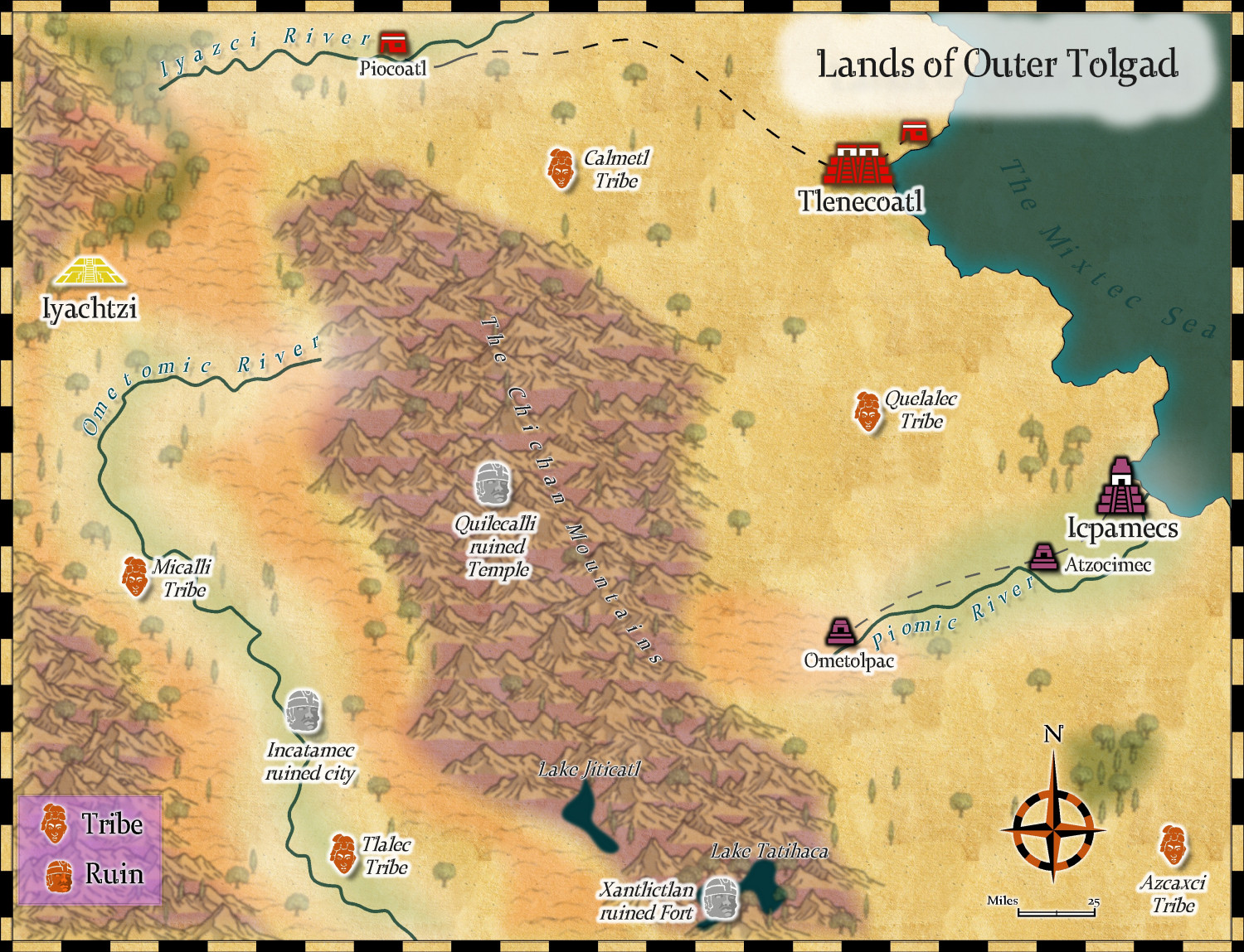
Community Atlas - Kumarikandam - Northwestern Tolgad
I have changed my mind about this map completely, and chosen the Mythic maps style instead. I will use Myrklund on a more jungle type area, which this is not supposed to be.
I used hill symbols from Sarah Wroot style, to make up for the fact there were no hill symbols in this style.
I think this is ready for Remy.
Comments and suggestions welcome.


-
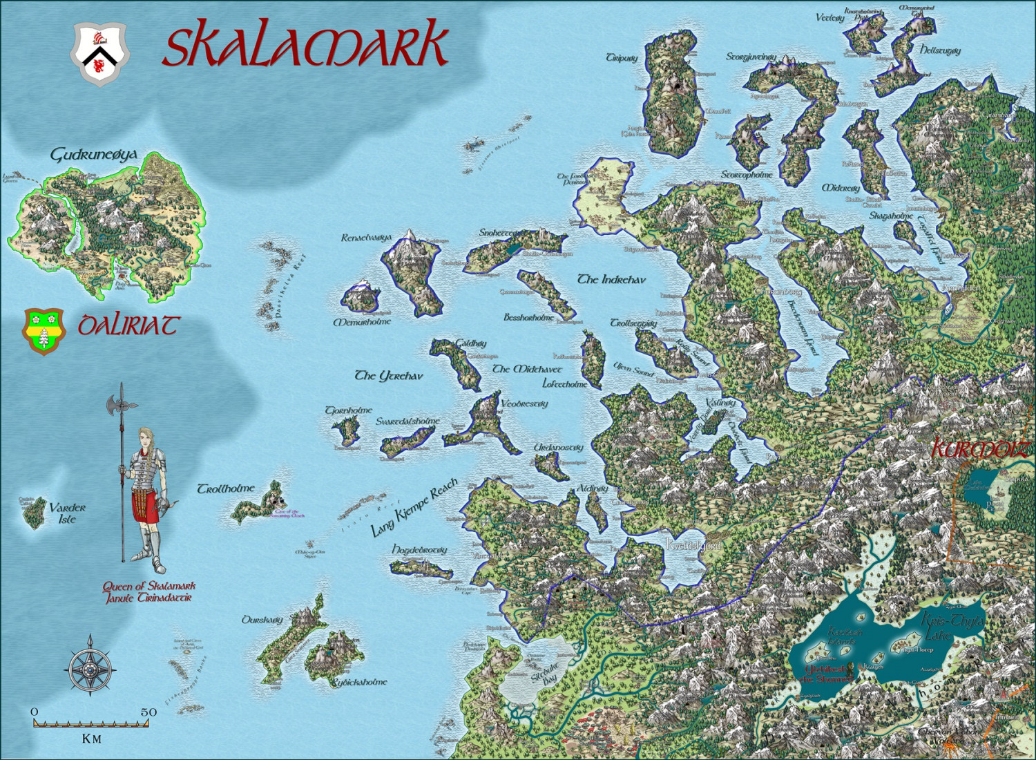
Myirandios - Hardin Region - Skalamark
Well, I have completed this map = all the names and features I want. Norwegian in style, similar to the kingdom of Harald Hardrada. The lower right hand corner is taken by a Cossack-style kingdom (Hetmanate) with Ukrainian names; and the very lowest right hand corner is a cult of darkness with Lovecraftian names. And the left hand upper corner is an island of mixed Norse and Celtic culture, formerly the Isle of Llum in the Atlas (Kentoria continent). Thanks to @Monsen for some naming ideas - though I am sure I have transgressed a fair bit! 😃. Some names are actual Norwegian or Ukrainian translations of English words, using Google Translate app.
Bigger version in the Gallery - Image Gallery: Hardin — ProFantasy Community Forum

-
CC4 Overland Development Thread
Love the mountain. For me, the snow is still a little bit too blue (though I can always fix that with Alter Hue effect if need be).

-
A1 Inn and Stable Battlemap
Only criticis is that the stalls for the horses are both too narrow and not long enough. There has to be room for the horses to move around a bit. I have made that mistake myself!

-
Watabaou Help
It is a Watabou issue with the svg export. He must be using a different app, or else he is using just lines and not polygons. I don't know if the wizards Ralf or Momsen can help


-
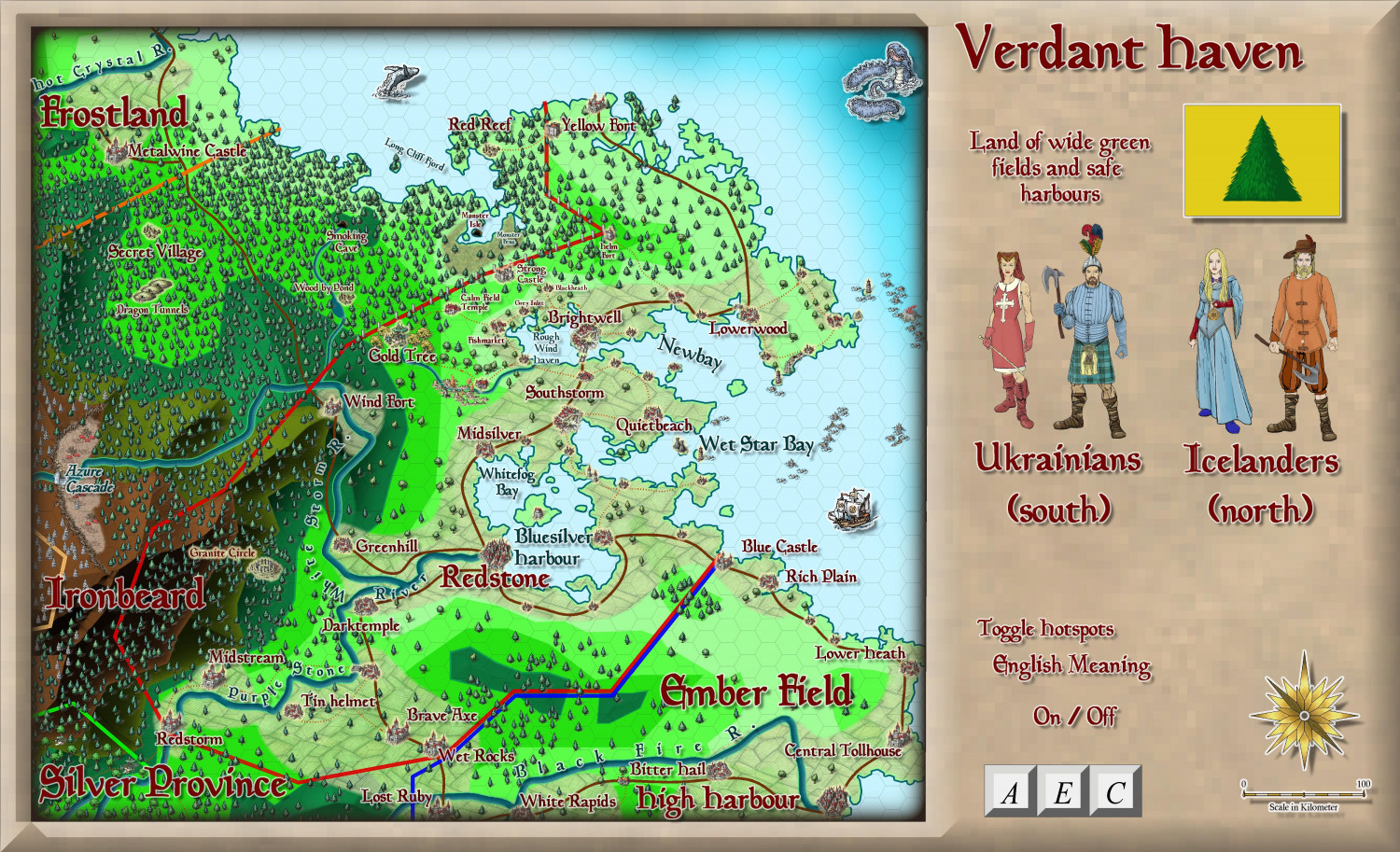
Ukadarlia
And the map with the English meanings.
Vynlings = Icelandic; Kratirim = Ukrainian; Aeifa (elves) = Irish Gaelic
-
Sinister Sewers - Style Development Thread (CA207)
Don't forget the advanced plumbing of the Minoans - they had flushing toilets, not reinvented till the 19th century. Don't know about their sewer system, but it would have been fairly advanced I think.
-
Sinister Sewers - Style Development Thread (CA207)
I want sickly vomit yellow!!!
-
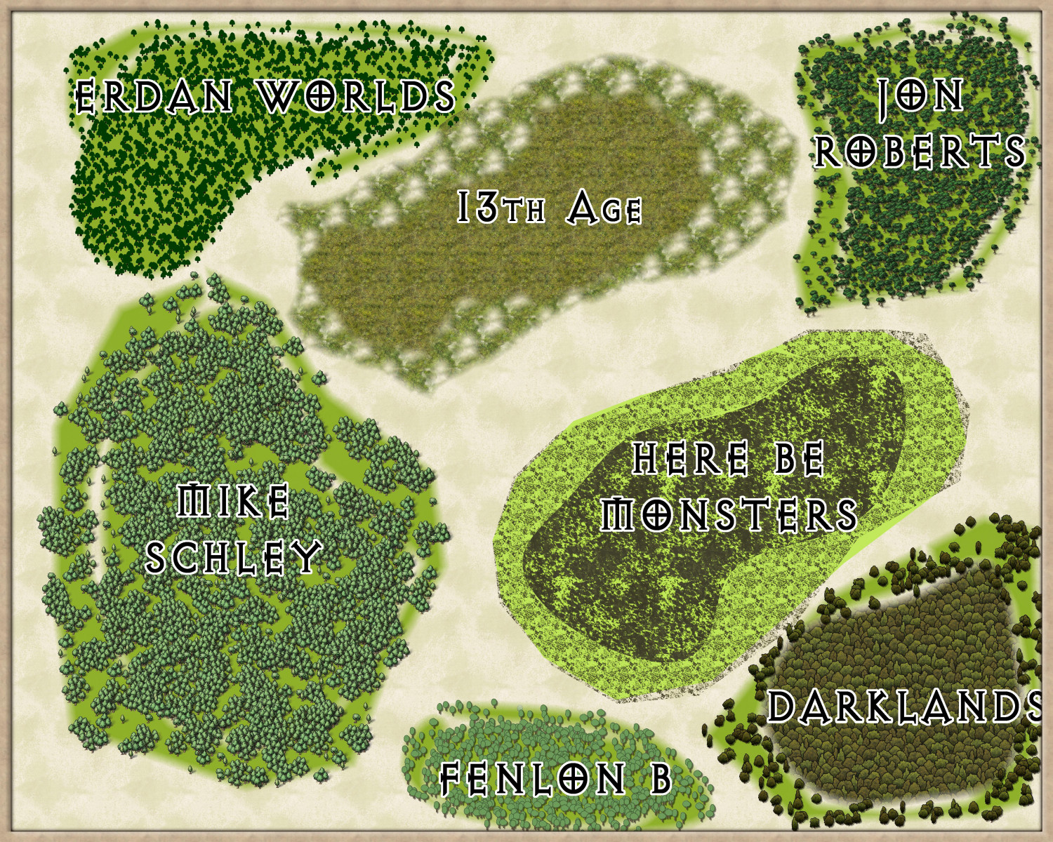
Forest depictions for large overland map.
Here are seven different depictions of forest that I would like your opinions on as to which is best. It is for a commission I have, and also will be used in my own Ukadarlia project.
If you have other thoughts, that is also welcome, but i really want to know which one you like best, and also the one you like least, even if you don't like any of them.
Each has dense forest in the centre, and woodland at the periphery.
-
Map under an hour challenge
I like this challenge. Of course, Ralf does it every time he does a Live Mapping session. Anyway, I will give it a go tomorrow.
