Quenten
Quenten
About
- Username
- Quenten
- Joined
- Visits
- 8,063
- Last Active
- Roles
- Member
- Points
- 3,090
- Birthday
- November 29, 1950
- Location
- Australia
- Real Name
- Quenten Walker
- Rank
- Mapmaker
- Badges
- 16
Latest Images


Reactions
-
Wilderland Campaign
Yes, that missing tree is SO SO obvious now - just can't help seeing the gap once it has been drawn to my intention.


-
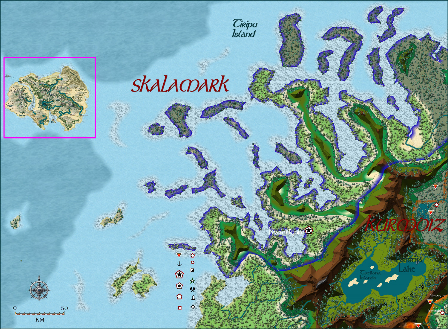
Hardin region of Myirandios
This is the next section I will tackle - the 'Viking' kingdom of Skalamark. It also includes the island of Llum (but with a new name) that I did for the Atlas, and for which I wrote extensive notes. Obviously, this is only a beginning.

-
Hardin region of Myirandios
Here is the final part of the map - the Kingdom of Nilterurn - a Slavic ship kingdom, and instigator of many raids on other lands for loot and slaves.
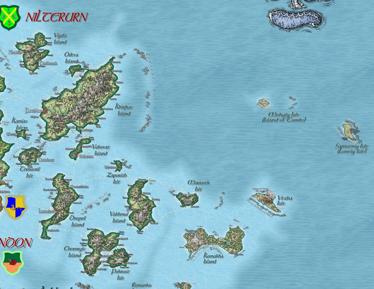
A larger version in the Gallery: Image Gallery: Hardin — ProFantasy Community Forum


-
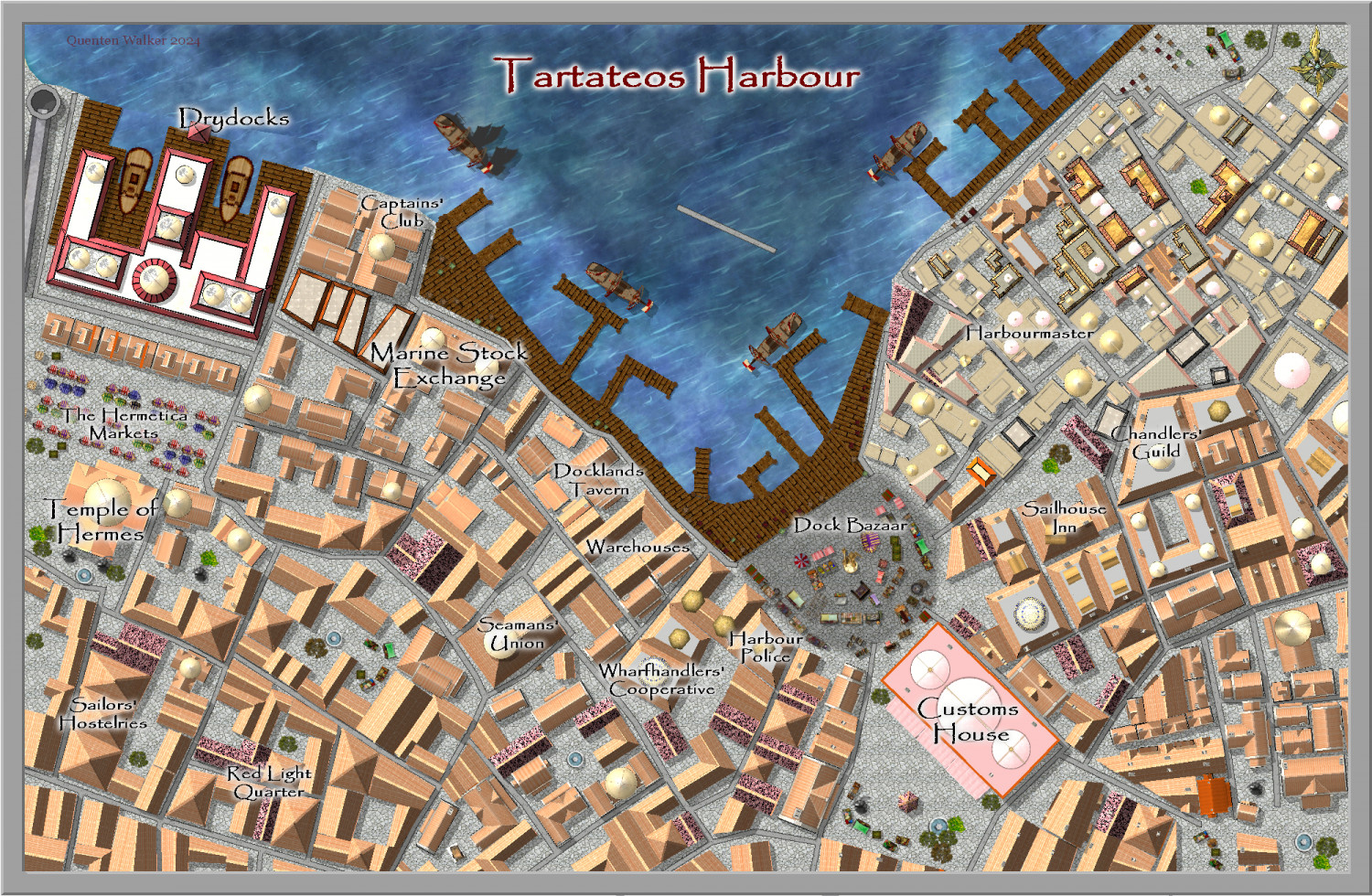
Community Atlas City of Tartateos - Shipyards District
Is this better @AleD ? I have also changed the location of the Customs House to match the parent map.

-
Dungeon Level Symbols - Celtic Revival Room by Room
Definitely need dogs - mine sleeps every night with me on the bed. And we also need single beds as well, I think.


-
Community Atlas - Kumarikandam - Myrklund Style
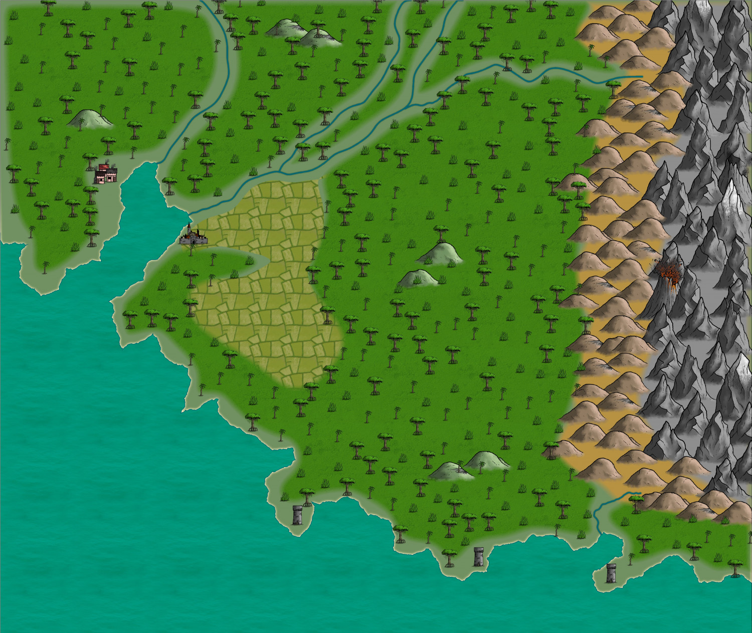
Here is a better area for a jungle Myrklund map.
This is VERY much a beginning. More later on today.

-
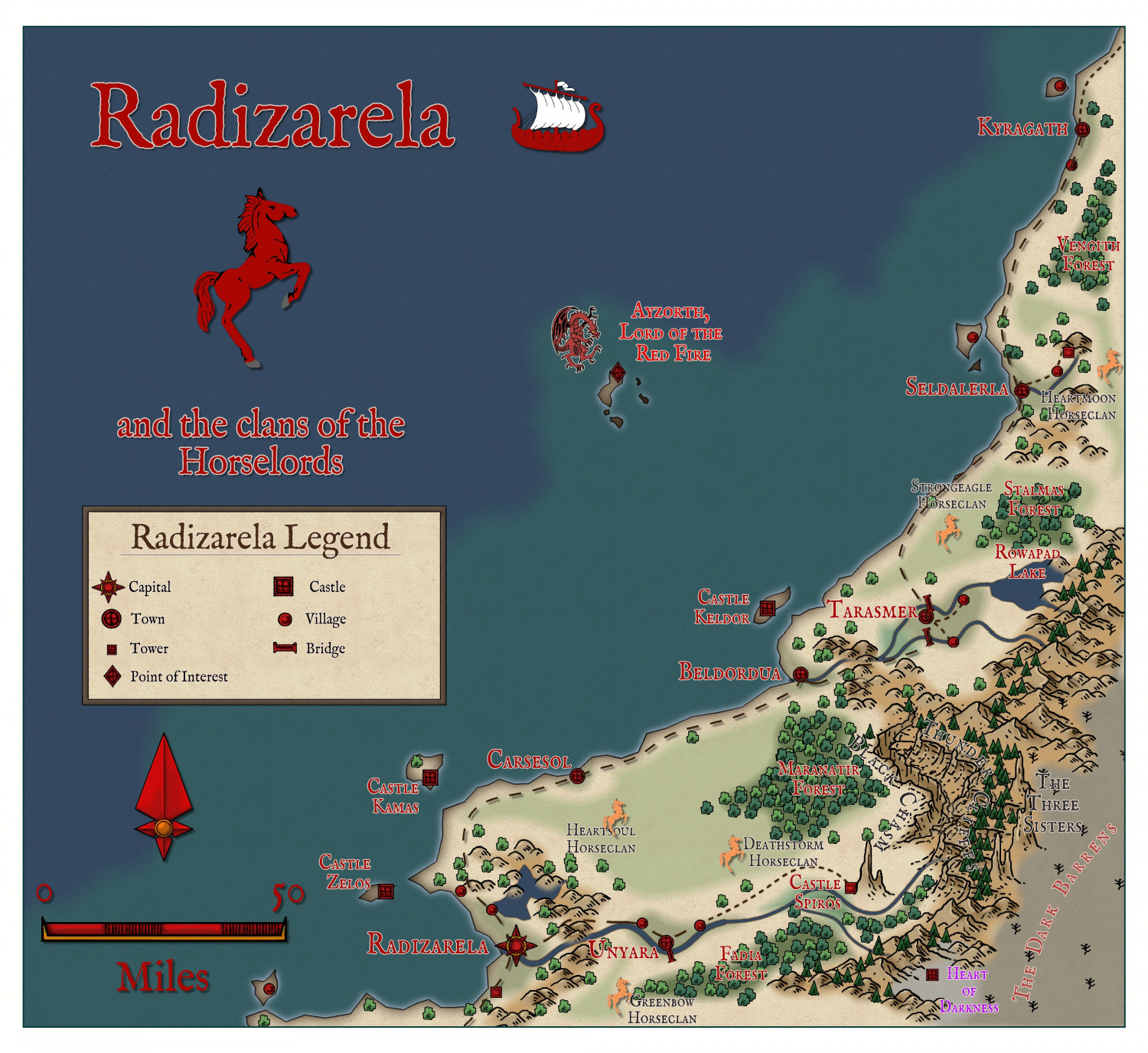
Community Atlas - Doriant - Radizarela
The finished map, ready for submission to Remy when he returns.
-
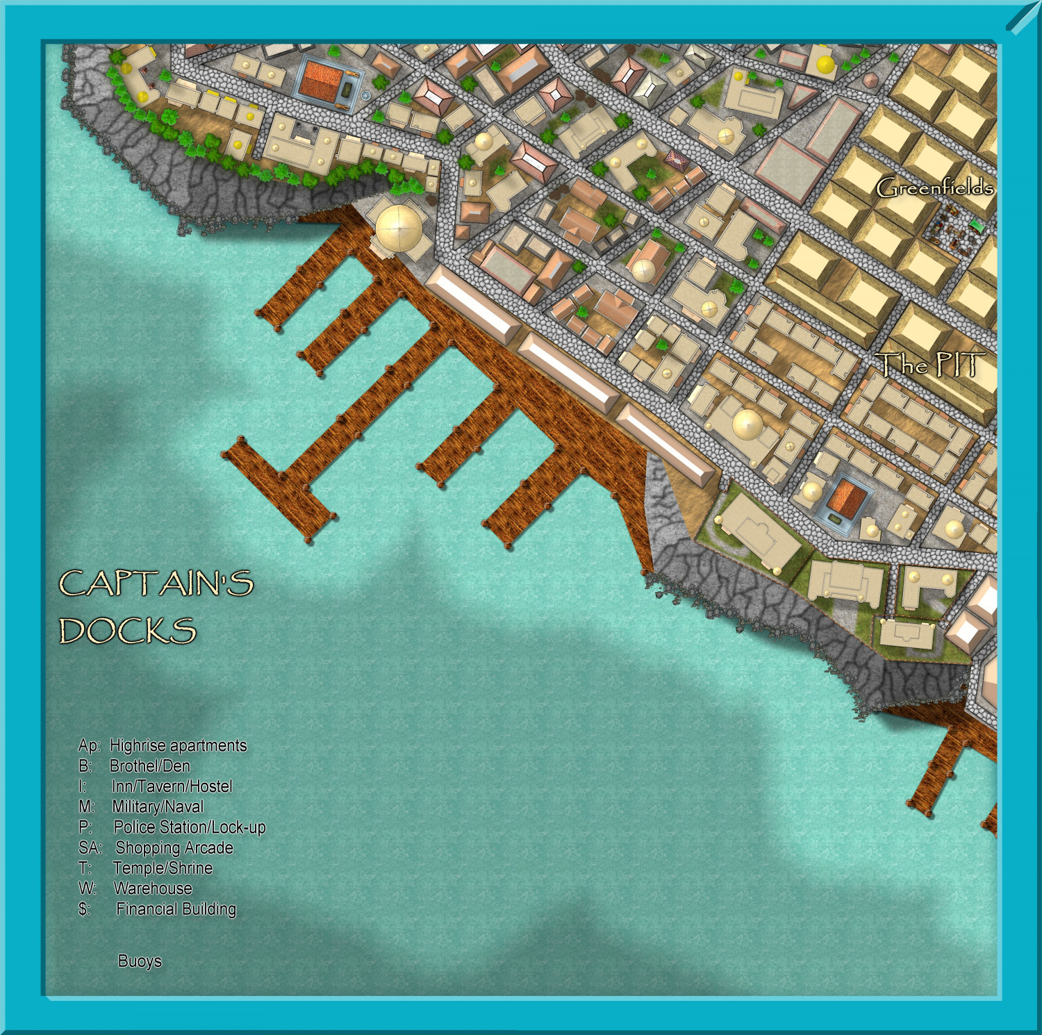
Community Atlas - Stromphe City - Captains Dock District
Well, real life didn't permit, but I am back onto it, and hope to have it ready to submit to Remy when he returns from holidays.
Statues, wells, fountains, market stalls, text and the actual harbour to go.

-
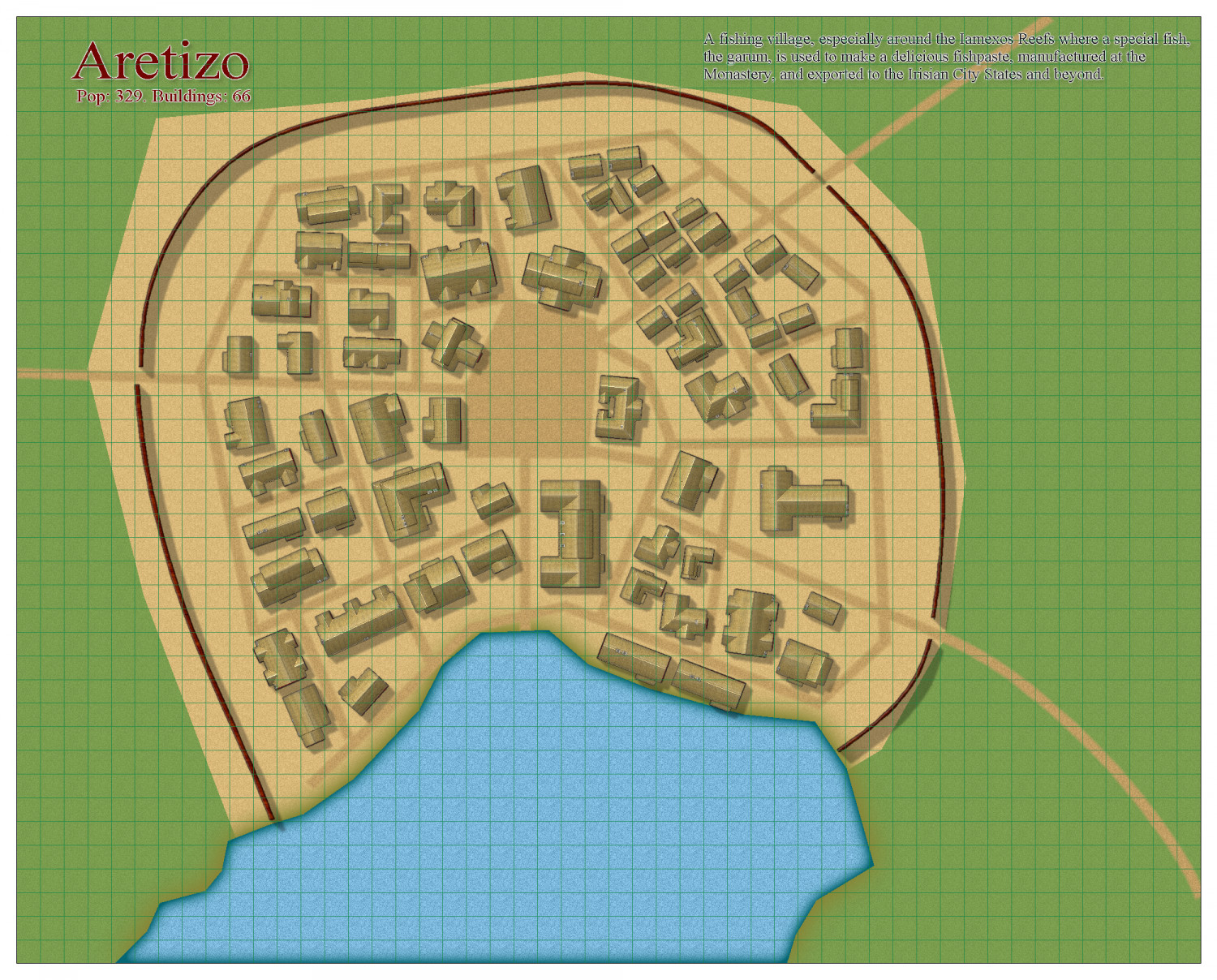
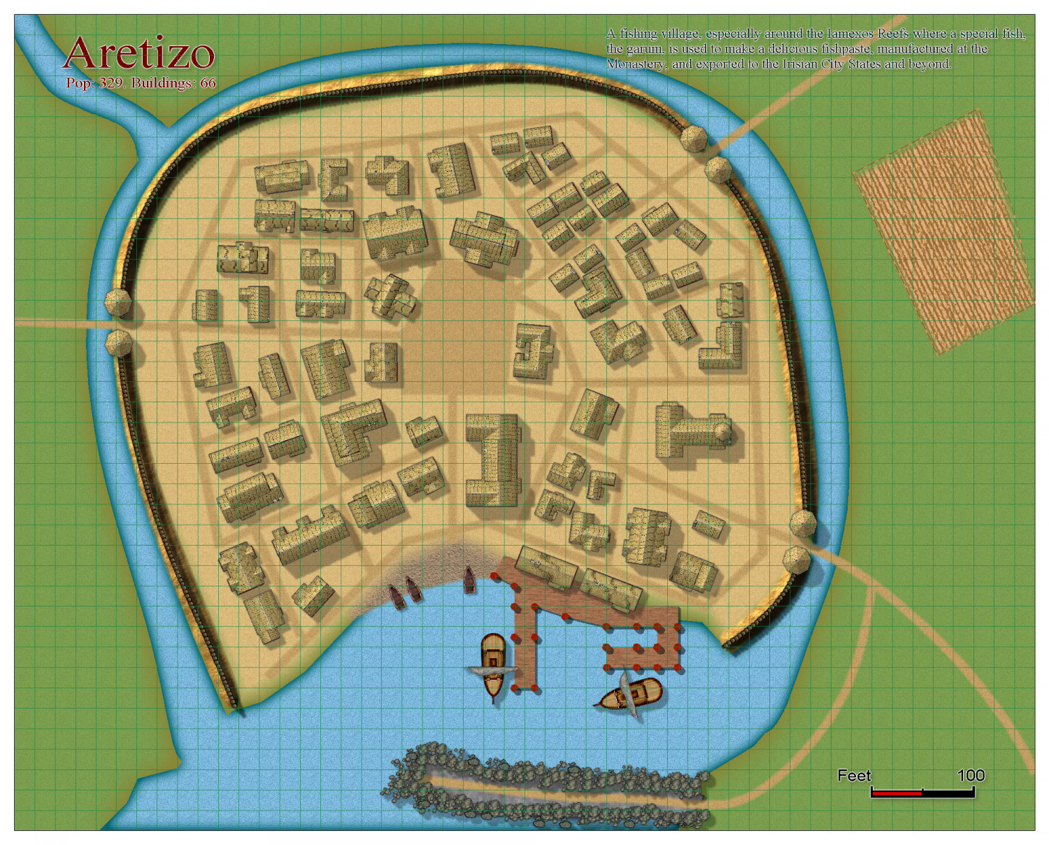
[WIP] Community Atlas Competition - Artemisia - Spiros Isle - Aretizo village
Some progress

-
[WIP] Community Atlas Competition - Artemisia - Spiros Isle - Aretizo village
I have laid down a draft of the buildings - 66 in all, enough to support a population of over 300, I think. This is still all very much in the draft stage, so comments welcome. And the buildings will no doubt be changed into different styles depending on the nature of the building.