


Quenten
Quenten
About
- Username
- Quenten
- Joined
- Visits
- 8,063
- Last Active
- Roles
- Member
- Points
- 3,090
- Birthday
- November 29, 1950
- Location
- Australia
- Real Name
- Quenten Walker
- Rank
- Mapmaker
- Badges
- 16
Latest Images


Reactions
-
Using Mike Schley symbols
I have made my own symbol catalogues for MS - and now no more problems


-
Feature Suggestion Thread
@jmabbott As they say in the country we both are in ; Yeah, Nah


-
Map using Sarah Wroot Style
It is in the very first annual. And it is fairly easy to draw more symbols if you need. Though each symbol has 2 sheets to it.
See this video by Ralf on that annual.
(1) Live Mapping: Sarah Wroot Overland (Annual 2007) - YouTube

-
Very Minor Interface Tweaks
First: When choosing Shaded Polygon by Edge in the Polygon drop down menu, it is a bit annoying to then have to type in editshading (if you even remember the command) in the command line - could editshading also be part of the dropdown menu?
Second: When choosing fractal polygon or polygon line, can a drop down menu option (ie right click) be added to edit the fractalise inputs.
Third: Could drop down menu (right click) on the erase button be added to just erase the top entity of the selection. Sometimes there are unintended duplicates. While I can deal with these by first clicking the top visual edit button, then Del then P, it would be so much quicker if I could just delete the top entity of the selection where I have had accidentally created multiple copies.
Finally, can the List command produce an output with about double the font size, and also perhaps a bigger window as well.
These are the most common procedures I use that would help a lot if put as drop down menus.

-
Starfinder rpg site, with maps
Jim is in hospice care, at his own request. I think Sue is in constant communication with his sister, as am I. He can talk and is sort of with it. I am sure that if any of you would like to write him a letter or card, he would appreciate it. The address to send any mail is
Jim Pierce
c/o 2955 Gladden Lane West
Alexandria
Alabama 36250
USA
His sister feels that contact with people from his hobby would help cheer him up. I have received permission from her to give out this address.

-
Community Atlas: Gruvrå's Mine, Serkbergen, Peredur
No, that is OK. I shouldn't have used the word fatties, sorry. Just wanted to let people know that by changing the x and y axis independently, you can get useful distortions - from severely anorexic, to morbidly obese (all medical terms).
-
Watabou City REVISED (annual 157)
I'm hoping people will try it out, and let me know of any bugs, or suggestions, so I can then talk to @Ralf about a revision of the annual. And I am sure he will also have even better ideas than me.

-
Vejorvik - Boris and Bear Tavern
Here is the 2nd floor - with the players' version as well as the gamesmaster one.

Gamesmaster version below:


-
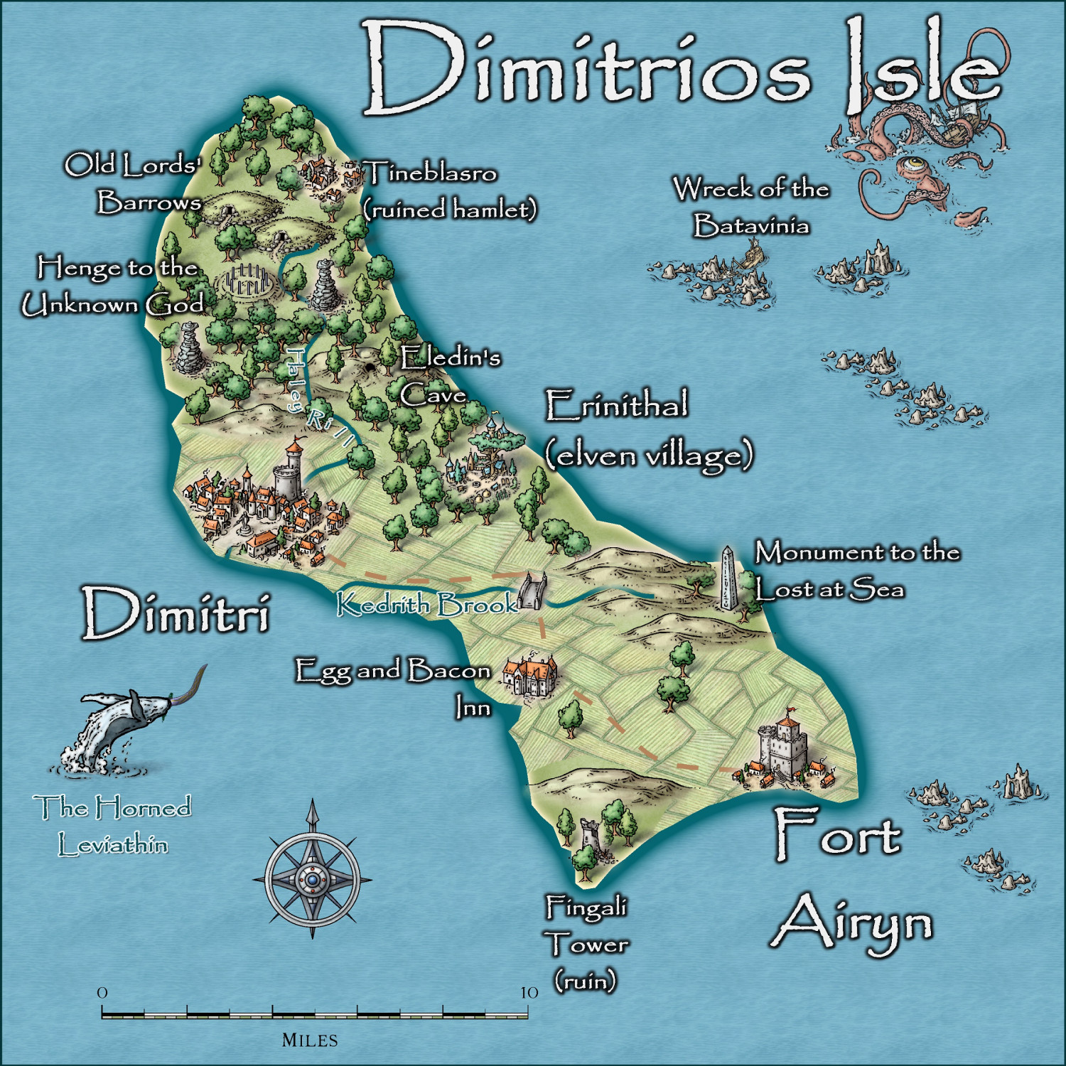
Community Atlas - Irisian City States - Dimitrios island
Do you mean make the farms smaller, or bigger?
Here is the map at present. I am happy to take on board your suggestion. I guess the paddocks are almost a mile wide at present!

-
Jim Pierce 1947 - 2024
A very sad moment and I will miss Jim in so many ways. He was a friend to me when I needed one. We had great chats about so many things, not just cartography.
@Monsen Could we have a competition for the Atlas in the new Year in honour of Jim?


