Quenten
Quenten
About
- Username
- Quenten
- Joined
- Visits
- 7,215
- Last Active
- Roles
- Member
- Points
- 2,865
- Birthday
- November 29, 1950
- Location
- Australia
- Real Name
- Quenten Walker
- Rank
- Mapmaker
- Badges
- 16
Reactions
-
Water Temple
-
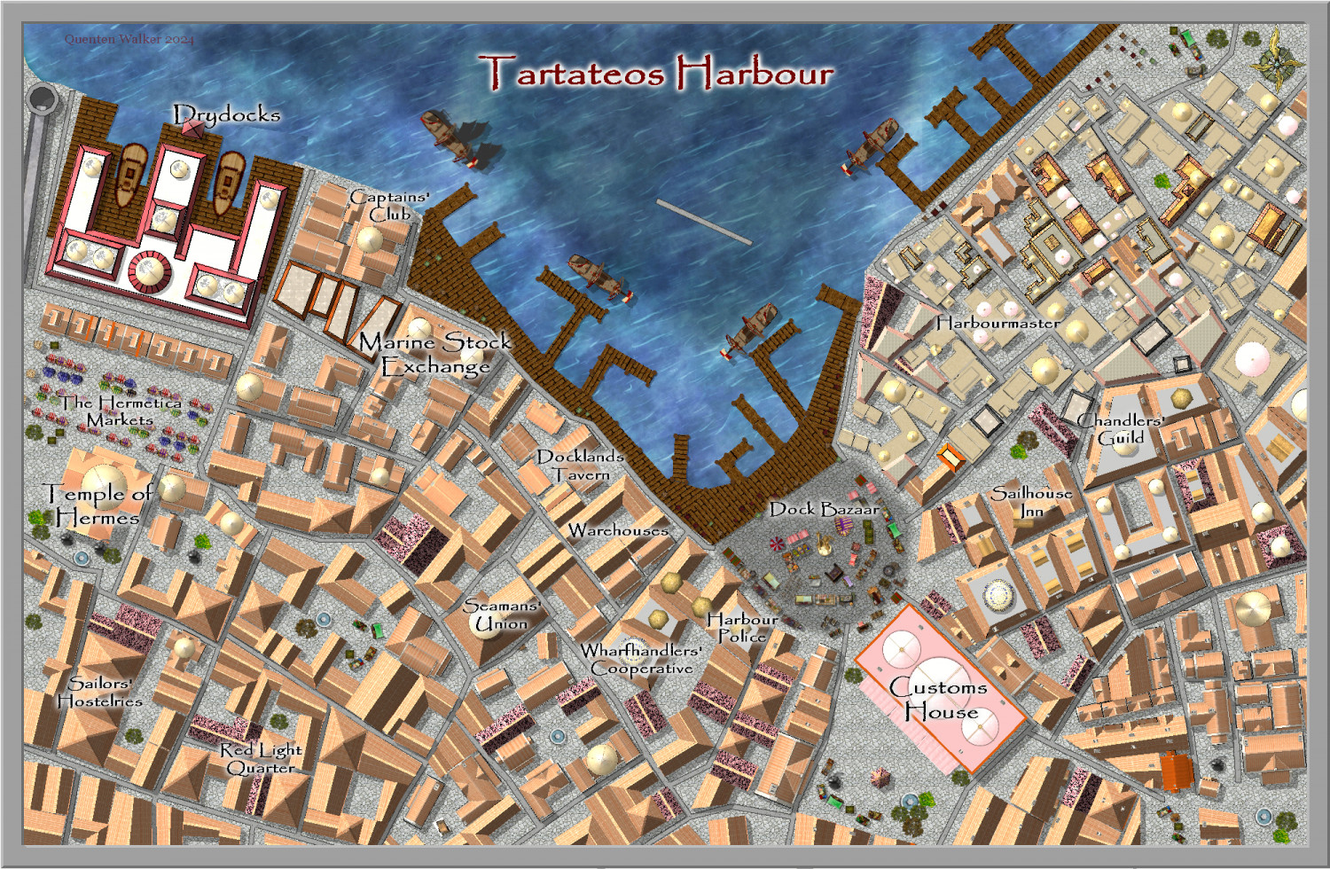
Community Atlas City of Tartateos - Shipyards District
Is this better @AleD ? I have also changed the location of the Customs House to match the parent map.
-
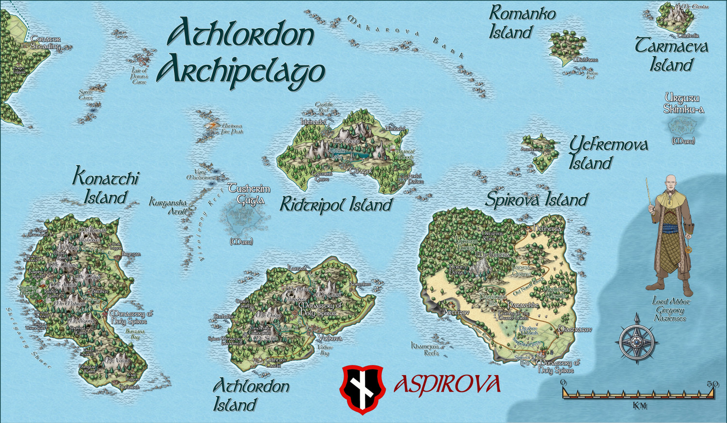
Myirandios - Hardin Region - Athlordon Archipelago
Here is my latest addition to the region of Hardin, my personal project. I am hoping to complete all the land regional maps in the next 6 weeks!
You may recognize Spirova Island as Spiros Island of Atlas origin. I have taken this to include in the map, and turned it into a three Island 'nation' led by a rather tyrannical theocracy. (any resemblance to a future nation on earth is totally coincidental - honest).
Next map is a more 'Ukrainian' based culture or the Cossack times.
A zoomable version is in the Gallery.
-
Map using Sarah Wroot Style
It is in the very first annual. And it is fairly easy to draw more symbols if you need. Though each symbol has 2 sheets to it.
See this video by Ralf on that annual.
(1) Live Mapping: Sarah Wroot Overland (Annual 2007) - YouTube
-
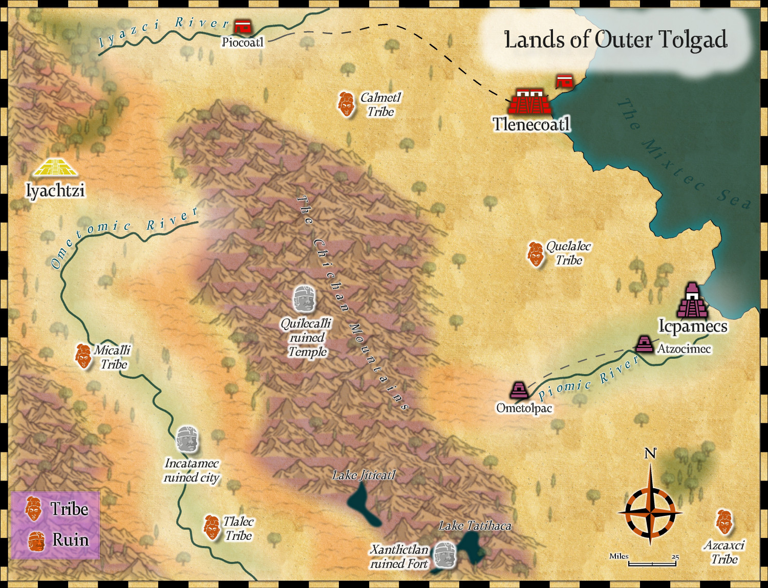
Community Atlas - Kumarikandam - Northwestern Tolgad
I have changed my mind about this map completely, and chosen the Mythic maps style instead. I will use Myrklund on a more jungle type area, which this is not supposed to be.
I used hill symbols from Sarah Wroot style, to make up for the fact there were no hill symbols in this style.
I think this is ready for Remy.
Comments and suggestions welcome.
-
Very Minor Interface Tweaks
First: When choosing Shaded Polygon by Edge in the Polygon drop down menu, it is a bit annoying to then have to type in editshading (if you even remember the command) in the command line - could editshading also be part of the dropdown menu?
Second: When choosing fractal polygon or polygon line, can a drop down menu option (ie right click) be added to edit the fractalise inputs.
Third: Could drop down menu (right click) on the erase button be added to just erase the top entity of the selection. Sometimes there are unintended duplicates. While I can deal with these by first clicking the top visual edit button, then Del then P, it would be so much quicker if I could just delete the top entity of the selection where I have had accidentally created multiple copies.
Finally, can the List command produce an output with about double the font size, and also perhaps a bigger window as well.
These are the most common procedures I use that would help a lot if put as drop down menus.
-
Community Atlas: Gruvrå's Mine, Serkbergen, Peredur
-
Watabou City REVISED (annual 157)
I'm hoping people will try it out, and let me know of any bugs, or suggestions, so I can then talk to @Ralf about a revision of the annual. And I am sure he will also have even better ideas than me.
-
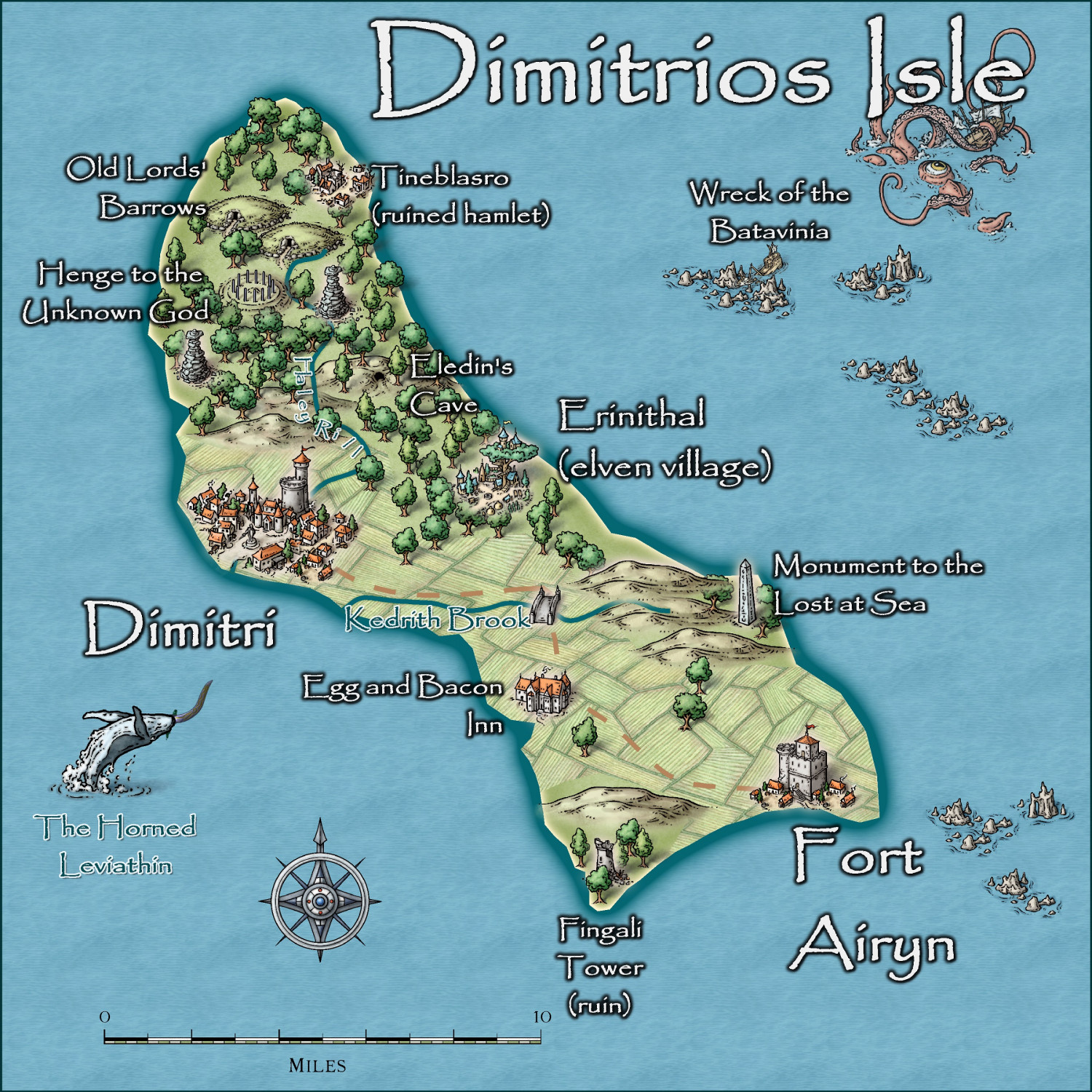
Community Atlas - Irisian City States - Dimitrios island
-
The Ten Kingdoms
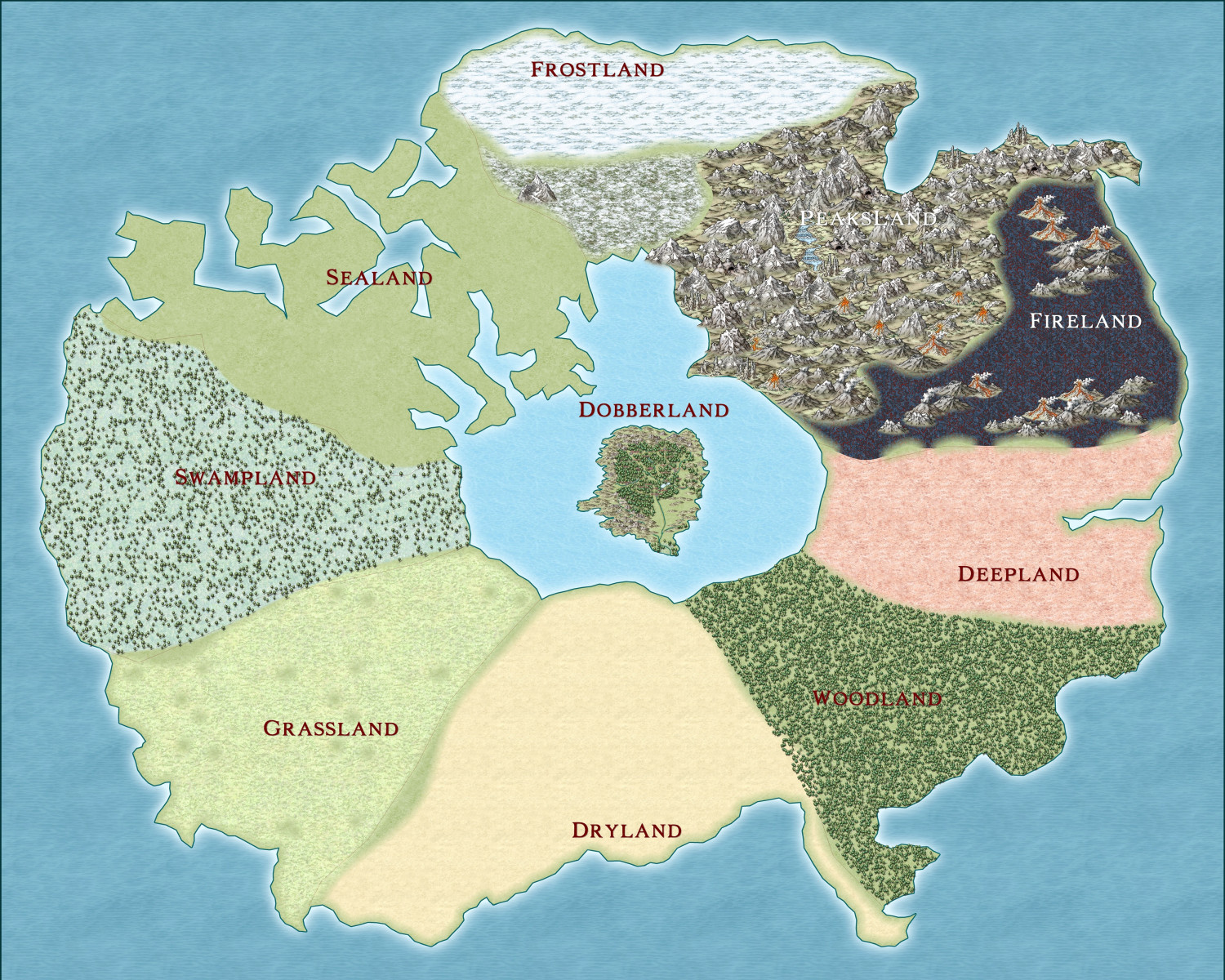
I have been asked by the DM of the campaign I have been playing, to design the larger realm of the 10 kingdoms, now we have finished the campaign set in the central Island kingdom of Dobberland.
The Kingdoms are each dominated by a particular terrain type - Arctic, Mountains, Fire, Forest, Desert, Grasslands, Swamp, Water, Underground and the central Kingdom in a central lake, Dobberland.
Dobberland consists of small humanoid creatures called Dobbers, and 'awakened' animals (as in Narnia), such as Echidnas, Wombats etc (we changed them to Aussie animals - i am Burlesque Spiderbane the most handsome Wombat, disrespectfully called Burly by the party members).
So here is the actual draft, and here are the first six Kingdoms. the names are all generic at present, till the DM decides on what he wants them to be.


