


Quenten
Quenten
About
- Username
- Quenten
- Joined
- Visits
- 8,062
- Last Active
- Roles
- Member
- Points
- 3,090
- Birthday
- November 29, 1950
- Location
- Australia
- Real Name
- Quenten Walker
- Rank
- Mapmaker
- Badges
- 16
Latest Images


Reactions
-
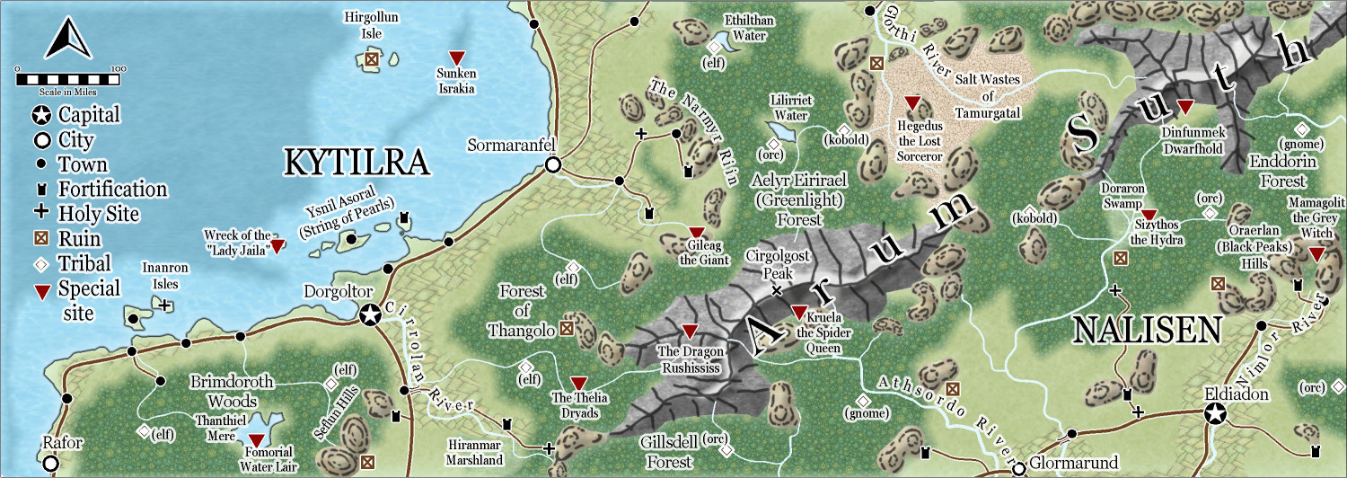
Community Atlas - Berenur - Arum Suth
I think this is finished and ready for the Atlas. But please give critiques before I submit it in a few days.


-
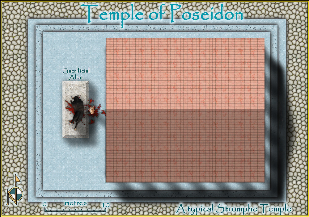
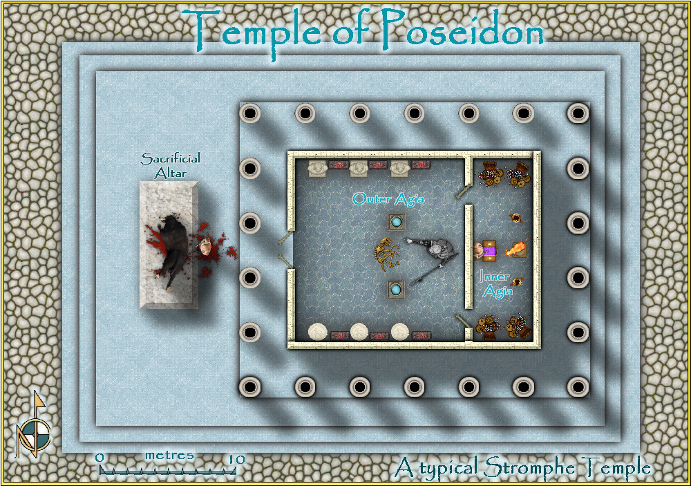
Mars Ultor
I also did a temple in the Community Atlas, if interested. With and without roof.
atlas.cdn.monsen.cc/atlas/artemisia/hi/typical temple.png


-
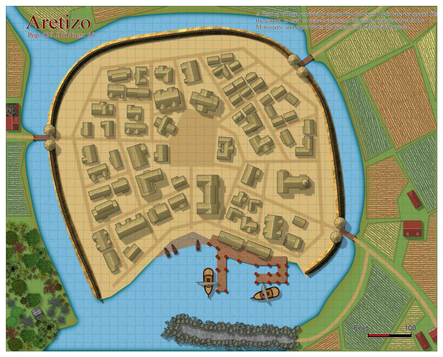
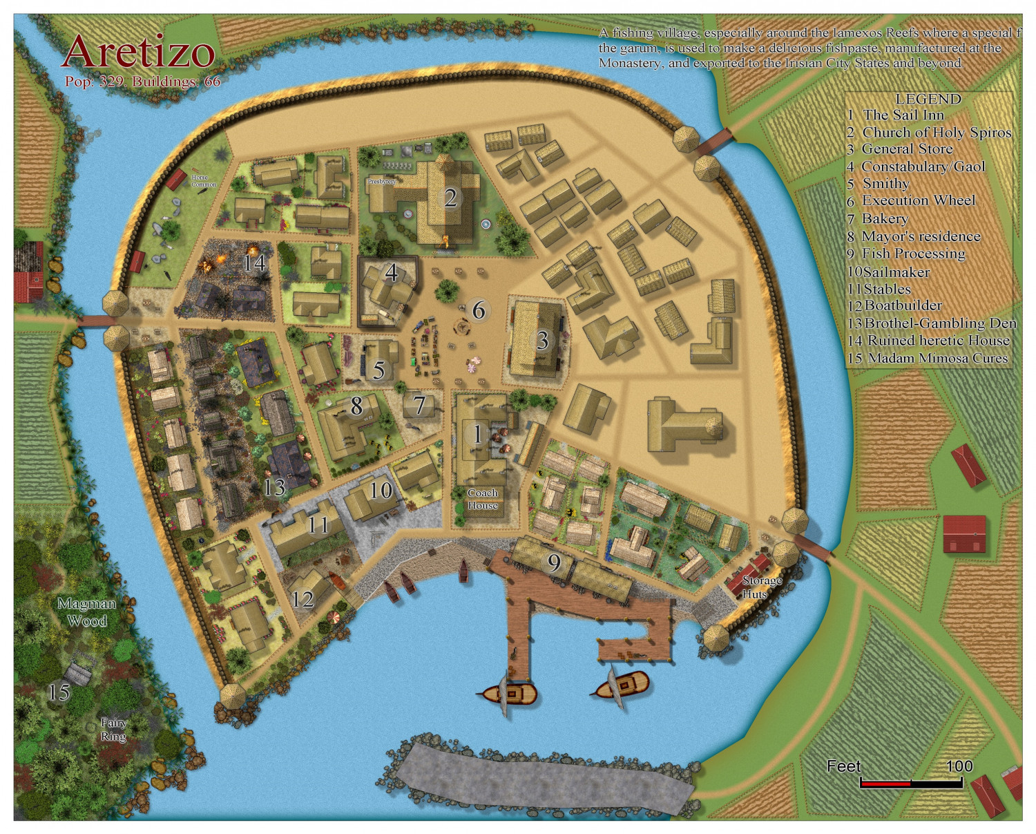
[WIP] Community Atlas Competition - Artemisia - Spiros Isle - Aretizo village
A bit more progress. Not sure about the woods.

-
Hardin region of Myirandios
And the larger map, to date. I will put the larger version in the gallery when it is complete.
-
Community Atlas Project - Download information - Contributions Welcome
I am having real internet problems, and can't get my internet to work well at all. So I am going to ask @Monsen to add this map to the Atlas - in southern berenur.
-
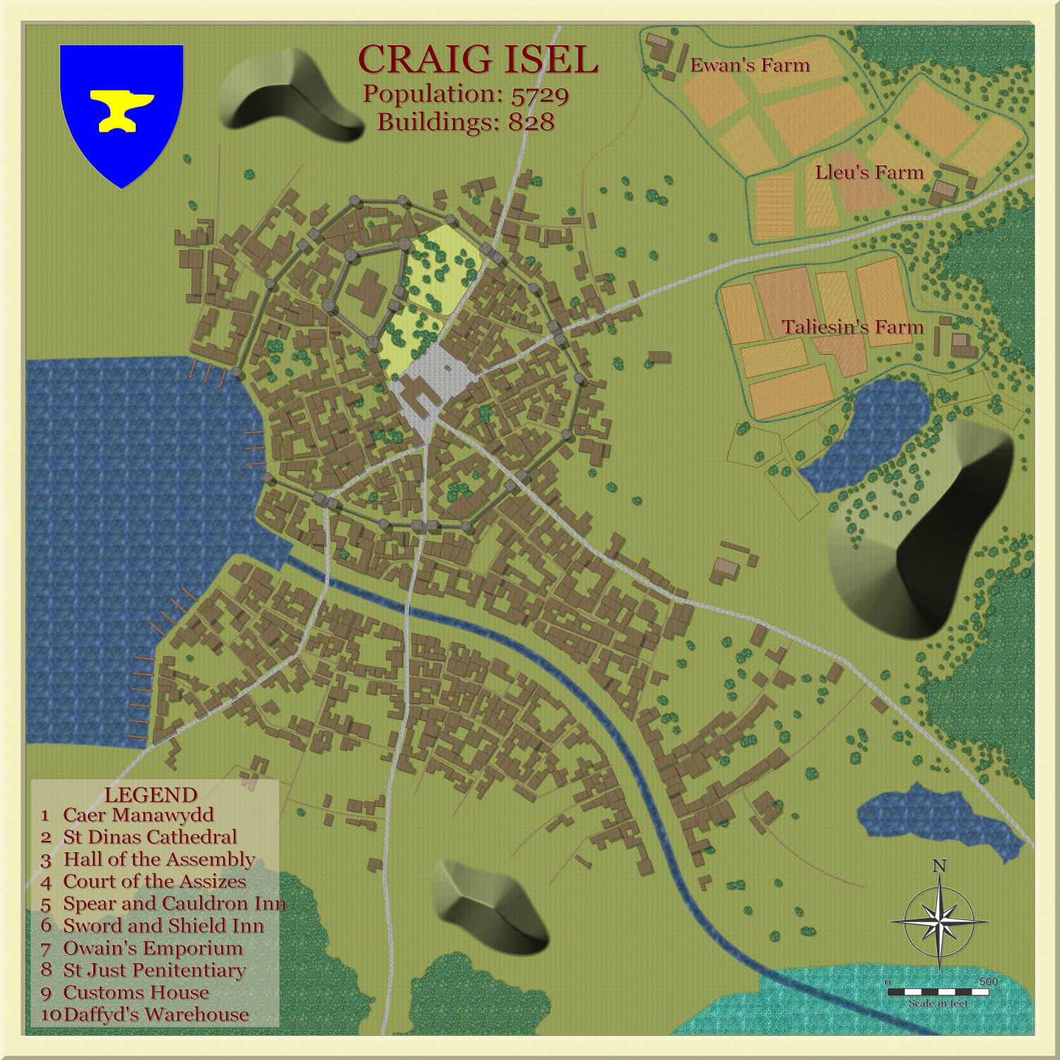
Watabou City REVISED (annual 157)
I have decided on another map for the annual sample. I am now able to include alleys and trees in the conversion process, so feel free to add trees and alleys to your generated maps from Watabou.
This is the map I generated from Watabou, including emblem, trees and alleys. It was called Low Rock, which translates to Craig Isel in Welsh, so I am intending to go for a Welsh feel with the names. And the industry will be some sort of iron-working industry, as per the coat of arms.
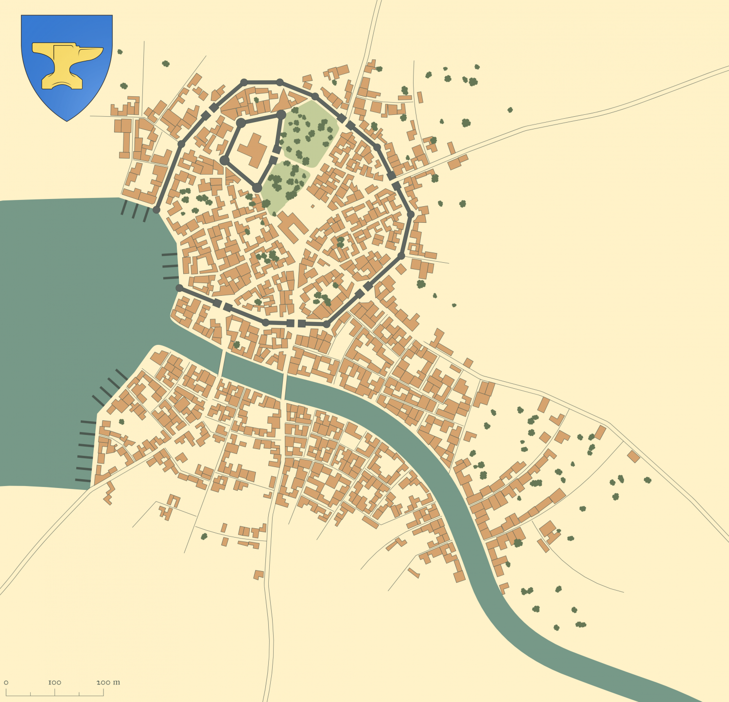
I have outlined the roads to show them, but in the SVG export, I have unchecked outlines for all except BUILDINGS. I haven't got any fields, so will use Drawtools to add my own.
Here is the result after complete conversion, all using Drawtools, except for the emblem (which I also exported from the generated map).
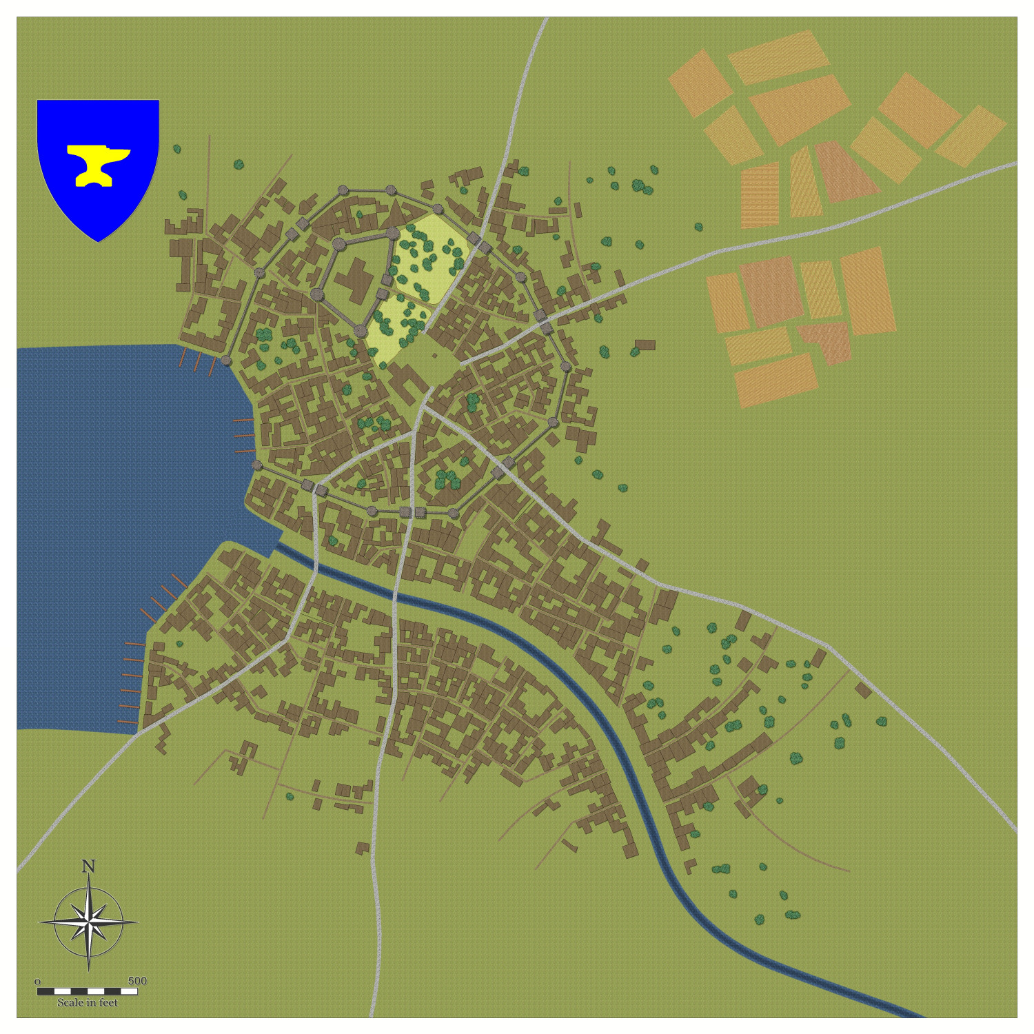
Here is the sample map so far, using Drawtools only, apart from text.

-
FT3 to CC3+ as per recent Live Mapping Tutorial
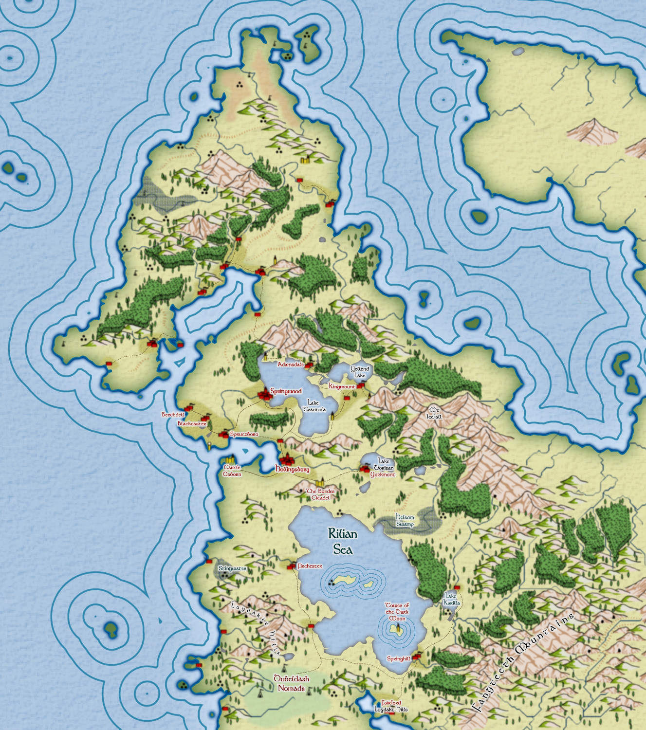
Some progress on this map - just goin' with tha flow, folks - very little planned.
Instead of the Caspian Sea, I named it after Caspian's son, Rilian! 😁


-
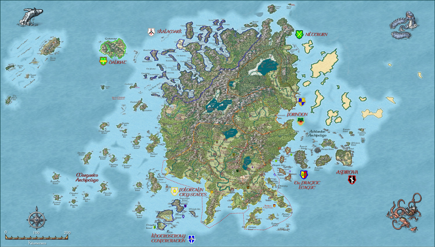
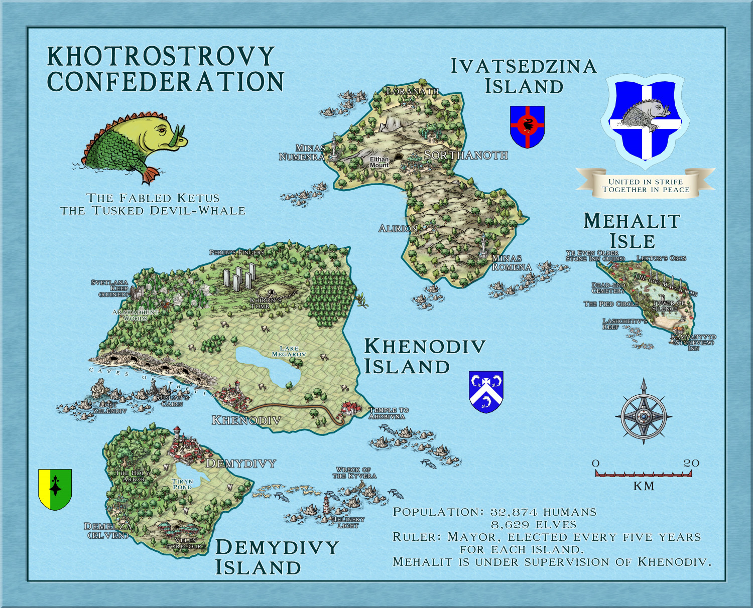
Myirandios - Hardin Region - Khotrostovy Confederation
Here is the map of the Khotrostovy Confederation - I reused the maps for the Community Atlas of Xenothon and Demydice, and Megalith Isle - yet to be included in the Atlas, but waiting for Remy to get time to put them in (I have asked him to wait till I finish the other islands' map notes, so the delay is my doing). In addition, I have changed the names to a more Slavic feel, and added another mainly wooded elven isle. Another advantage to reusing these maps, is that I already have map notes, which I can expand upon for my own world.
-
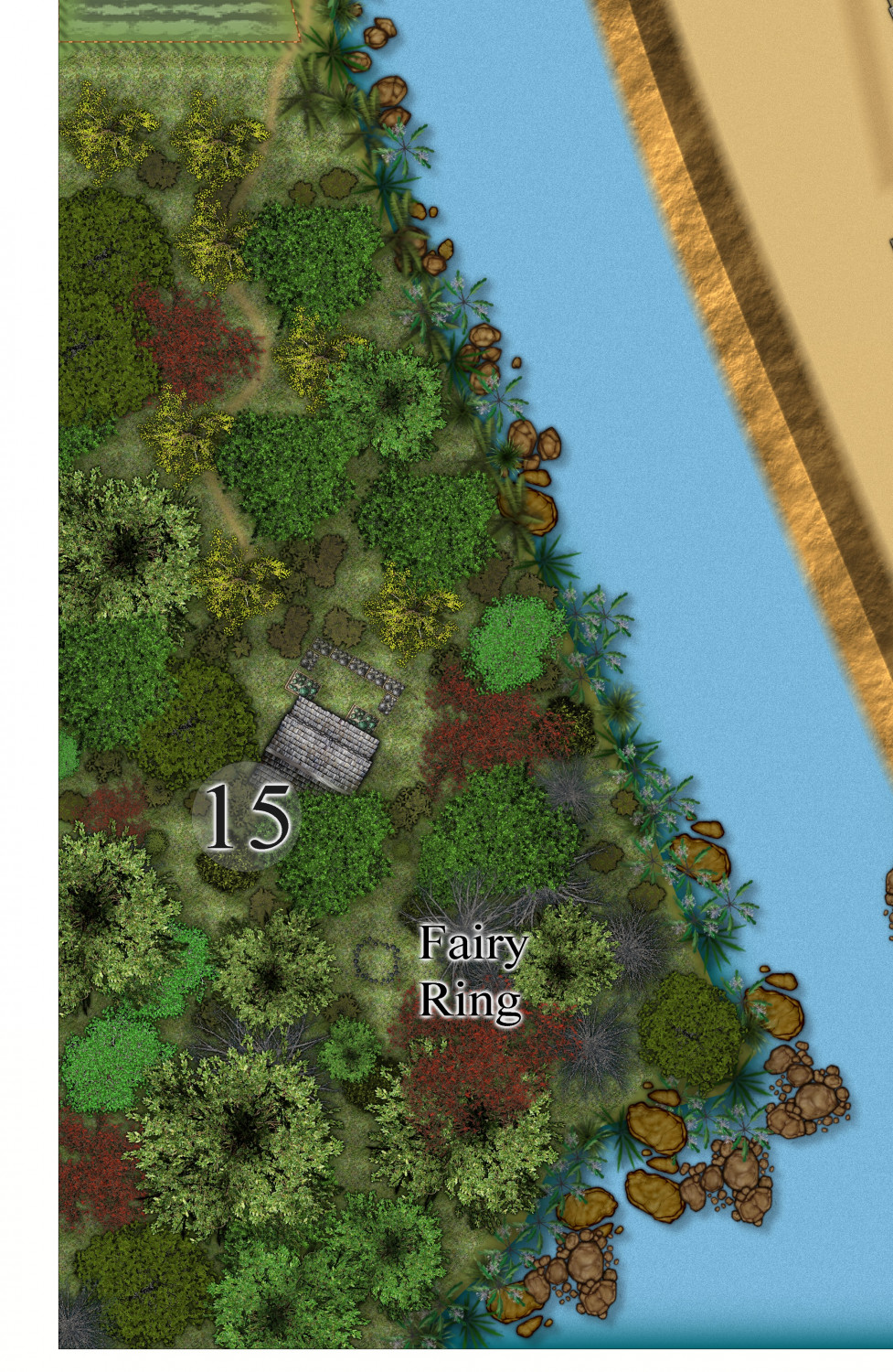
[WIP] Community Atlas Competition - Artemisia - Spiros Isle - Aretizo village
The witch's cottage in the south-west. I think I am a bit happier about the forest now.

-
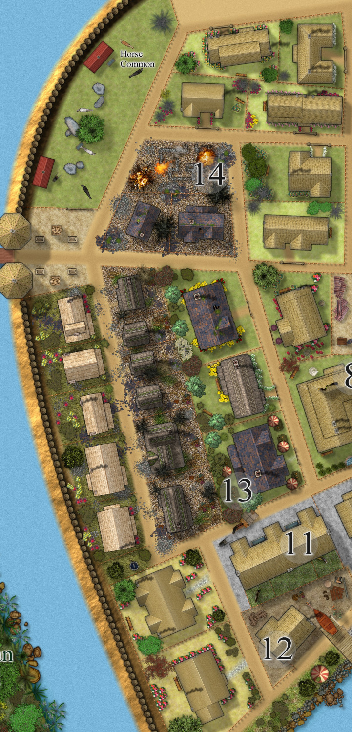
[WIP] Community Atlas Competition - Artemisia - Spiros Isle - Aretizo village
Slow progress. Here is the village as a whole to date, and the west quarter - Grimy Street, with the heretic (who is on the execution wheel) house which has been burned to the ground by orders of the kind gentle merciful Monks of Holy Spiros. (so glad nothing like this happens here in real earth).


