


Quenten
Quenten
About
- Username
- Quenten
- Joined
- Visits
- 8,062
- Last Active
- Roles
- Member
- Points
- 3,090
- Birthday
- November 29, 1950
- Location
- Australia
- Real Name
- Quenten Walker
- Rank
- Mapmaker
- Badges
- 16
Latest Images


Reactions
-
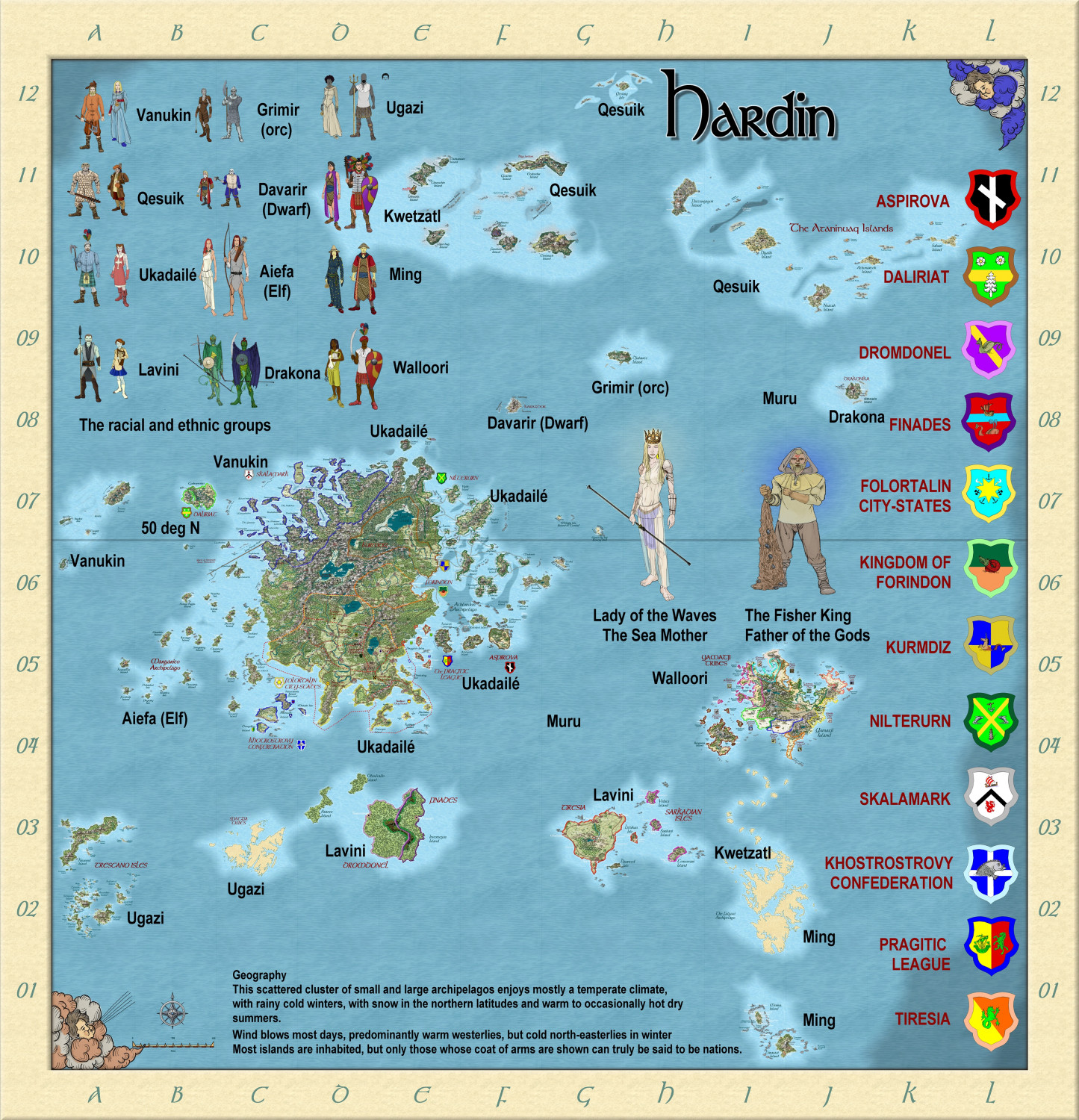
Hardin region of Myirandios
Here is a revised map of the whole Hardin region - not fully complete yet. Ranges from subarctic to subtropical.


-
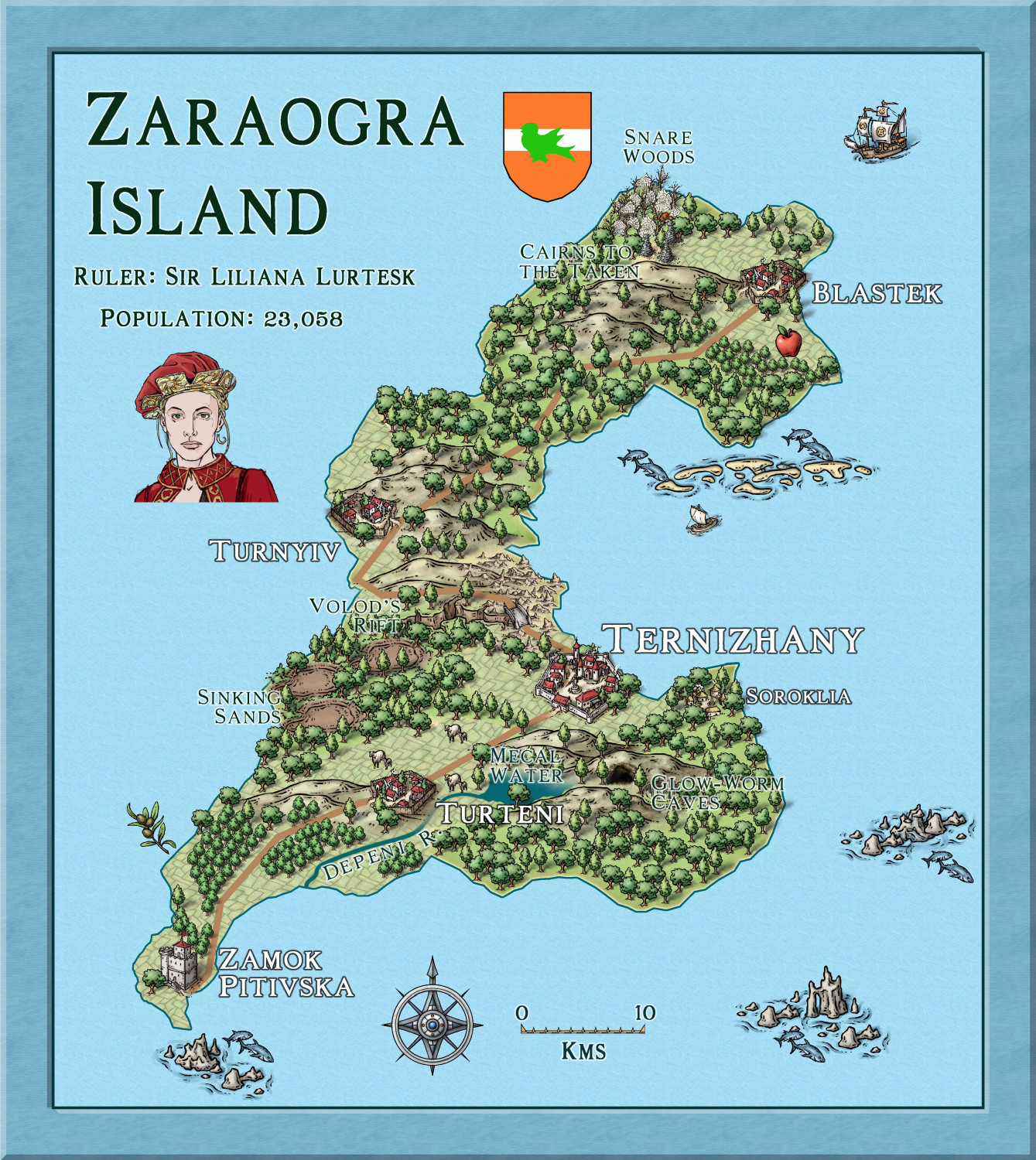
Hardin - Folortalin - Zaraogra Island
Here is another Island in the detailed map of Hardin I am doing.
The title is correct - all knights and other nobles have the so-called 'male' titles, regardless of sex, to indicate that this is a FEMALE dominated world. (as the females are SO much stronger in use of innate 'magic' powers, called etherics).

-
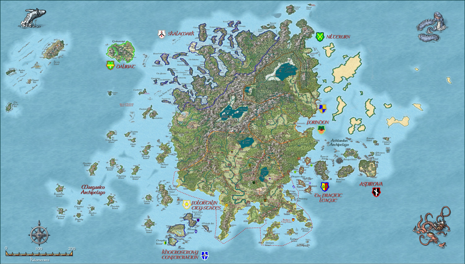
Hardin region of Myirandios
And the larger map, to date. I will put the larger version in the gallery when it is complete.
-
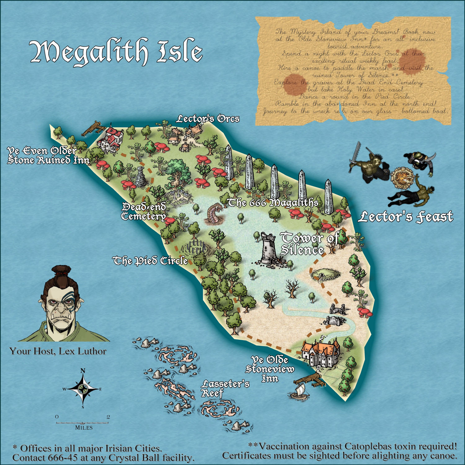
Community Atlas - Irisian City States - Megalith island
Most recent update. I think this is ready for the Atlas. Again, thanks to @Ricko Hasche for his very helpful suggestions in a private message.

-
Creating large cities without crashing
My advice is to show only all the buildings by hiding all sheets without Buildings on them, then dividing the buildings into various districts suing layers. Then hiding all building layers except the district you are working on. And the more bitmap symbols you use, the better - i know it takes longer, but the map will actually look better as well as run better.
Here is your FCW with the buildings divided into 5 separate layers - North, South, East, West and Central. You can hide those layers except for the district you are working on. I suggest you use bitmap buildings for at least 20% of the buildings you have in the map - just delete a few houses here and there and use bitmap ones instead.
Incidentally, I had no trouble or even much of a delay in redrawing the map with all buildings showing, with Sheet effects on.


-
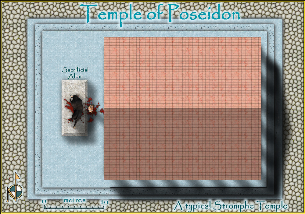
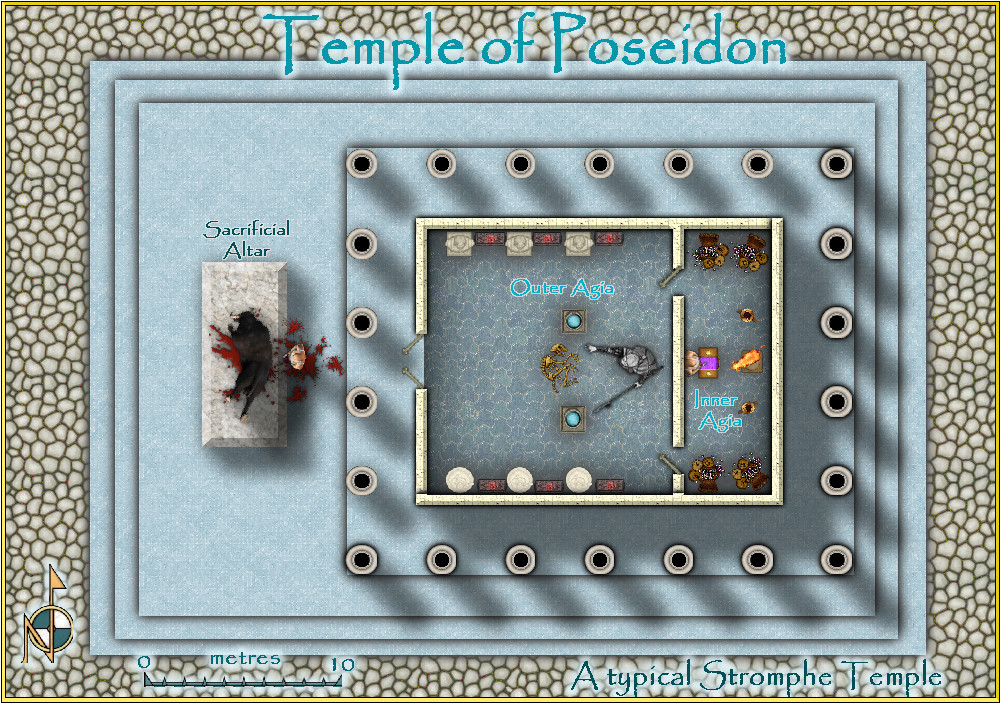
Mars Ultor
I also did a temple in the Community Atlas, if interested. With and without roof.
atlas.cdn.monsen.cc/atlas/artemisia/hi/typical temple.png


-
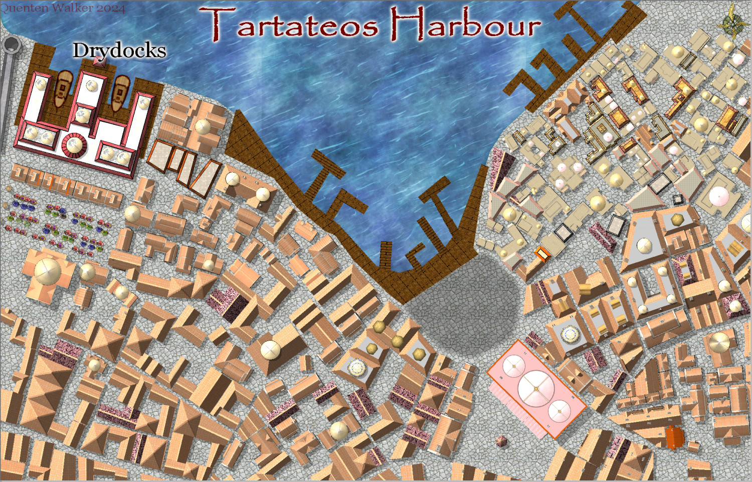
Community Atlas City of Tartateos - Shipyards District
Progress - now for house trimmings, and street furniture, and some ships.
Comments welcome, especially on improvements needed or things added or subtracted.

-
Hardin region of Myirandios
Second last map in the region to be completed - the Lavini (Italian-like) nations of Finedesa and Dromidonla. Needless to say, the outlying islands are run by the 'benign' La Familia (aka the Mafia).
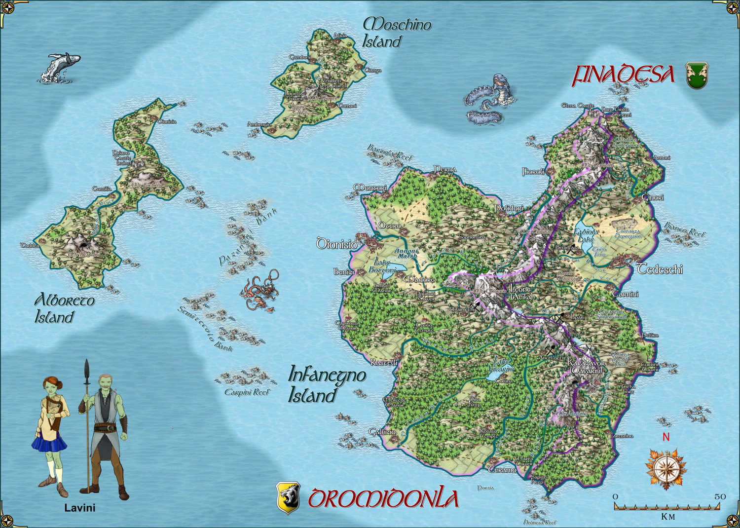
Larger version in the gallery.

-
Community Atlas Project - Download information - Contributions Welcome
I am having real internet problems, and can't get my internet to work well at all. So I am going to ask @Monsen to add this map to the Atlas - in southern berenur.
-
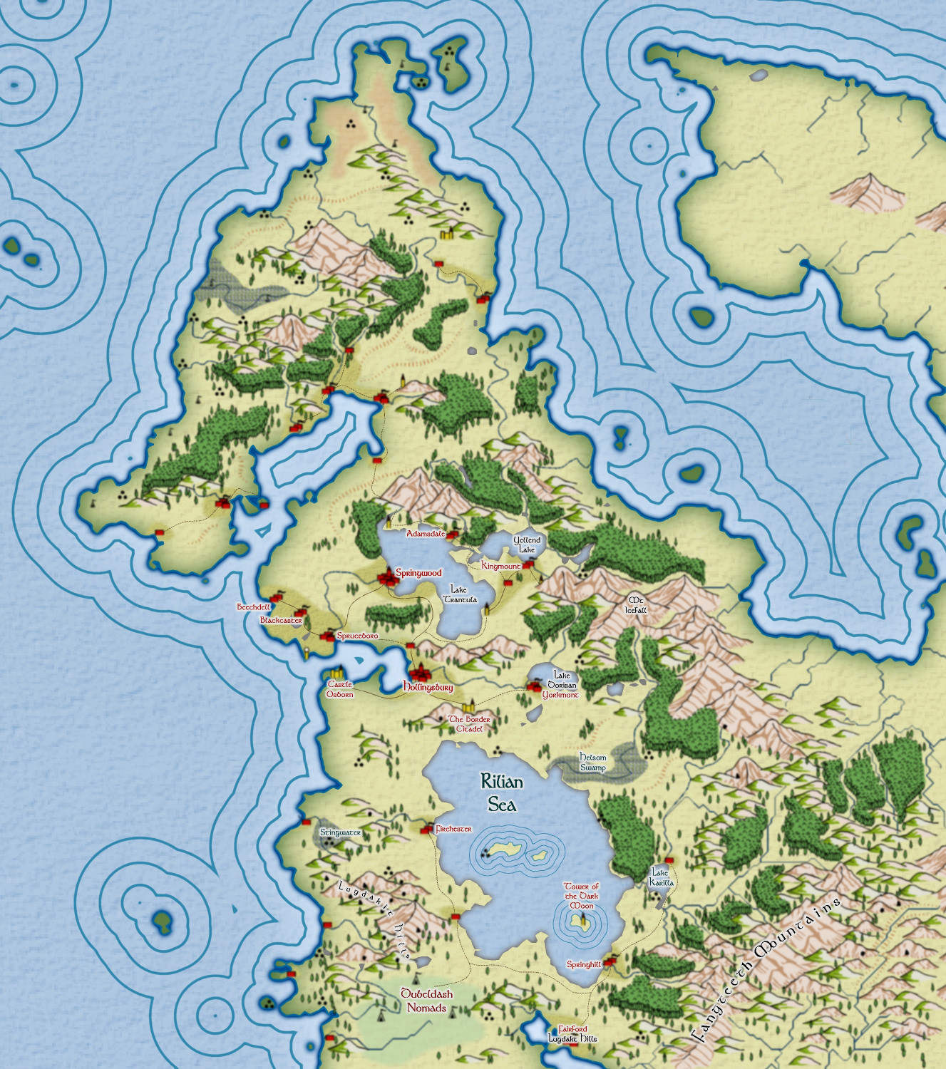
FT3 to CC3+ as per recent Live Mapping Tutorial
Some progress on this map - just goin' with tha flow, folks - very little planned.
Instead of the Caspian Sea, I named it after Caspian's son, Rilian! 😁
