Avatar

Quenten

Quenten

About

Username
Quenten
Joined
Visits
4,356
Last Active
Roles
Member
Points
2,198
Birthday
November 29, 1950
Location
Australia
Real Name
Quenten Walker
Rank
Mapmaker
Badges
15

Latest Images

  • Hardin Region (Myirandios) - Isle of Kalihirin, and Isle of adventure for low level characters.

    Here is a setting for a series of low level adventures to get a beginner D&D party on its way to fame and glory ... or grisly death.

    Kalihirin Island (nowhere near complete, of course). Of course, adventure sites etc are yet to be added.

    Detkhiv, the main settlement with a population of over 600.

    I have made use of the draft version of the Watabou revised city annual to come later this year.

    Ricko HascheRoyal ScribeLoopysueJuanpi
  • Myirandios Regions mapped in detail.

    I have decided to not continue with my other worlds, but go back to my original Myirandios world, which has so much lore already. This is what I hope to publish as an RPG supplement next year.

    There will initially be three main regions - two are outlined in red, the other is Logrid and Evain to the south.

    I will be using some of the ideas and maps and races I designed for the other worlds, so as not to waste stuff, and also because they are all designed with Myirandios at the back of my mind anyway.

    So here are the two Regional maps. The bigger one on the lower left is cut into two. Each grid is 1600 km x 1600 km (approx 1000 x 1000 miles).

    I have supplied the altitude and climate maps.

    These are the two regions, at their very beginning.

    The Hardin region first, inspired by Harnworld.

    This is the larger region, divided into two halves.

    As you can see, I have already done a lot of work on these already.

    The Weldarmon-Gyaflaggio region, which contains the core playing area:

    As you can see, it uses primarily symbols from Mike Schley.

    I will work on this under a different discussion thread.

    The second area - Deithardt-Kolsven region - to the east of this, uses both symbols and also bevel-lighted contours for the mountains, instead of Mountain symbols. I would be interested in your thoughts on this. I will eventually decide on one style for all the maps, of course. But input will be very helpful.

    Here is an inset showing the bevel way of doing the mountains, combined with symbols for other things.

    I do need to finesse this more, I do realize.

    Still not sure which way is best.

    whit2468JimPCalibre
  • Community Atlas - Irisian City States - Tiresia City State

    Got bored! Here is the Haunted Island south-east of the main Isle of Tiresia.

    Feel free to make suggestions, otherwise it is ready for the Atlas.

    LoopysueMonsenJuanpi
  • Community Atlas - Irisian City States - Tiresia City State

    The Map notes for the City State of Tiresia.

    Tiresia City State

    Tiresia is the smallest in power, both militarily, and economically, of the five Irisian City States. However, compared to the rest of Artemisia, it still ranks highly. The mainstay of the economy is agricultural, especially the olive oil industry, with a minor tin extraction industry. Most of the tin is exported to be refined elsewhere, with the State collecting both royalties, and a newly raised resources rent tac, to bolster the faltering economy of the City-State after a few years of devastating drought wrought havoc on the agricultural economy.

    The olive oil industry is by far the most lucrative for the City-State, with large government holdings in one of the main Olive Oil companies, called The Popeye Oil Consortium. The purity, and special flavour of the oil is prized throughout Artemisia and beyond. The special flavour is imparted by pollinating bees of a unique kind, and causes the subsequent oil to have a faint honey-flavoured scent.

    Tiresia is ruled by a Senate composed of 25 Senators, voted into office by all property holders with over 50,000 Drachmas in value ie only the wealthy families can vote. They then elect three Magisters, who hold office for three years, staggering the elections so that one is elected each year. This staggers the office holders so that the government is unusually stable, but also more likey to fall into corruption – which it has, leading as it does to a monopolization of power and wealth into the hands of a few families, a high level of corruption, (the highest of all the City-States), and a very unequal society.

    Subsequently, demands from the rest of the populace, who cannot vote in any election, and have had their needs ignored for far too long, have grown stronger, accompanied by greater and greater civil unrest. The capital of Tiresia is most affected, but the more violent acts of arson, theft, destruction of government and senators’ private property, and abductions occur in the countryside, which has suffered extensively because of the three year drought. Various groups are calling for abolition of the Senate, replacement with an Assembly of the People and universal suffrage, including both genders, and a government headed by a directly elected Tribune. Finally, they are calling for trials of all corrupt officials – the one thing that sends tremors down the backbone of most of the Senate and government, and stiffens their resolve not to give an inch to those calling for change.

    The increasingly radical and tense political situation has drawn the worried attention of the other City States, some of whom are wanting to send troops to quell the increasing unrest. However, Stromphe, the largest and most powerful of the City-States, has vetoed this and insists on non-interference. It is well-known that Stromphe, the least corrupt, and most democratic of the City-Sates, has contempt for the government of Tiresia, and would happily see it fall, and so extend their direct influence over the island. The other States, especially Otykos and Arete, have thus decided to keep their aid to an increasingly beleaguered government at the clandestine level, with moles in the radical groups, passing information to the Tiresian Magisters, and financial loans to the Senate to enable them to increase the ‘bread and circuses’ policy that they hope will have effect. Cake, rather than bread, is offered!

    Unknown to all is that the mysterious Purple Daffodil (a rare bloom found in western Tiresia), leader of the most influential, and violent, of the groups calling for reforms, is in fact Demetrios Kaluthenas, younger son of one of the Magisters, Gerolimeo Kaluthenas. He seems motivated by a genuine disgust of the corruption of the present system, as well as anger at his treatment as an unwanted child by his authoritarian father. He has already drawn up a list of those he wants executed for corruption – and strangely, includes leading figures of the other three reformist groups. His own group is now the largest and most influential, and calls itself the Directorate of the People. His identity is known only by his closest friend, Brutos Skipianas, who is even more in favour of violent revolution than his leader. Not even Demetrios’ wife and children know of his true identity, and he plays the role of an incompetent fop and socialite very well. After every atrocity committed by the groups, and every murder or abduction, a purple daffodil is left as a sinister calling card.

    The cycle of increasing violence and harsh counter-measures has the whole City-State ready to explode in violent revolution – and perhaps get beyond the control of even the manipulative Demetrios.

    The religion of Tiresia, like that of all south and western Artemisia, is that of worship of the Olympian Gods, but especially Athea, Poseidon and Demeter. The clergy are calling for peaceful negotiations between the people and the Senate, but increasingly, their pleas are falling on deaf ears, and many of the would-be revolutionaries are casting the priests as fellow-travellers of the privileged classes.

    The stage is set for events which may become world-shattering!

    GlitchDon Anderson Jr.Ricko Hasche
  • Community Atlas - Irisian City States - Dimitrios island

    The final map. Map notes to come, then off to the Atlas. Next island coming up.

    For those (including me) who wonder how much could be reasonably fitted on such a small island, I attach this map of the Scilly Isles. the largest island, St Mary's, has many interesting prehistoric ruins, and other features, and is only a fraction the size of this island.


    LoopysueRicko HascheDon Anderson Jr.
  • Torstan Holy Head Sewers

    I have decided to give the sewer annual a go, and am using the sewer map I did for Torstan, just for the Holy Head District. Even that might be a bit much, but we will see how I go.

    I will keep the buildings on the map with a solid50 bitmap between them and the sewers. It will also be for the same city in my campaign world, where it is the city of Krakatos.

    So, this is what I will be doing. There will be three sewer widths - the main channels about 5-7 metres, the intermediate ones of 3 metres, and the smaller ones less than 1 metre (not shown on the map above ... yet).


    Ricko HascheRoyal ScribeJimPGlitch
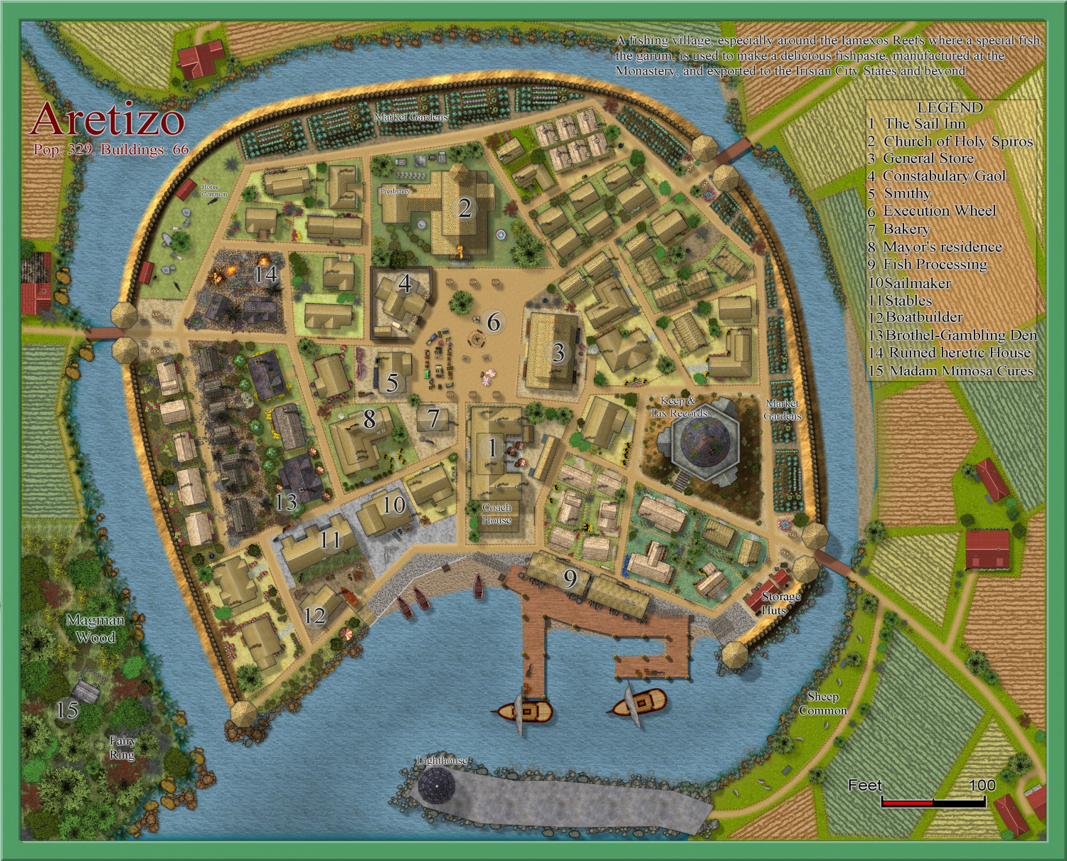
  • [WIP] Community Atlas Competition - Artemisia - Spiros Isle - Aretizo village

    Some progress on the three main buildings in the village = Church, Inn and Store. No town hall, though - all such community gathering places have been forbidden by the monks of Holy Spiros.


    LoopysueMonsenRicko HascheRoyal Scribe
  • Modern City Generator?

  • Weldarmon-Gyaflaggio region

    This stream will be dedicated to this region only.

    I am still undecided whether to use Schley Symbols for the structures, or more generic ones, as shown here. Opinions very welcome, and in fact necessary. In places I have used both, with one or other to be removed once you all help me make my decision.

    Here are a few areas already mapped out fairly completely, with the last the least complete to date.

    This is THE core area, with many adventure sites already mapped and keyed in with both map and text links.

    This is the whole of Gyaflaggio - not complete in the western area of the map.

    These are small nations to the north of Gyaflaggio


    This is Western Bolasov - the least complete so far, and no use of Schley structure symbols. Comments on that please.


    MonsenRicko HascheJimP
  • Community Atlas - Forlorn Archipelago - The Bleakness - Dungeon of the Dragon

    Or else, resize the scale bar AFTER you resize everything. And I use Remy's SCALEDRAWING command (not official CC3+ command, unfortunately - it has always worked brilliantly for me, and takes care of bitmap scaling as well.

    Here is the bit he wrote about it in his dissertation on scaling. (SCALE MATTERS, May 2018)

    The Automatic Option

    Because rescaling a map is actually a lot of steps, especially if you need effects and fill rescaling too, I’ve created a CC3+-addon to do all of this automatically, you only need to determine the scale factor.

    To use it, download the file from this address, and put the .dll file from the .zip inside your CC3+ installation directory (C:\Program Files (x86)\ProFantasy\CC3Plus by default).

    You’ll also need to have the Visual C++ 2017 runtime installed on your computer. You may already have this, but if you don’t, you’ll get an error message when starting CC3+ with this .dll in it’s directory. Download from the official Microsoft download site, you’ll need the 32-bit version (vc_redist.x86.exe)

    After installing the .dll and the Visual C++ runtimes (if required), you can run the command by typing SCALEDRAWING on your command line. The command line will then ask for the scale factor, which you can provide either as the number, or the calculation as with the non-visual scale command. Once you hit enter after providing the scale factor, the command will take care of the rest. Note that it doesn’t update the display when done, so simply hit the Zoom Extents button after running the command. The map should look visually identical to what it did before, as this command handles the scaling of entities, effects and fills automatically, only way to see that the command did anything is to measure distances again after running this command (and AFTER hitting Zoom Extents). Because it doesn’t do any screen updates, it should also be lightning fast, but remember, you won’t see the result until you hit Zoom Extents. If you hit Redraw instead, you can easier see the result of the scale operation, because this leave your current zoom intact.

    Profantasy's Map-Making Journal » Blog Archive » Scale Matters

    GlitchJimP