


Quenten
Quenten
About
- Username
- Quenten
- Joined
- Visits
- 8,060
- Last Active
- Roles
- Member
- Points
- 3,085
- Birthday
- November 29, 1950
- Location
- Australia
- Real Name
- Quenten Walker
- Rank
- Mapmaker
- Badges
- 16
Latest Images


Reactions
-
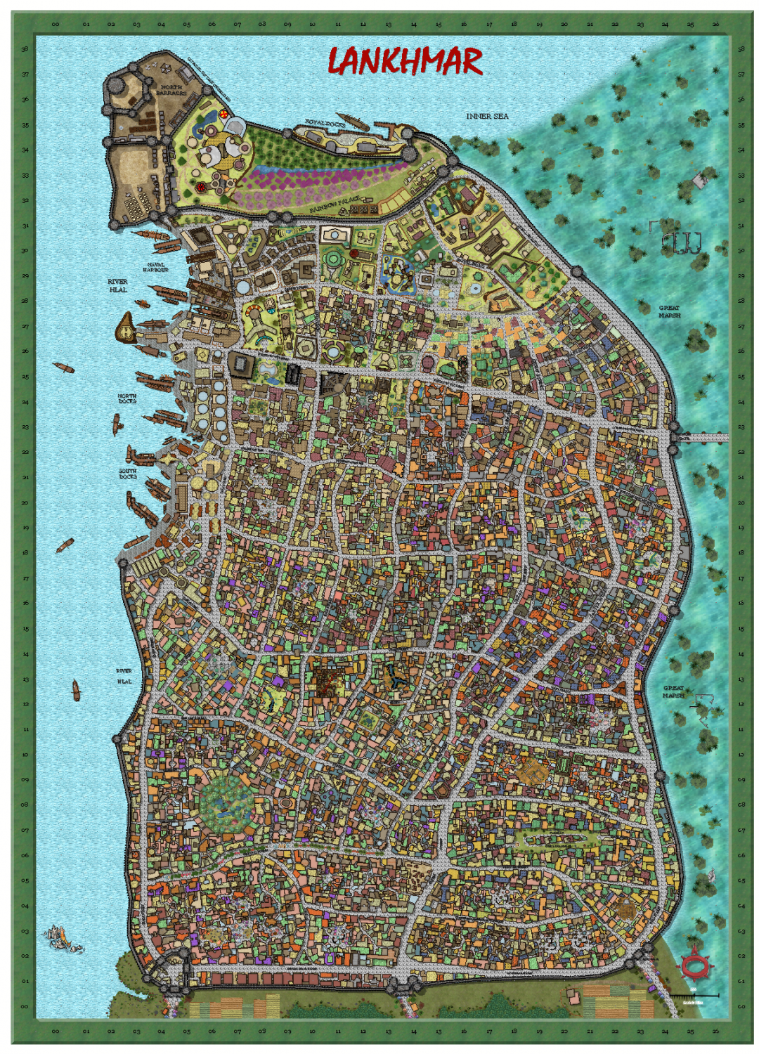
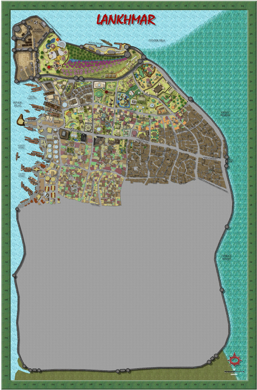
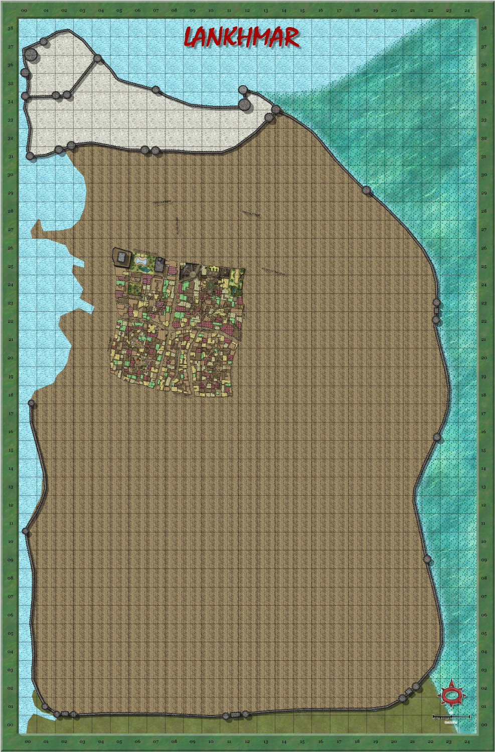
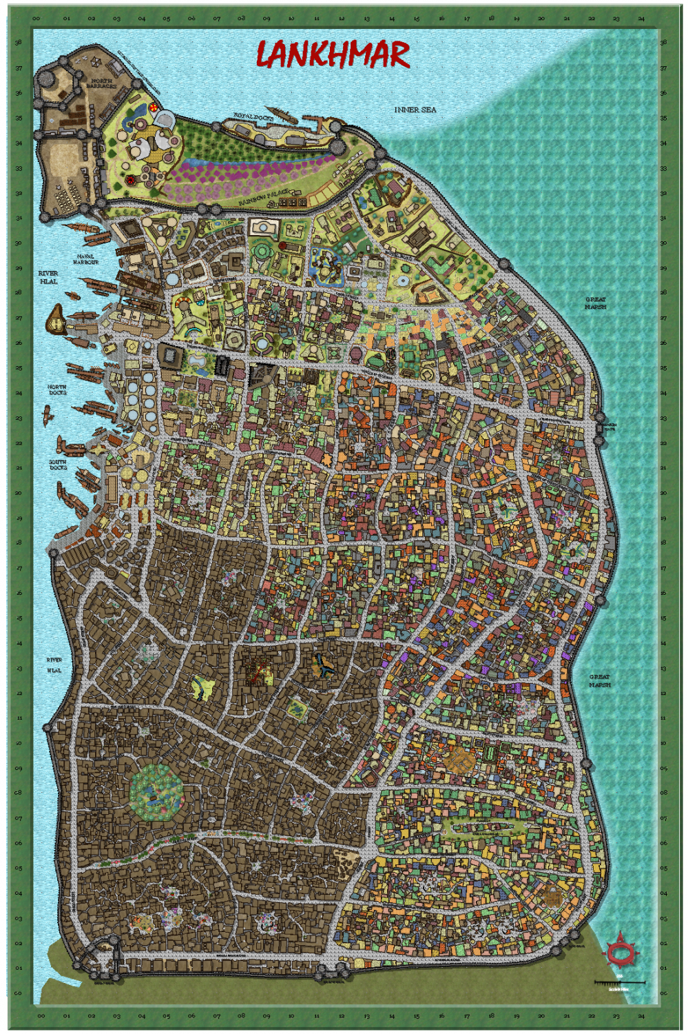
My version of Lankhmar
FINISHED! Any alterations suggested welcome.


-
Working on Atlas maps....
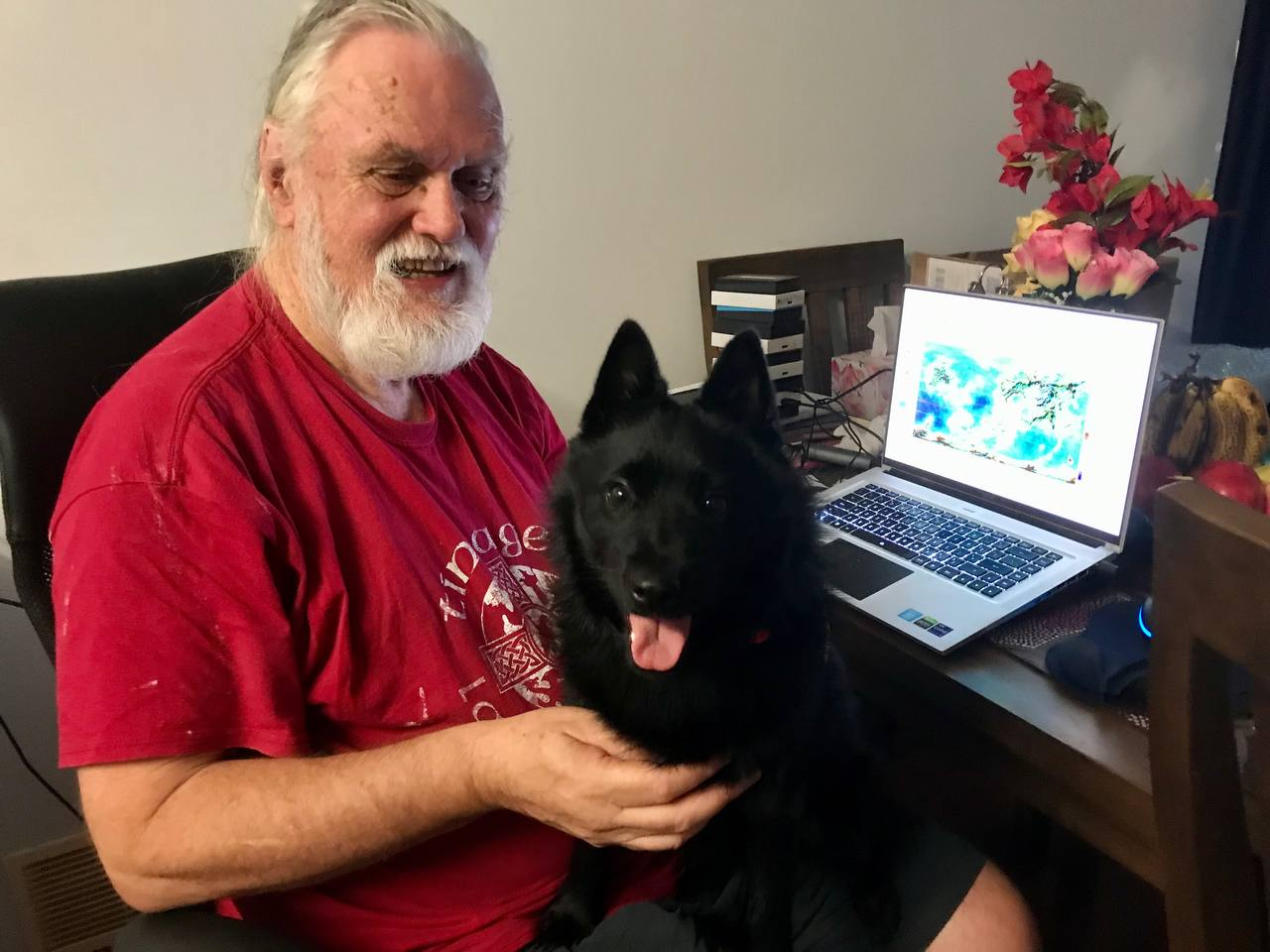
Another non-cat photo of MY mapping assistant


 and 1 other.
 -
Carn Dum - using Inked Ruins annual
Well, I decided to try out this annual. I've not done much in B&W before (ie none)
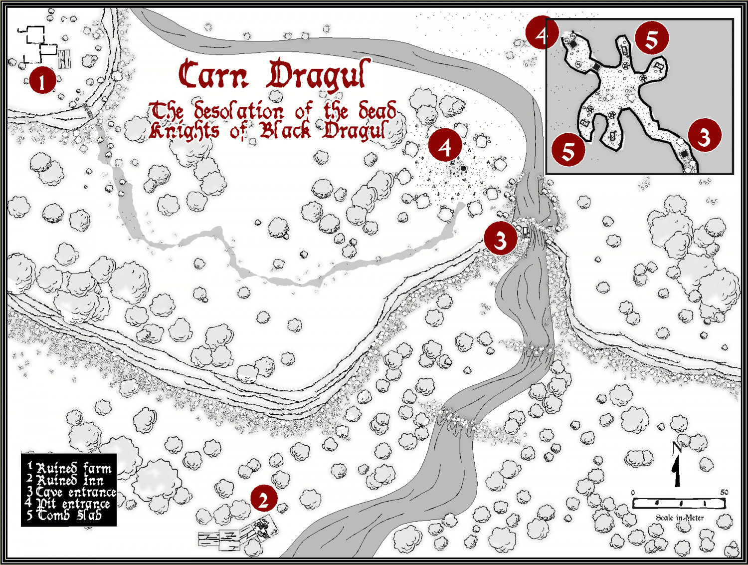
Larger version in the gallery


 and 2 others.
 -
My version of Lankhmar
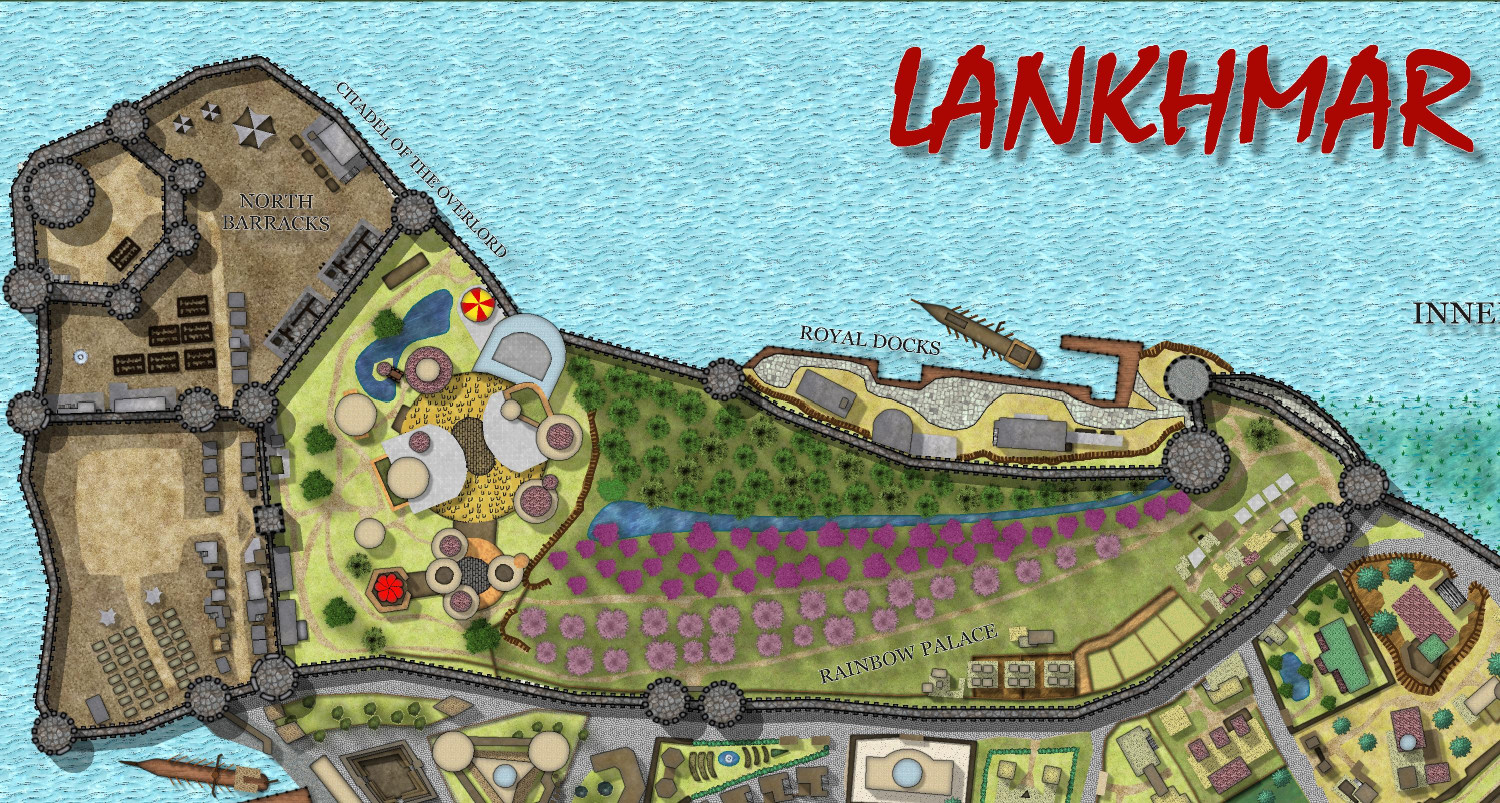
I admit I have slowed down a bit - mainly because I am working on some commissions. But here is the Palace area completed, and more of the city building added, albeit not yet prettied up.


-
My version of Lankhmar
Today's effort - 2 more blocks, and outlined the sea, marsh and walls.
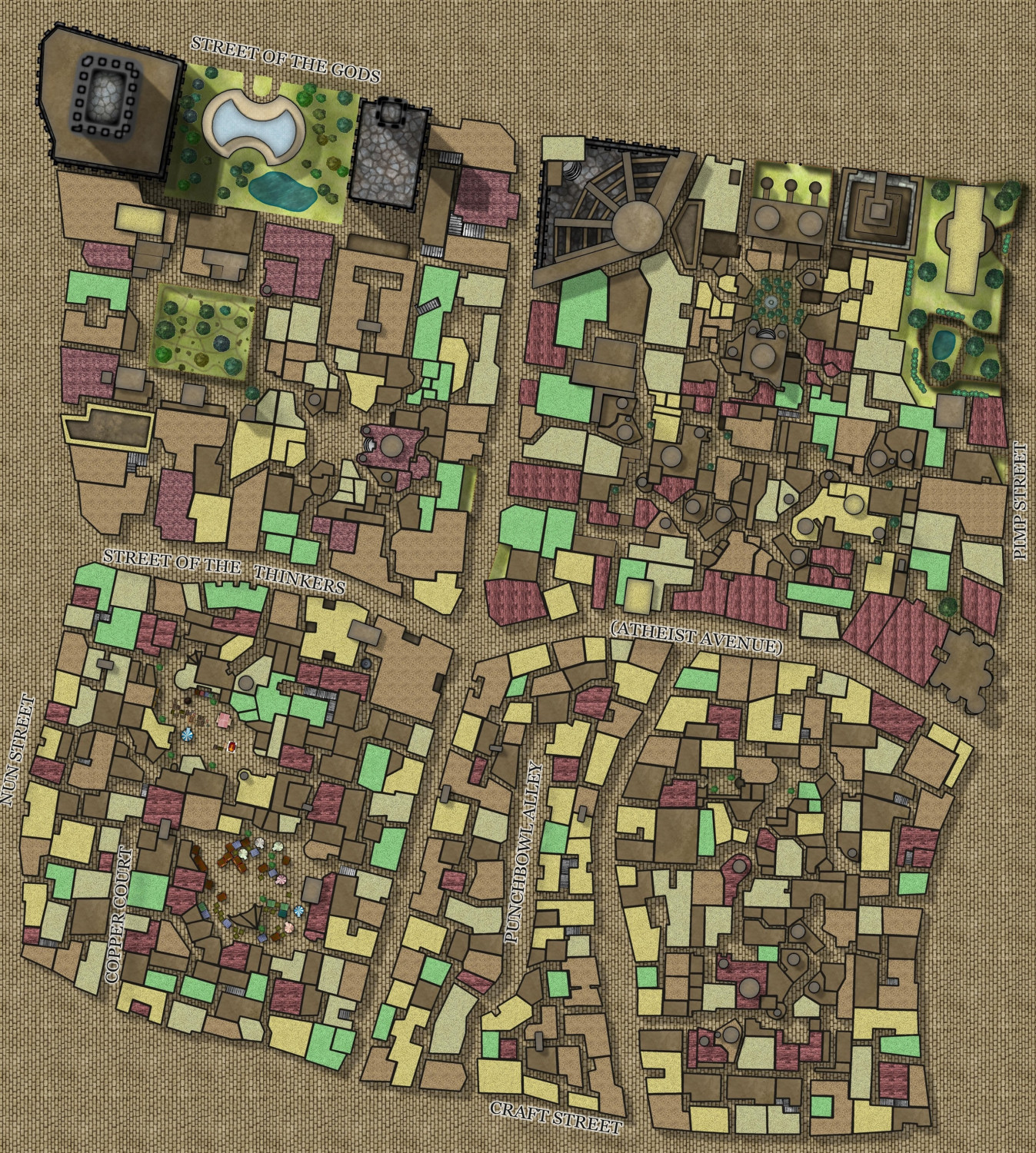
Total progress to date.
-
Watabou City REVISED (annual 157)
Here is the final draft (repeat, draft - feel free to add suggestions) for the example city for the July Annual.
I have completed all the drawtools and instructions to my satisfaction - just waiting for @Ralf to return from his well-earned holiday to see what he says. I am also going to add a plain version of the wall and tower buildings, but this will make the drawtool list quite long.
It has been quite a journey, being able to take the new version of the Medieval City Generator into a form which can be more or less easily transform into a format that CC3+ can use. I was really pleased to be able to add the trees, alleys and even more simple versions of the Coat of Arms to the mix.
The bitmap resolution still is not totally satisfactory - but if I make it too large, then the result looks strange, and if smaller, even more tiled. Grrr. And finally the hatch symbol for the fields at the top right are too fine, I think - not enough space between them for a city this size, but I am unsure how to scale them so they work better. And also how to get them to show up in the Symbol Fills list. I guess Ralf will help with this on his return.
I might also do a much smaller settlement, but use the plain style, to see which people prefer.
This is the first (probably only) annual style I have done, and I am a nervous wreck - haha I really take my hat off to those like Sue who produce such magnificent annuals. Thank you Sue amd Remy for your helpful suggestions - jsut having difficulty with the fill resolution size.
I forgot to fix the legend as per Remy's suggestion. Rather than redo it just for this correction, i will post the final map when all the suggestions have come in. I want to turn everything in by 3-4th June.

-
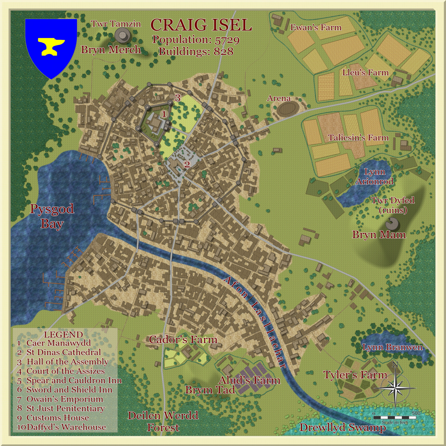
Commission Map - Mistwood town
This is a map of Mistwood, a town set in my client's world. it is OBVIOUSLY copyright.
I am in the process of developing my own style, based on SS5, to do all my town maps in the future.


 and 2 others.
 -
My version of Lankhmar
Gradually approaching the finale.
-
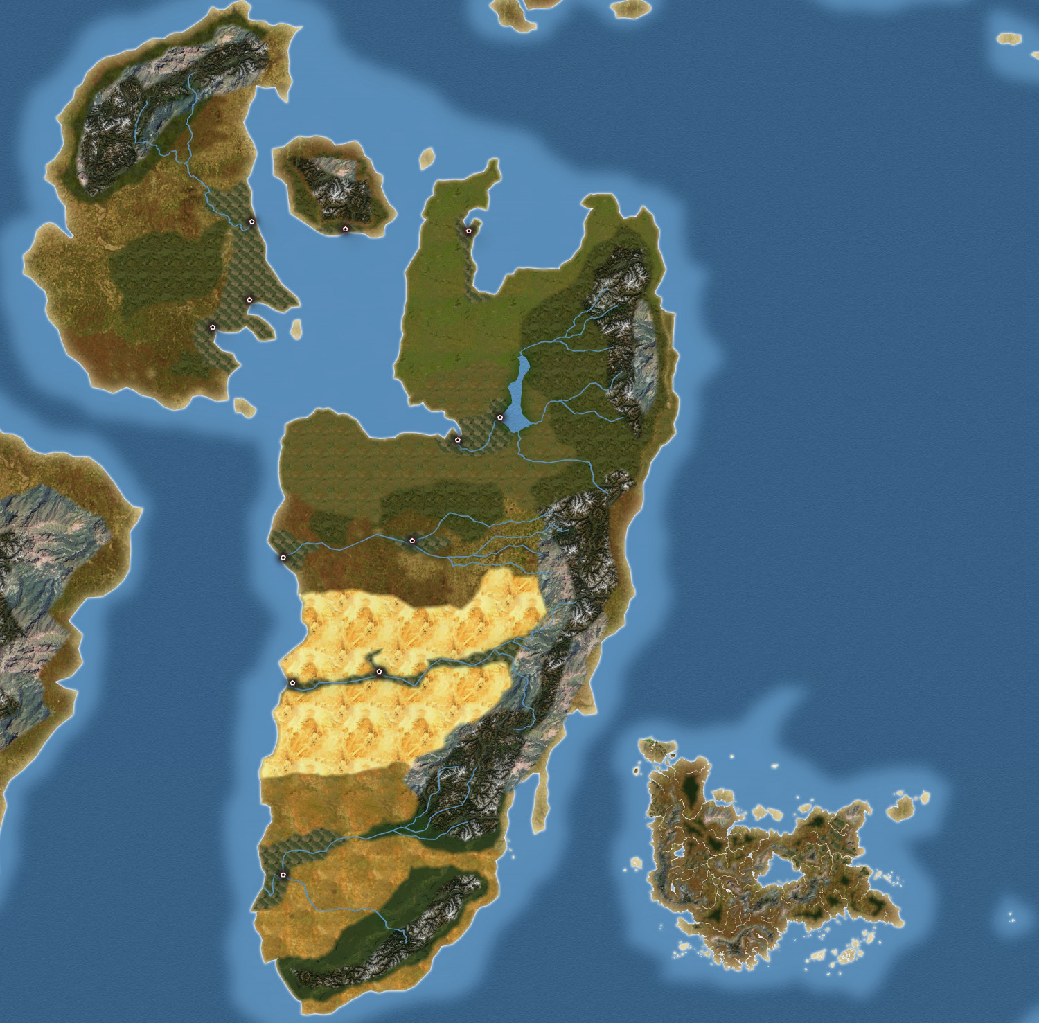
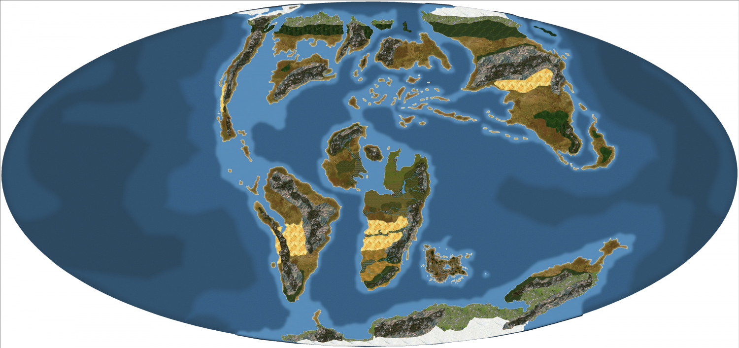
Dinosaur World
A map using Climate Textures and satellite World styles (60 and 62) based on a map of the breakup of Gondwanaland. I have replaced proto-India with Harn.
Putting in reptilian civilizations for fun. Not complete of course.
But Happy New year, everyone.

 and 1 other.
 -
Howdy ! from Jim P
Just want to say something here, so people can get some sense of the sort of person Jim was. I am very sad today, as are his family and friends, of course. He gave so much to the mapping community here. And was always a true gentleman.


