


Frosty
Frosty
About
- Username
- Frosty
- Joined
- Visits
- 160
- Last Active
- Roles
- Member
- Points
- 148
- Rank
- Surveyor
- Badges
- 2
Latest Images
Reactions
-
Forgotten Realms Interactive Atlas repairs.
Sadly none of my PCs have one but I was contemplating checking to see if my BlueRay Player shows on the network and if so I might be able to map to that. Worse case I have a DVD drive I can hook up while the case is open or something :-)


-
[WIP] Community Atlas: Kumarikandam - SE Tiantang Region
these were amazing


-
Lovecraft's Providence
Wyvern that map is awesome sauce. I can share a Map of 1920 Chicago for you but most of it is not my map but a BMP I imported and started adding buildings and labels to. The Map I found is very detailed and quite large and includes a directory on the sides. For personal use like what I am doing it is grand.
here found the link to it in case it is of use to anyone running a game or they want to use it to trace etc. https://commons.wikimedia.org/wiki/File:1920_Chicago_map_by_Fred_Wild.jpg 13MB if I recall


-
Arce Ursi
Will take a look hsv216..I also was looking at this Dungeon Alchemist thing and that kinda of blew me away but feel like I am I already invested here though DA does not do everything CC does for darn sure.

-
1920s Town
Started working on this today but think I am to start over as i am not liking how some of the walls overlap and I am questioning my use of black and white stuff inside.
-
My First Map - Cthulhu Caves
When I am done will post them. Making a couple of maps using this trick. The first is one using Modern Journey where I dropped a partial map of 1920's earth in the background. And the other more involved one, that I might need to start over on, is 1923 Western South Dakota Map that I am using to get landmarks etc correct and will eventually hide it or delete it from the file. A big thanks for all the help and hopefully as I get better I will be able to give back to the community.

-
Call of Cthulhu Campaign Maps
Thanks JMAbbott I was looking at a few of those annuals and I am in 1923 SD at the moment but I have a trick up my sleave to get to Down Darker Trails. In the Maps for 1920's I was thinking of Trying the Western Style but also bring in some more modern style elements. Moody Mansions is one I have not looked at closely but will since it is in your list above.

-
Vector Mapping and natural Earth data from 2014 Annual
Hey folks, hoping someone can point me in the right direction. I recently purchased the 2014 annual and installed it and I noticed one entry was vector mapping using data from www.naturalearthdata.com. I followed the instruction and managed to convert the coastlines file and get a coastline image. The instructions then call for change properties to change the map color which seems to do nothing for me. I was also wondering if there might be a video or additional insturctions as I would ideally like to import most of the geographic data for a small map (not world) Maybe say South Dakota or part of South Dakota (USA).
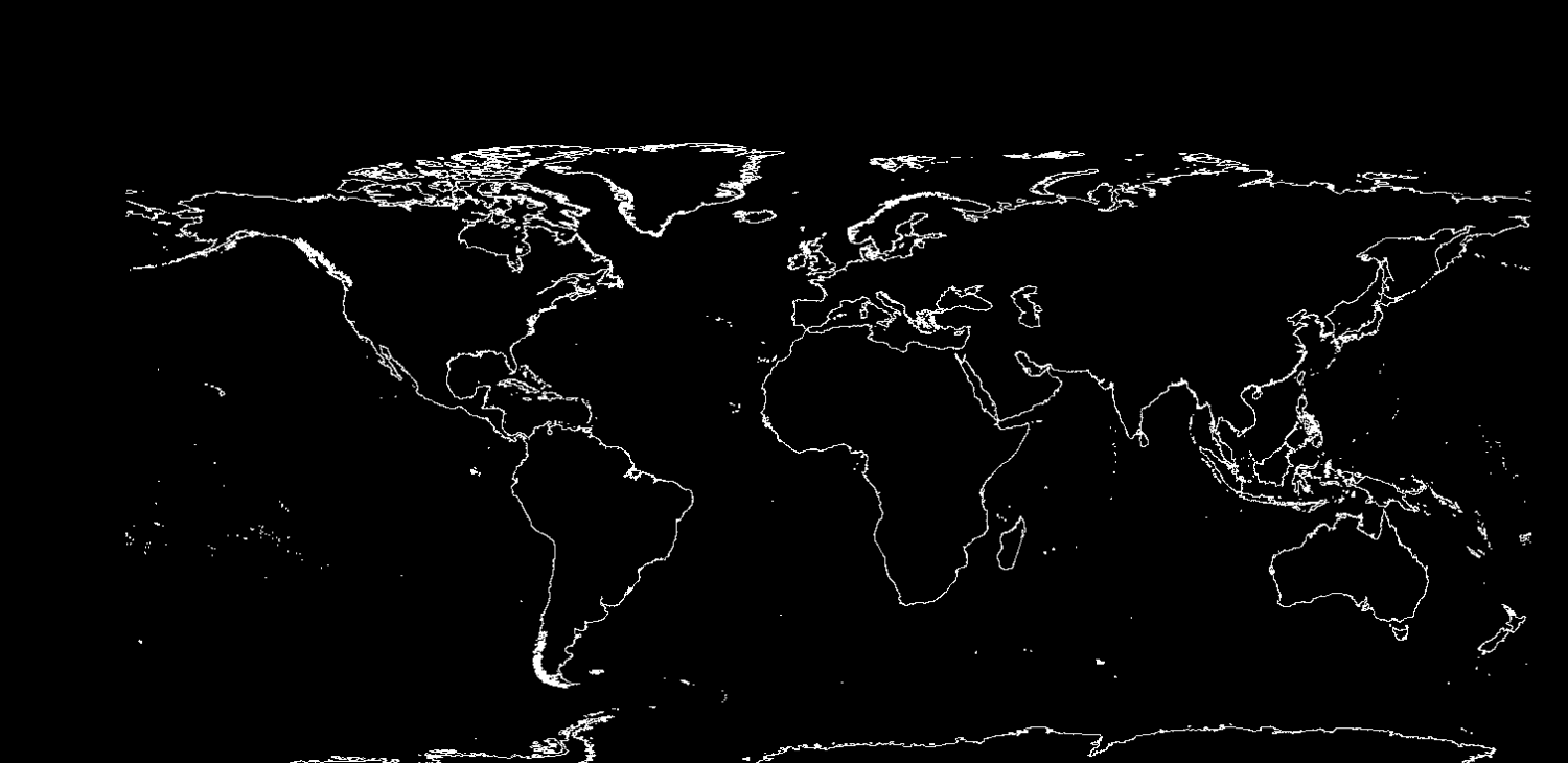
Annual instructions title - Vol 8 2014
Mapping Guide:
Using Real-world Vector Data in CC3
-
Ukadarlia
Amazing work love it. I can feel your imagination churning through the maps and peoples of the world as I look at it.
-
Forgotten Realms Interactive Atlas repairs.
This is the old interactive atlas tat use to come on DVD/CD right? I think I use to own that..I wonder if it is in a box somewhere.

