WIP Community Atlas - Mortyn-Goya Confluence
 KertDawg
🖼️ 2 images Surveyor
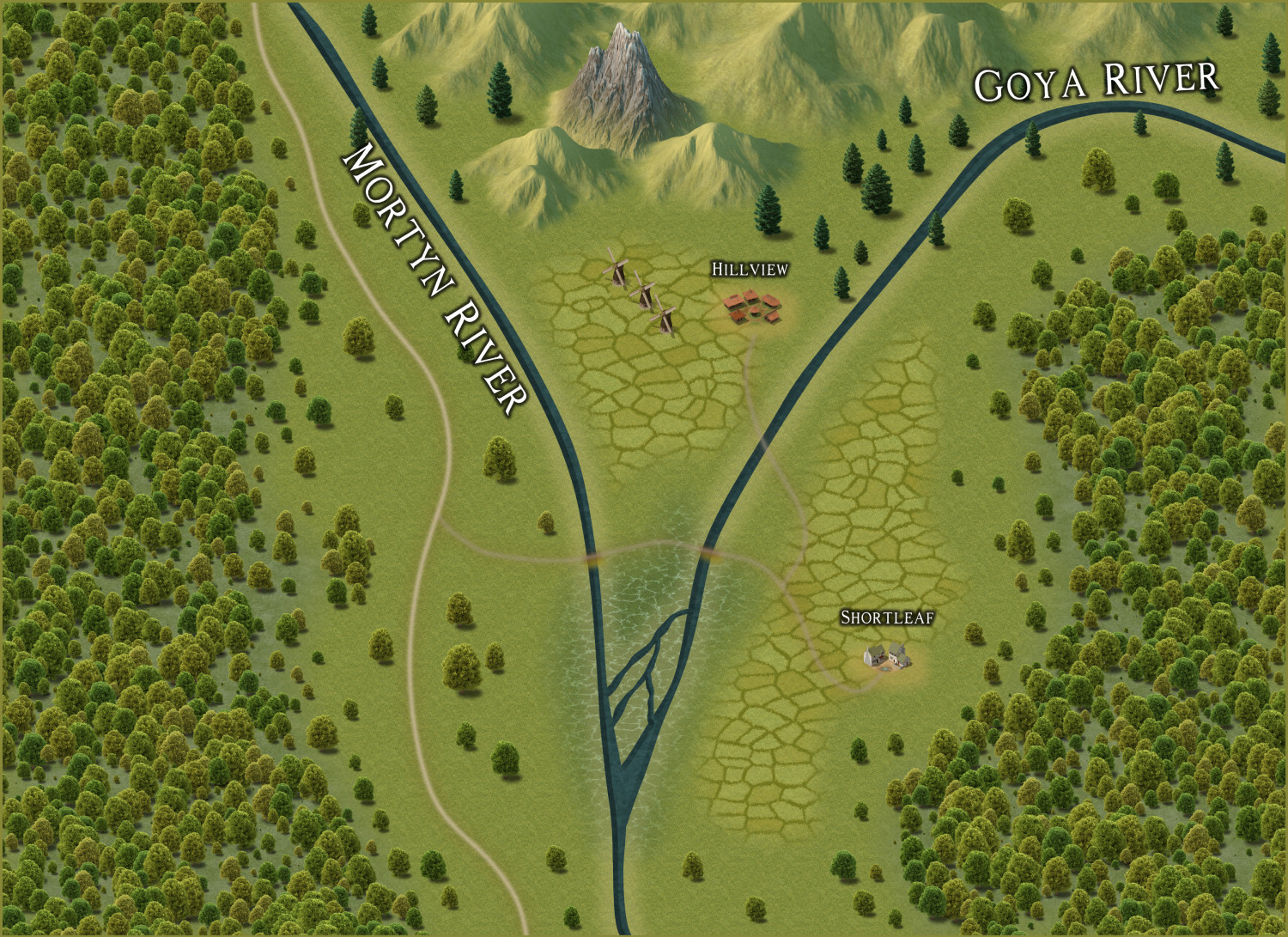
This is my first community atlas contribution. I ask for input. What do you think should be added? I tried a few things like fishers, hobbit (or baddie?) holes, and wizard towers. These things did not seem to fit well. I have creator's block!
(Yes, I see the need to clean up the text. That will come.)
What do you think might be in the woods to the west, for example?
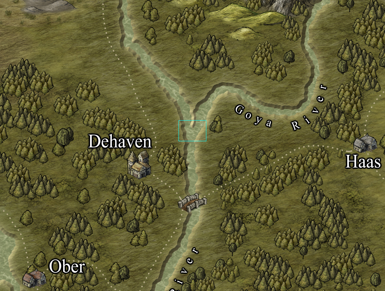
For reference, here's the parent map:
Thank you.


Comments
I just love the Spectrum Overland style. It's so lush. I love the river delta.
What's the scale of this map? At this scale, you may be forced to use the hamlet or village symbols to show your hobbit communities. I can't remember if there are cave symbols that could serve as hobbit holes, though you could draw them in -- but even that would probably be out of scale for this map.
That's said, it's okay to have some things out of scale. If there's a notable wizard's tower, for example, it may take up the space of an entire village on the map, but that's just to allow users of the map to know where it is.
If you're stumped for ideas of what to place and where on a map, I'd suggest trying out some dice rolls on a few random overland design or encounter tables, if you have any. Even if you don't like what they come up with, that might spark ideas you do prefer - or variants on those themes.
As I have the book sitting by me as I type this, have six random throws from the Shadowdark RPG overland generator tables:
Make of those what you will!
There are hosts of free-access tables online, often on blogs, although many are for rolling encounters, rather than places. Even so, you can still glean ideas from those. I came up with these three, of perhaps variable utility here, on a quick search just now:
100 Overland Descriptors by Gnome Stew
1d100 Random Events for Overland Traveling from Lore Wise Games
The Collaborative Gamer's System for Creating Fantasy Adventures
The last one has a whole series of tables, many of which won't be of much use here, but some of the later ones are readily adaptable for ideas such as you're asking for.
Good luck!
The map is about 20 miles wide. So, the rivers are to scale for what I was trying to do for large rivers.
Thanks for the advice. I think my writer's block is fading.
Here's an update. I added some detail. I'm stepping back to evaluate the entire map.
Click here for the larger gallery image.
Well, I now see that many of the trails are too blurry. That's one thing to address.
If you are talking about the trails on this forum version, that may be because it's very small and low resolution.
By the way - you can upload much larger versions that that on the forum. Not gigantic, but much larger.
Thanks. I read an old post about middle clicking in the gallery, posting that link, then posting the full gallery link below it. I wanted to follow the rules!
My gallery image has the same problem.
Oh I see. So maybe the trails are a bit blurred.
Here's an update. It's really minor stuff. I think I'm close to submitting this. I need to review the process, as it's been so long since I started!
Gallery Link
Here's the map file. I can't find the official way to submit it, aside from tagging @Monsen here. Is this sufficient? Thanks.
Yea, it's fine.
I am seriously behind processing stuff right now though, been doing some server upgrades that takes some time, and limited my own access to efficient processing, but I'll add it to the queue.
Thanks for participating.