[CLOSED] Community Atlas, Forlorn Archipelago, Fisher Island, Moroni Range, local maps
 JimP
🖼️ 280 images Departed Legend - Rest in Peace
browser hiccup, try this again.
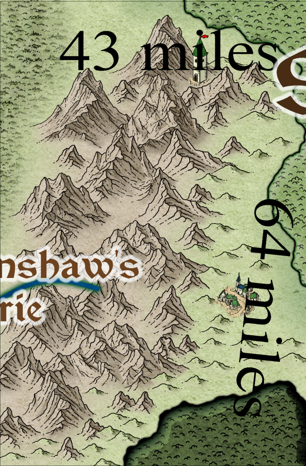
Area map, Eyrie to the west, Elves to the East. Small village near the mountains, tower for possible help miles to the North.
A ground level entrance for the dungeon city, maybe some ruins, maybe an active settlement.
Maybe an orc village or so. We shall see what time and good fortune bring.
map is 43 miles by 64 miles, had to tweak the map border and background.
edit.
Ah, Having remembered to read the map notes for this area, I made some mistakes above.
Moroni Range: the large western range transected by Starshine Forest and its river that flows through the
forest to the sea. Home to giant eagles, allies of the elves, and less desirable monsters – wyverns, rock
giants, and those pesky goblins and kobolds.
* Renshaw’s Eyrie: Raised by the notorious Bandit King, Roaring Renshaw, a bandit chieftain who
spreads mayhem and terror in the surrounding countryside.
Starshine Forest (elves): An elven forest ruled by an elected prince. The elves are good friends with the
Kingdom of Zarto, and aid in keeping the humanoids of the mountains to its west in check. They also are
opposed to the banditry practices by the self-styled Bandit-King of Renshaw’s Eyrie.


Comments
Here is more of an area map, I couldn't get dreadwood to match on my map with Fisher Island map. I'll include the fcw.
I'll be adding a border as well. Scrublands text needs to be moved over.
Next thing to work on is the 'Castle Defender' at the top of the map. Along with Keeper Tower.
Wood roofed and slate roofed buildings.
Not sure why the some of the palisade parts did that.
It's all looking really good, Jim
I found it easier to erase and re-add using endpoint.
Then I'll work more on the town.
A) main gate
C) Town Hall
D) probably a wizard tower
E) Merchant homes
F) Bill's Inn and Bar
G) Town water fountain and well
Are you really sure you want the tower to be quite so massive? Each tile on its roof is as big as the width of the smaller buildings.
As for the walls, I might try checking to see if Endpoint will do better connecting them, but I think thats for lines only.
J) storage
The letter I isn't used.
Did think about at least town hall being on a slight rise, but I might do that for just outside the town walls. Easier for them to manage an assault against the town.
There are kobolds, et al, in the nearby mountains.
Tentative plans may change, but here they are: Wrel Tower, Wrelna Town, Keeper Tower, Castle Defender, and an entrance area in the mountains for the dungeon city.
Didn't see any Strength on the roads edge fade, inner.
100' x 80'
Not sure why the white floor in the cage is there.