Little Bighorn Battlefield Map
 mike robel
🖼️ 15 images Surveyor
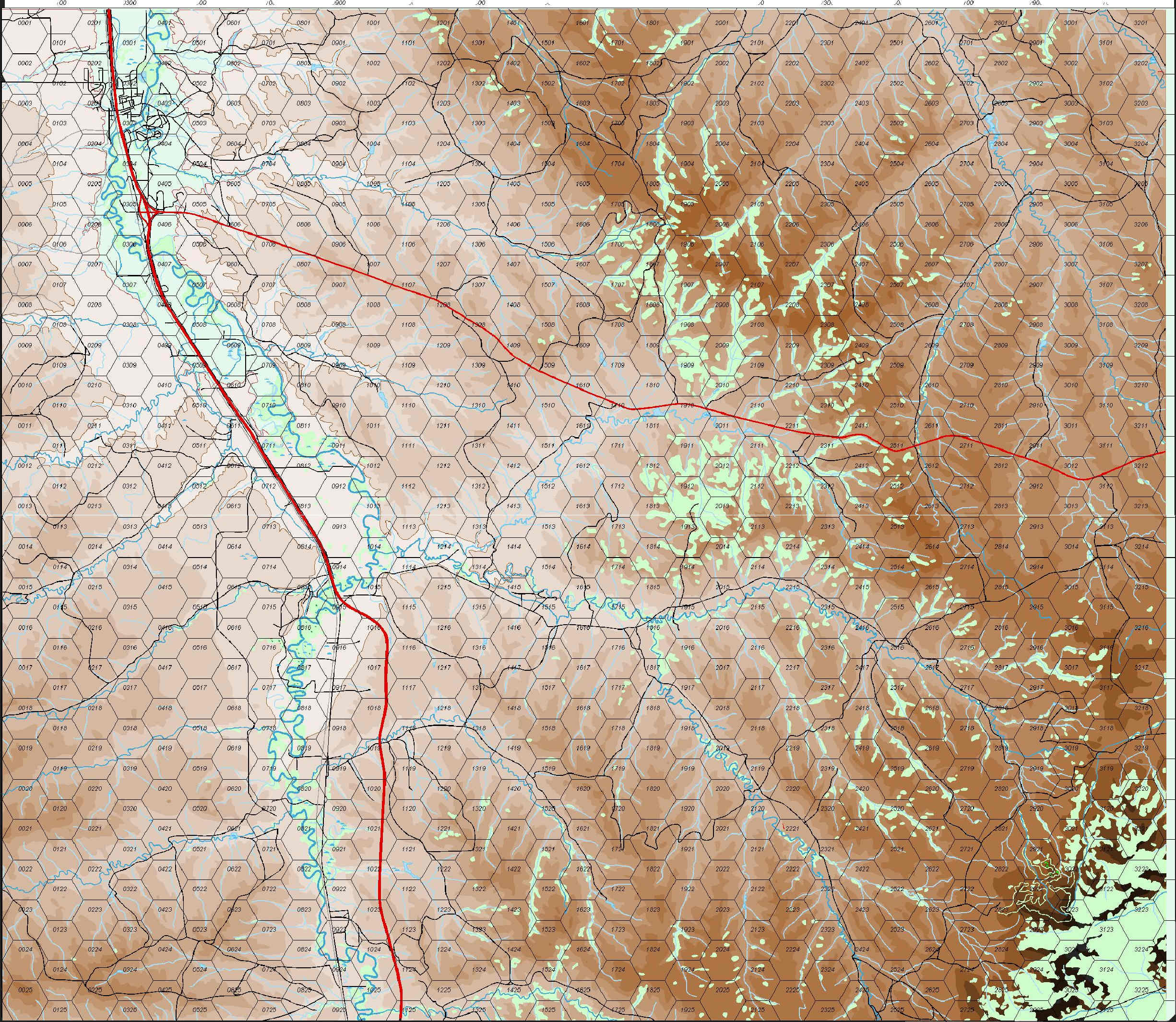
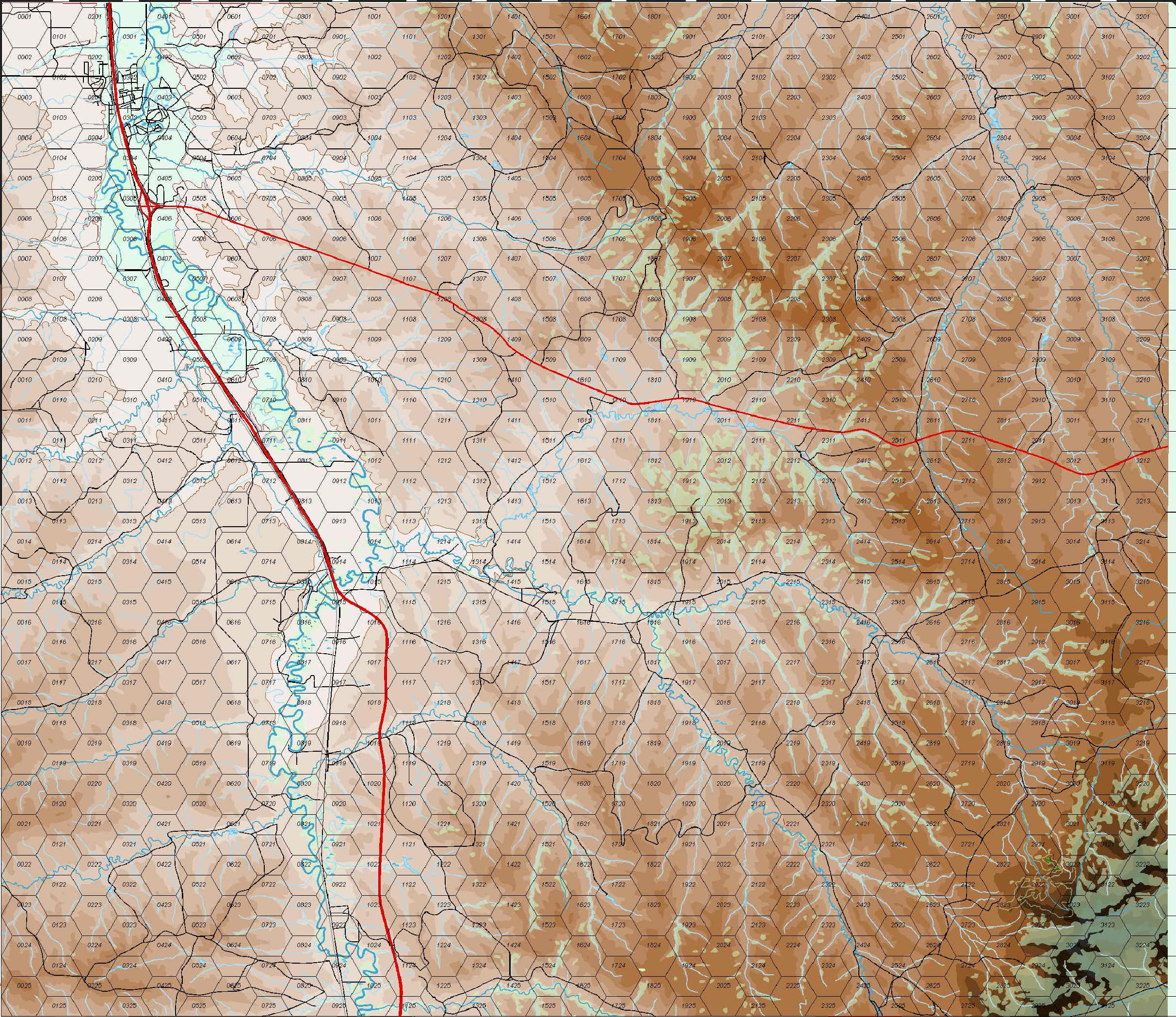
At this point, the map is at a stopping point while I move on to other projects. As one can see by the title, it is the area in which the Battle of the Little Bighorn (aka Custer's Last Stand) was fought. I need to tune the road network, consider if I want to place buildings and other objects on the map, and add place names. I really like the way the shaded contour areas define the terrain and combined with the water courses and the vegetated areas, highlight the ridgelines and draws.
The map will be for a science fiction game based on Hammer's Slammers stories by David Drake (with his permission).
My quandary at this point is the vegetated area. As the map is drawn right now, those areas are solid. The drawback is they block the contours of the map, as can be clear seen in the lower right corner of the top image. The alternative is to fool with the transparency, and the second image shows that. I think it makes the map look like it has small pox or something and the vegetation since it is fairly light, seems to blend in with the terrain. The last image shows a close up of the lower right with transparent terrain.
Alternatives:
1. Just leave it solid and be done with it.
2. Fiddle with the transparency and accept how it looks.
3. Split the vegetation layer into two layers with one area covering top or left side and the other area covering the bottom or right side and have the transparency different. I think this would give the map a very odd look.
4. Go through and convert all the vegetation to Polygons with no fill, leaving only the border, then fill the polygon with symbols, and then convert all the polygon boundaries to no line. This would probably give the best artistic look, but would be tedious. It also would potentially put non-topographic symbols on the map (if I use top down tree symbols) or look kind of weird if I used the available topographic symbols for various types of vegetations, mostly deciduous trees.
5. Convert the contour polygons so they are hollow and then place them over the vegetation symbols. This has the draw back of making it more difficult for some people to visualize the terrain. Many game players don't really know how to read contour lines. (I find it interesting for instance, that Google Maps/Earth don't have them.)
At this point, I am sort of leaning toward option 4. It requires Brute Force and Ignorance to get through, I think, but some say that is what I excel at to get through notty problems. It will take a lot of fiddling to get the fill to look right and at some points, for very small regions, I may just manually plop the symbols down.
I'd appreciate comments and other potential solutions.


Comments
How long did it take you to do all those contours and rivers?
The contours took about 20-24 hours I figure. The Rivers probably about 6. Roads about 3. I've been working on the map for about 4 months. (I do have other things to do, like playing wargames (12 - 16 hours/week), home duties, game design, sleeping, etc. hahahahaha.)
I think the longest contour line (in terms of relative length) took me 3 or 4 hours to do, because the program kept crashing or I made some other error that caused me to restart. I think some of them were 2 or 3 meters long if you measured them out.
I guess the crashing might have been down to the sheer number of nodes, but the results prove that perseverance works
The third photo shows a close up of the high contours with the transparent vegetation. I think it might be okay like that when printed out.
The fourth and fifth are just other views of the battlefield.
Incidently, this is the first look at the game product anywhere.
Those colours have turned out really beautiful in the printed version. Good call you your part
For various reasons, I flew to Seattle and was able to visit the Little Bighorn as I drove back. Weather and some other issues conspired against me so I only had two hours on the battlefield. Here is a photo of me at the visitor center with the Little Bighorn Game I like best.
This view is from Calhoun Hill to Last Stand Hill in the distance. It's kind of hard to see, but it is sort of in the center of the picture and there is a small group of trees to its left where the current cemetery is.
The units were unable to support each other and so were all destroyed individually by the Sioux and Cheyenne.
This is the area where I took the photo. Calhoun Hill is South and I was standing on the highest point on the hill top.
This is the map I drew in CC3 of the same area. Due to the contour interval I selected for the map (100m vice 20m), Calhoun Hill, the small hill where the 7 is, and Last Stand Hill are all obliberated. Drawing all the 20m mines would probably overtask the software given the size of the original map to say nothing of the number of nodes required.
I don't think I'll be going back. It's a long dang drive from Merritt Island to Billings, the most civilized city near the battlefield and back. Covid forced me to cancel my 5 - 7 day trip I had planned before. Sigh.
Lovely. I always enjoy visiting historic sites. Hope you had an enjoyable visit, even if it was a bit on the short side.
Maybe you could drop by Norway one day, I have a lot of hills here I need flattened....
You got to see it at last! Well done you :)
Well, I still am scheming to get my wife (and maybe me) to visit her aunt who is 13 years older than she. Torill is next in line as the family matriarch. So, not impossible. :)
Thanks, Sue. It was almost exactly as I imagined it from looking (and drawing) maps. !!!!
Lovely work Mike, really superb and an act of true dedication to the craft.
I know it's rather late, but I would've added a colour key on the vegetation layer to mask out the water courses.
When (IF) it ever gets published as part of a game, there will be a terrain effects chart depicting elevation, water courses, road, vegetation types, terrain types (ford, bog, etc) and their effects on movement, combat, and spotting (if any).
One brave said of the battle of the greasy grass, The battle lasted as long as it takes a hungry man to eat a meal.