Wilbur, FT3, There and back again, blank map in FT3 (SOLVED)
 Loopysue
ProFantasy 🖼️ 41 images Cartographer
I have a nice FT3 world that I wanted to use as a sample map to show off a few new overland textures in a CC3 map I'm going to export from it.
Normally I would just export the coastline and invent my own hinterland geography, but this time I decided to have a go at exporting the FT3 world to Wilbur, eroding it, and then bringing it back to FT3 to export the eroded version to CC3 for the contours. The process is covered in one of the Wilbur tutorials, and it seems quite simple. Save the FT3 world as an MDR file, open and edit it in Wilbur, save as an MDR file, then create a new FT3 world by picking the binary option in the new world wizard, and browsing to the MDR file exported from Wilbur. It should then open as an FT3 world using the height information contained in the MDR file.
The problem is I can't seem to re-introduce my nicely eroded world back into FT3. I have a feeling that this has been covered before on the forum, but I can't find any of the threads. So this one I've given a title that will be picked up by most searches for this issue.
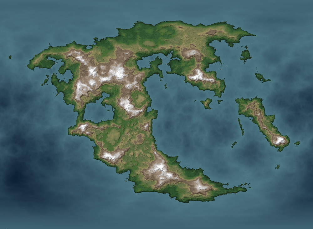
Here is the prepared FT3 world (shown in Miller Cylindrical projection, but the attempt to process it in Wilbur was carried out in Equirectangular projection).
[Image_12855]
And here is a section of the eroded result in Wilbur
[Image_12856]
I just can't get it back into FT3 again. All I get is a blank ocean with no height information at all.


Comments
Thank you so very much, Joe!
I obviously have much to learn about the subtleties of NOT engraving the rivers so deeply that they all seem to be at sea level, and creating exclusion areas at the 30 and 90 degree latitudes where the deserts and polar caps are, but other than that I feel pretty proud of myself now
I recommend an exponential and morphological erode operation in Wilbur to reduce some of the effect. Possibly a pass or two of fluvial erosion as well.
I will continue to experiment.
This is one I did with a much larger blur on the first incise operation. I was trying to reduce the sheer bulk of the FT3 mountains and give rise to plains and plateaus. It sort of worked, but not quite as intended. (My homespun altitude shader is a bit dark on the lower levels, which doesn't really help with the visualisation).
I have found that I learn a lot more every time I go back to FT3. Usually its just one or two new tricks, but after a while they start to accumulate and the work I produce gets better