CC3+ Invisible Border - Not allowing terrain, land or sea.
I don't know why I always have so many issues lol. I have been revamping and editing one of my current maps that I reformatted from CC3 to CC3+. For some reason, in the southern portion of the map I can't draw any land, terrain or lakes/rivers/seas. It's acting like a border for some reason. I can still place symbols there. I was able to draw terrain there yesterday but for some reason don't have access for that portion. It's not bleeding off the canvas either. I am not sure what's the issue. Any remedies welcomed. I can attach the CC3+ file if needed.
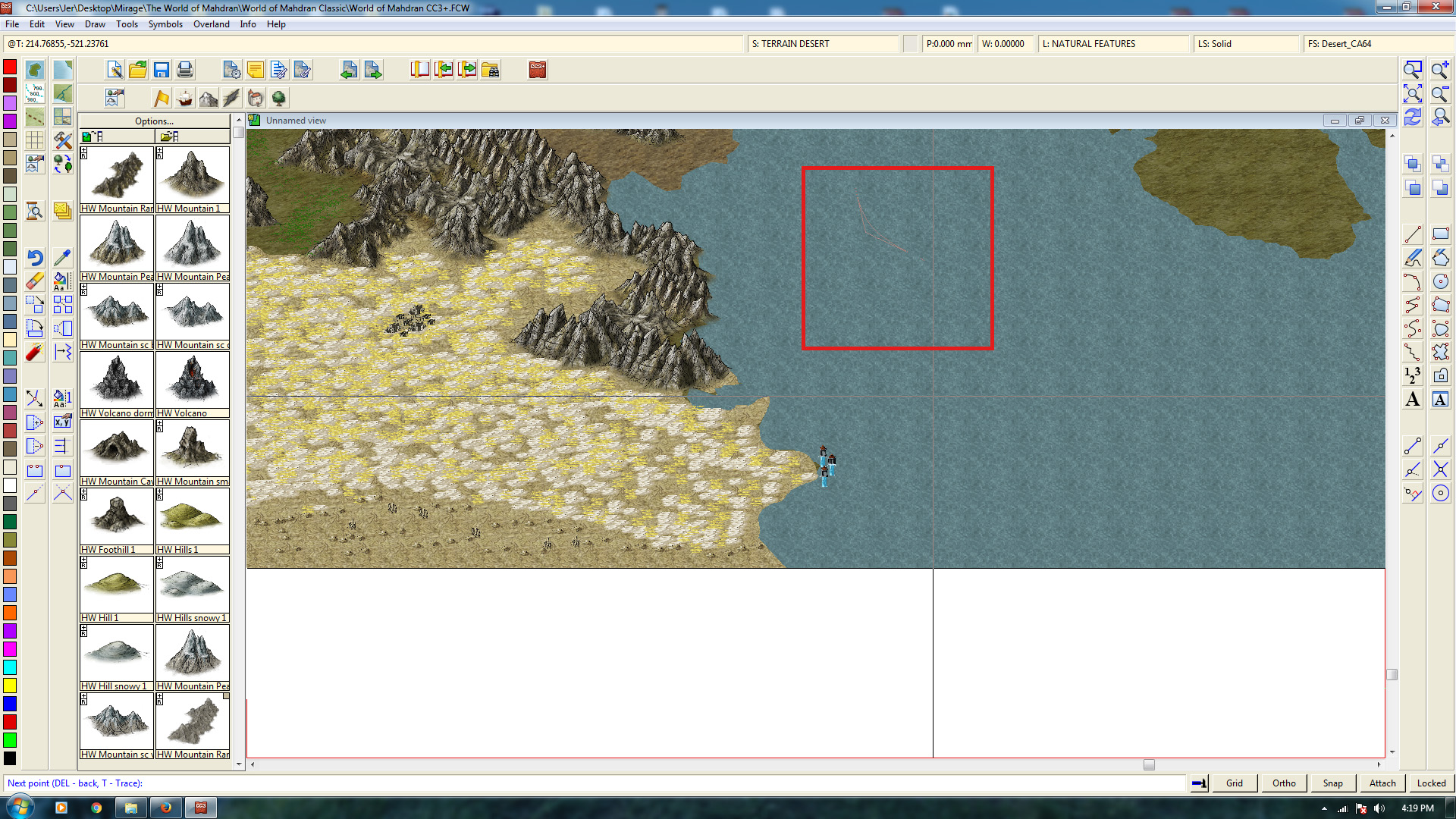
As you can see the terrain line just ends in that location while the terrain cursor to draw is somewhere else not connected to the terrain line. It's like this on the entire southern portion of the map. See image below.
As you can see the terrain line just ends in that location while the terrain cursor to draw is somewhere else not connected to the terrain line. It's like this on the entire southern portion of the map. See image below.


Comments
The map border itself is defined as entities on the MAP BORDER layer. So I would suggest you start by hiding every layer except MAP BORDER, STANDARD and SYMBOL DEFINITION, and then look for rogue entities. Normally, the map border should just contain a simple line border around the map, there should be nothing else there. If you have anything else there, either erase it, or use change properties and move it to a more relevant layer.
Note that anything extra on this layer serves to block the tools, it doesn't have to actually pass the location you are currently experiencing problems. When CC3+ determines where the map border is, it just look at the coordinates, and extend invisible lines from that point.
You can also edit the drawing tool and tell it to not stop at the map border, but finding the rogue entity is the better option.