The Vagothian Kingdoms
The lands of the Vagoth comprise a large territory. But they consist of small kingdoms hanging on to the coastal areas and islands. They are the most numerous in Sutheimr (Western/Central/Eastern), the Skjaldborg Eylands, the northern lands of Brython, the northwestern coast of Beorgumende, and among the abandoned coastal ruins of the Dragon realms. Finally, there is the mythical island of Thrace and Niflheimr - the land of the dead.
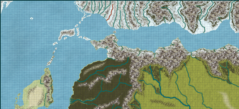
Below is the overall land area that the Vagoth dwell. Each grid square is equal to 50 miles. This is taken right off of the Kelleemah World Map. I will be using these maps as the templates for making more detailed maps of the area.
Below is the overall land area that the Vagoth dwell. Each grid square is equal to 50 miles. This is taken right off of the Kelleemah World Map. I will be using these maps as the templates for making more detailed maps of the area.


Comments
The second one is a Vagothian map showing the straits and the major mountain ranges along with the major settlements. North of the straits are the lands of the Vagoth and Elves. South of the straits are the lands of the Dwarves and the Kingdoms of the Vistulans.
I used the Par Lindstrom BW Style to represent Vagothian maps.
I love the runes along the border.
I also used some symbols from the Mike Schley Inks Style.
The map is split between Eastern Sutheimr in the northern side of the map and the Dwarven Realms of the Sellevolk to the south along with their Vistulan allies.
The Straits of Kaldrmarr (The Cold Sea) separates the Northlands from the Mainland.
From east to west the mountain ranges of Eastern Sutheimr are:
1. Hundrbjarg (Hounds Rock)
2. Austriveggr (East Wall)
3. Valdrtonn (Wolf Fang)
4. Sytnrfell (Moaning Mountains)
The only city in Eastern Sutheimr is Farmadrborg (Trader's Town).
The mountains from east to west in the lands of the Sellevolk & Vistulan are:
1. Vostok Sellevolk (East Sellevolk)
2. Sredniy Sellevolk (Middle Sellevolk)
The Vistulan city of Severmore (North Sea) is situated between the two mountain ranges and is a major trading partner with the Vagothian city of Farmardrborg.
Here is a link to the larger image: https://www.cartographersguild.com/album.php?albumid=4853&attachmentid=97505
Just my 2 cents.
Cheers,
~Dogtag
BW Map with light blue sea, blue rivers, red text, red border, and color detailed icons in the corners.
Here is the WIP.
For some reason the only people who've ever made a success of mixing black and white symbols with colour wash areas are the Ordnance Survey, but they modified it by making the symbols the same colour as the colour fill.
I agree with Dogtag that the colour version you've done looks ok, but isn't really doing anything for me more than the black and white version.
EDIT: btw - the reason I started this comment and got carried away was to tell you that the upload hasn't worked on your previous comment
The key was the "WIP" in the quote in regard to the Barliman's and Quenten's questions about why the red is only on the top.
WIP stands for Work In Progress. :-)
As far as color is concerned, I did something similar with a parchment map and it worked out great. I added color for the water, had red text, and added red to the border. It came out great. I think that it works when done in small amounts like that. This one of course is still a WIP (Work in progress). :-)
And if it does not work, then I simply eliminate or hide the color specific sheets. The FCW is built so I can turn off or on the three versions of the map and I may make a built in third version that does not include mountain text and has just political borders and kingdom names.
One FCW and four built in maps. :-)
I am just experimenting, having fun, and glad to have my health back to normal. ;-)
Thoughts?
Once again great job!:)
1. Added compass rose
2. Added scale bar
3. Could not get the font to change on the scale bar to the one I was using. So, I switched the rest of the text to the same font as the scale bar.
4. I decided that I did not want to use the different symbols for the plain version versus the hex version. As such, I kept the original symbols to the style and shrunk them down a little bit to fit within the hexes and moved some of them.
5. I added couple of more towns to the map.
6. I fixed some issues with the rivers connecting to the coast.
7. This one has the hexes on it.