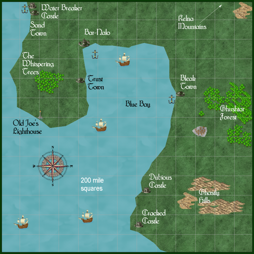
some detail, Blue Bay area, Darshan continent, Crestar
 JimP
🖼️ 280 images Departed Legend - Rest in Peace
first map is the continent of Darshan, Northern Hemisphere of Crestar. The second is a some what detailed map of Blue Bay same continent. The maps are a smaller size than the original map export.


Comments
Cracked Castle could have something wrong with its foundation, its walls, or the leadership.
Dubious Castle, likely their loyalty is dubious.
I have GitS in all media, includng the Manga in English. I am waiting for the live action to be on DvD, I'll buy that to. If it comes true, the cyber brain firewalls need drastic work.
These town, castle, tower, and crop locations are 'in the ball park'. They might be moved depending on many factors as I go into a closer and closer map.
"Elves ! Mr. Frodo !" But towers for defense ? Interesting.
Edit, I had to add it from my Windows 10 font list.
As the Bleak Town map, these are generalized areas, except for Bar-Nalo.
Thats makes the two small towers, also a port area. But they may not have tested that area's depth yet.
No, I haven't forgotten our Interactive Atlas here.
So I'm doing these.
This is a more detailed map of the Bar-Nalo area. Could be too much detail for a 50 mile across map.
10 miles across.
However, I think a distance of 1 mile between villages/hamlets is far too small... But, then, it ain't my map!
Using medieval and later maps for the British Isles and continental Europe (but pre-19th century), and dependent on terrain and agricultural yields (hence population densities), you can get away with a village or hamlet every couple of miles or so, and a town every 15-25 miles, as a working average - which also means greater and lesser settlement densities are also practical, of course.
I haven't given this much thought so far, but 20 miles in between villages seems like a lot, at least for swiss proportions. I guess the village density depends on what era one is looking at and on the geographic region. Therefore it would be interesting to know your presumptions.