Three Rivers Island, and area, Southern Hemisphere, Crestar
 JimP
🖼️ 280 images Departed Legend - Rest in Peace
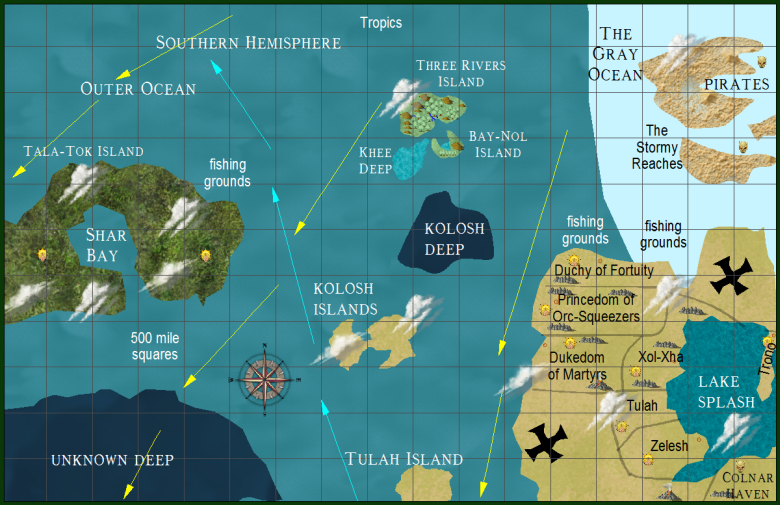
Here is another zoomed in area. The two huge Xs over on the continent are possible portals mentioned for B4 The Lost City which is also in the works. The top of the map is the equator. Pirates are nearby. An island jungle to the west. Blue arrows are low in the ocean cold currents. The yellow arrows are top of the ocean warm currents. The Stormy Reaches islands are estimates made by survivors of the pirate attacks on their ships.


Comments
I'm a bit confused about the three different blues of the ocean. Is it that the different blues are different territories, a bit like the way Antarctica is divided?
Khee Deep is presumably not quite so deep?
Why is it a different colour to the other deeps?
Kolosh is named as it was found, unknown is called that as the people living on Crestar haven't found it.
The typical ocean goes down to 500 feet to 1 mile. Deeps go down 2 or 3 miles. Unknown is deeper than Kolosh, so its a darker color.
The Gray Ocean is greenish-gray, but I decided to draw it blue so it wouldn't look overly odd. Its not the typical ocean blue.
I have been in the Carribean Sea, the Mediterranean Sea, and the Atlantic Ocean when I was in the US Navy. So I have seen different ocean colors, mostly due to air or contaminants in them, ocean calm or wind blown due to storms. I have also seen the Sargasso Sea. Not the ship trapper many think it is from legend. I was very unimpressed by it.
Well... I meant for Kolosh and Unknown to be the same color, but decided to make one darker.