White Lines around Buildings SOLVED!
 Loopysue
ProFantasy 🖼️ 41 images Cartographer
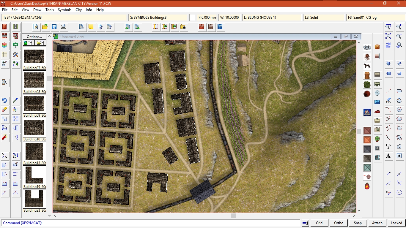
Does anyone know what might be causing all the new buildings I paste into this map to have white lines around them?
As you can see from the smaller brown buildings I wasn't having this problem before, but I am now that I'm trying to add the larger buildings on the right of the shot.
I should maybe add that I think the file could be corrupted, because I had a crash and when I reopened it there was a single coordinate point about five times the size of the map off to the top right corner that caused it to nearly disappear when I hit the zoom to extents button. I managed to find it and delete it (whatever it was), but I'm thinking that wasn't the only thing wrong with the map that made it crash in the first place.


Comments
I'm thinking that I may have to go back a couple of versions and lose a couple of days work (he-he won't that be peaceful for you all!). Rather that, though, than end up with a file that's falling apart before I've even half done with it.
If you look at the image below you can see a collection of buildings, all with different colours edging them. The colour depends on the drawing colour you just happen to have selected at the time you paste the building!
I don't think it affects more than just the collection shown, but it means I'm going to have to make sure I have a neutral grey brown selected whenever I paste any more of the same type.
By some incredible coincidence whenever I was pasting all the other houses in the city before these few on top I had the colour set to black (which explains the hard lines around some of them)
I don't know why its happening, it just is, that's all.
Is there any reason I can't just delete that layer if its only causing me a headache?
Note that the color you see is intended to use for informational purposes, CC3 can show your city with building colored by their type/functionality or whatever you decide really. Because of this, there is a colored polygon below every building, which is normally obscured by that building. Bu hiding that layer, you also hide these polygons.
Building symbols in CD3 are actually quite complex entities, with a lot of functionality provided, and not just simple images.
THANK YOU!
Happy mapping
How do I know this ? Yellow or orange outlines of roads. Couldn't figure out why, until I noticed the current color in the color requestor/select color was yellow.
In both cases, the area and the road assume the active fill, so I always make sure I have the right one for that particular filled area or road before I start drawing.
I think some of the special tools for drawing roads and areas of fill have an outline setting on them which makes it automatic. If you just want to get rid of the visible outline on an area of fill, try changing properties and checking the little tick box that says something like "hide outline if filled".