World of Larysia Cont'd
 LadieStorm
🖼️ 50 images Surveyor
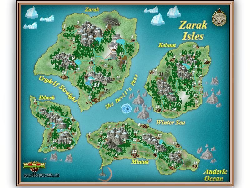
So I am continuing to draw up my world called Larysia, and I decided to rethink it a bit. Since I can't seem to figure out how to draw up a new map from an old one, I can't continue Andelar as I originally planned. And when I try to start with the world map and work down, I tend not to like the results. So I'm trying a new tactic. I am creating each section of the map based on the land mass(es). So to that end, I started with the first set of land masses on Larysia - The Zarak Isles. Now this map is actually complete, but I still want suggestions, because I do have other maps to make.

I hope you enjoy seeing these as much as I am enjoying making them!

I hope you enjoy seeing these as much as I am enjoying making them!


Comments
I would also smooth some of the island landmass edges, there are many "pointy" edges, like on both ends of Ibbeck, the southern extremities of Mintuk and of Zarak, and the northern tip of Kebuut. Doesn't look very natural in my opinion.
How would I go about smoothing those edges?
I particularly like the improved look of your lakes and rivers, and you seem to have a good feel for how to place your forest trees.
Bravo!