Options for Doing Large Detailed Maps
I am working on my world of Kelleemah.
After showing off the continent, I was made aware of a few challenges:
1. Once you get to 10,000 nodes, you start to have performance issues when working with the map (for both CC3+ & Your Operating System).
2. After awhile, to many symbols cause performance issues because of all the operations that CC3+ has to calculate for each symbol.
I really like having detail in my maps, so I started looking at options.
What I came up with is to have two maps:
1. Kelleemah Template
2. Kelleemah
The Kelleemah Template map is the land forms with the proper texturing and that is it.
The Kelleemah map has the detailed regions.
I am also looking at making a Overall World map that is more general and has large symbols as an additional map to what I am already creating.
The idea is to complete a region and transfer it to the Kelleemah Template as an imported drawing:
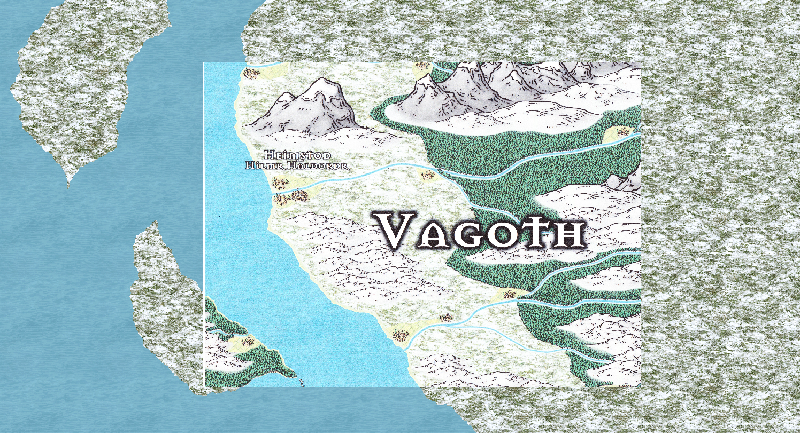
1. For testing, I just printed the section that I wanted to transfer and then scanned it and saved it as a PNG.
2. I have found that to keep the quality to an acceptable level, for the detail that I wanted, that I needed to create a square grid set for 50.
3. I would then zoom into that targeted 50x50 square.
4. I had to increase the size of the fonts for my settlements.
5. I printed it, scanned it, and then imported onto the Kelleemah Template.
6. I am also going to try and get the print wizard to work and print strait to a PNG instead of to paper.
7. It took a lot of fiddling to get the scale and placing right.
8. My printed maps come out great, but the scanned versions at 600dpi are not as good and are lighter in shading
9. I definitely want to print strait to a file instead to printed version.
10. I think the image will come out better.
11. I would also save a lot of money for ink - Ha, ha!
12. Since the overall map is 10,000x12,000; I would need 48,000 overlapping images to pull this off.
13. I also need a better way of scaling and placing these since I was eyeballing it.
Here is my first test example:


Comments
I sure wish there was some way to automate this using a program - Ha, ha!
Thanks
:-)
I went all the way through and did not see an option to print to file (such as a PNG).
Is there a way to do this?
In addition, it printed everything that was white as black instead.
So what I ended up with was black hills (that are supposed to be white hills) and black text (that are supposed to be white text).
Why is it that when I just print without using the print wizard, It comes out great; but when I use the print wizard, it crashes a lot and does not print correctly?
Thanks,
:-)
I will experiment with it. :-)
I just realized,
Maybe, I don't need base landmass on the template at all.
;-)
I tried your suggestion with disastrous results - Ha, ha!
If you just hit save as and then PNG you get the whole bloody world!
You can hit save as Rectangle PNG and choose your area but it don't not print it to scale.
As such, you end up with a 800 x 600 file that you can not manipulate at all.
If you try to increase the size at all, it goes all pixelated on you.
It does get the color spot on, but that is about it.
I may have to try doing slightly darker scan on the printed copy (If I have that option) to try and make it not so light in color.
I sure wish they could make this easier:
1. Click on Print Tool.
2. Select area (just like you do for zooming in).
3. Click Do It.
4. It takes you to the print options (I would select Scale 8" = 50 Miles).
5. Select a Print As drop down menu (select Print to Scale PNG).
6. Select Print.
Here is attempt 2 with this little experiment.
Scanned version wins!
I was hoping that the PNG versions would be better on detail and that I would not have to physical print and scan the individual drawings.
:-)
I know, everyone is a critic - Ha, ha!
Maybe this will give them some cool ideas though.
If anyone but JimP looks at it - Ha, ha!
:-)
Any rule of thumb on how to determine best value or is it trial and error?
As for your idea about 'print to scale PNG', that is unfortunately not really possible, because an image doesn't have a fixed distance like a paper has. I guess you could scale it to a pixel value, but then you miss out on the intuitive scaling CC3 has anyway, and can just as well use the export dialog.
This time I did a Save As for a Rectangular PNG at 4000x4000.
It came out great!
I then inserted it into the Kelleemah Template.
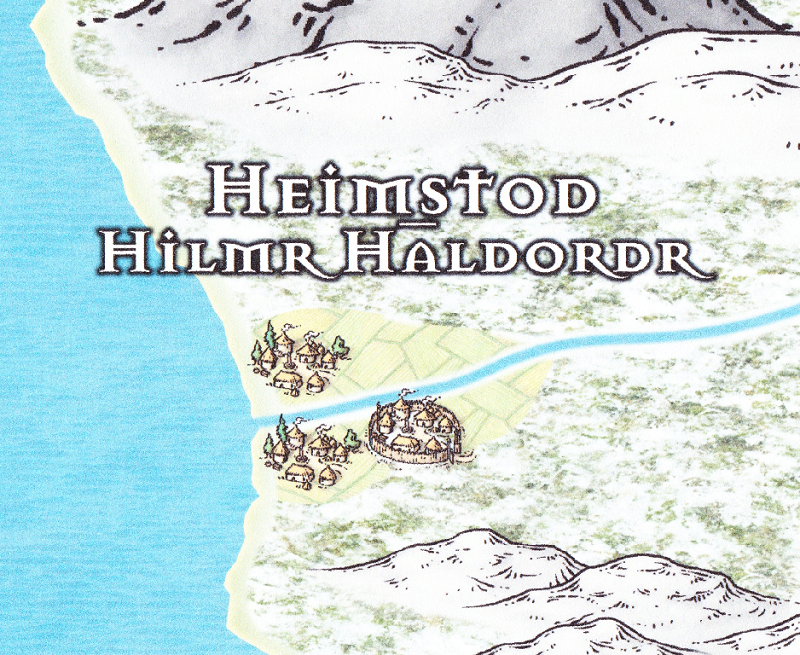
There is some degradation when you get real close to the settlements but not that much, especially compared to the last test.
Thanks Monsen!!
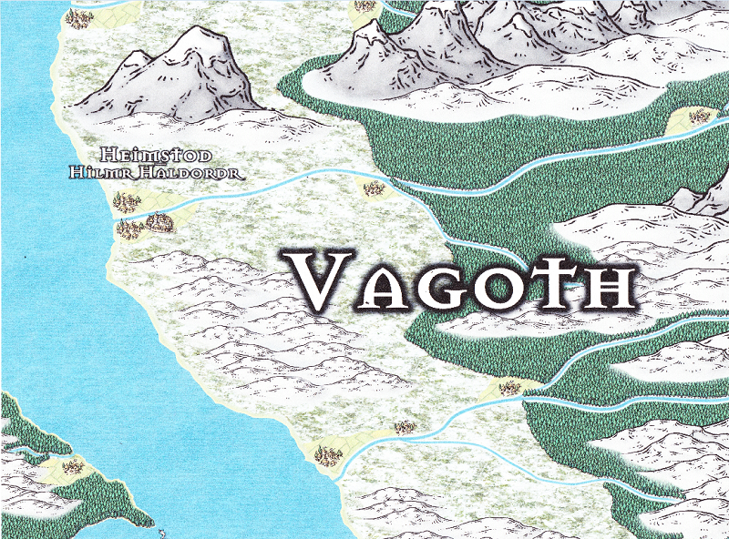
Here is the original PNG strait from the map and rescaled to 800 for placing on the forum
You can see the degradation between the original copied PNG and the inserted file.
but is not to bad.
Again, you can see the degradation, but it works. :-)
I am shrinking the inserted file to fit and normally that does not affect the image.
But I like the overall results.
And the settlement does not even have the larger font that I was experimenting with.
And even more exciting, I can now scan larger images and that will reduce the number of images that I will have to transfer.
Indeed, I can transfer the whole region at one go if I want to.
And, I should be able to have the detail that I want for my world map.
Thanks again Monsen!
So what do you think?
:-)
I have learned to think in unorthodox ways.
Of course, it could also be the brain damage.
Ha, ha!