Need Help - Can't Create Custom Files! Yaaaaarrrrgggghhhh!!!!
 Terraformer_Author
Newcomer
Ok - here's the story...
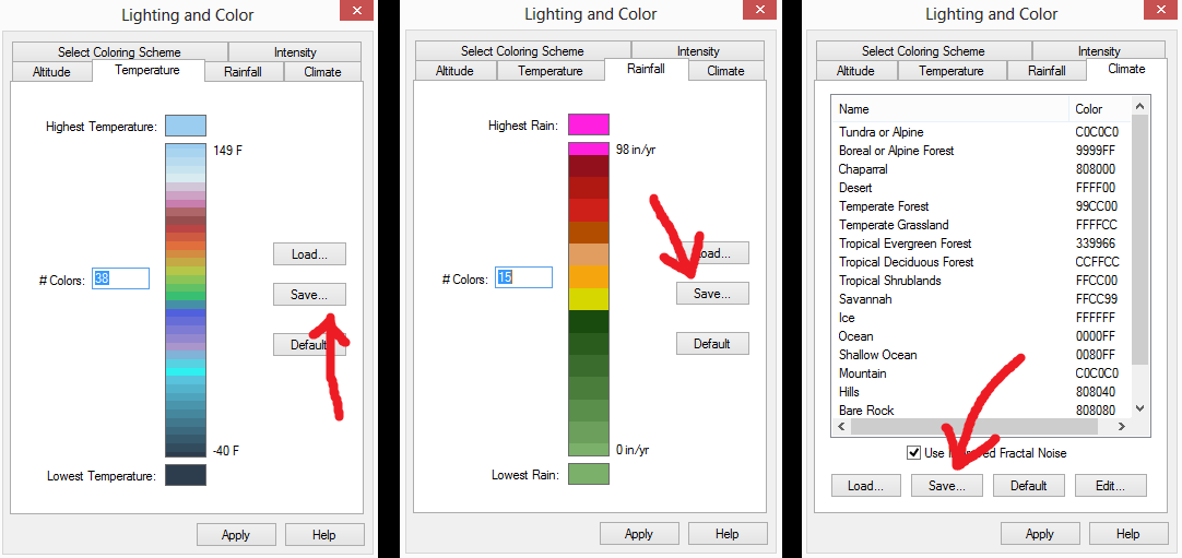
I wanted to make custom files for Temperature, Rainfall, and Climates in FT3 to maybe stick into Terraformer 1.0 when I start working on it after I have my guts reassembled in the hospital - so I saved some test files into a desktop test folder thusly (see Graphic #1 below):
I wanted to make custom files for Temperature, Rainfall, and Climates in FT3 to maybe stick into Terraformer 1.0 when I start working on it after I have my guts reassembled in the hospital - so I saved some test files into a desktop test folder thusly (see Graphic #1 below):


Comments
There is more in the .bcl file than there is in the .clr file and it's that extra information that led to the binary format.
I'm not sure what you mean by redistributable. They're files. They go wherever they're copied. There can be no legal restrictions on those files as they contain only user-generated content.
If you have an RGB color set that contains colors not in FT's default palette and then export data to CCx (e.g. exporting a custom RGB altitude set to a CC3 file), then FT will pick the closest color in the CCx palette according to RGB distance. A better metric might have been HLS distance or a perceptual metric, but that's what I knew how to do back 20 years ago.
If there is ever an FT4 - then I guess making custom colors inter-useable between the two apps might be one of the things on the grocery list of upgrades to look into anyway I suppose.
I really do believe that since the color approximations on FT3 to CC3 maps are probably going to be extremely close anyway - nothing of any real consequence insomuch as color quality is concerned - is going to be tragically lost in translation after all. The colors are "generally" going to look "roughly" the same - give or take some changes in subtle hues and tones - after all - 256 colors isn't really anything to sneeze at as far as topical maps like rainfall, climate, temp, and just straight forward topographical contour maps. Temperature and rainfall projections actually look more "realistic" in FT3 anyway - because they look more like real radar maps from a space agency or weather service bureau.