The Trouble With Texture Terrains
 Terraformer_Author
Newcomer
Ok - so - the story thus far...
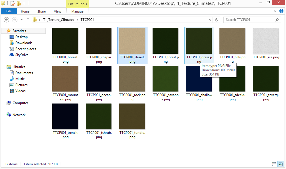
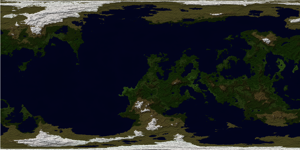
"Our hero - in an attempt to perfect the art of creating texture climates for Fractal Terrains 3 - has come yet two steps closer - and one step back - to actually accomplishing something. As you "might" recall from a couple of previous discussions - with the generous input of Joe Slayton's tidbits of useful guidance - I have developed a set of rather flacid, yet informative test textures using a rehearsed procedure in the GIMP - pictured below with the resulting output...
"Our hero - in an attempt to perfect the art of creating texture climates for Fractal Terrains 3 - has come yet two steps closer - and one step back - to actually accomplishing something. As you "might" recall from a couple of previous discussions - with the generous input of Joe Slayton's tidbits of useful guidance - I have developed a set of rather flacid, yet informative test textures using a rehearsed procedure in the GIMP - pictured below with the resulting output...


Comments
Well - what conclusions can I draw from this - firstly - much more subtle color differences on the layers of course are needed - but I think that aside from maybe tightening up the cloud patterns on the trans map, using the difference cloud approach have yielded interesting results for incidental terrain colorations - but it's still a log way from being where I would like it to be (below shows what I did in IMAGE INC to get these). I'll have to teach myself how to do this in the GIMP instead of IMAGE INC so that I can write a tutorial AFTER I have refined this to where it looks halfway passable - and if somebody wants to try this in Photoshop, then let me know the steps that you are taking insomuch as layering, masking, ect., So that when I start writing the T1 manual I can stick it in there for photoshop users also (I'm strictly a GIMP guy myself). If get outstanding results because you are naturally smarter than me - and you write up a tut - then whisper me and I'll provide an addy, or let me know where to snag and bag it. Suggestions - ideas - pointers - advise - and religious guidance is always welcome on this effort - INPUT PLEASE?...
I'm thinking along the lines of refining the transmap map. I tried applieing a fog effect but that doesn't have a tileable option in the GIMP. I'll also have to see if I can distribute the scripts for the Photo Effects in GIMP for GIMP users if the license will allow for distribution - if not - a link will have to do (which troubles me because there's no such thing as a truly permanent website, lol.). I have to develop a method that I can follow in a step by step way that will allow me to crank out Texture Climates by the oodles - yet have amazing results (I won't settle for less that amazing, lol).
I can pretty much tell that bringing these textures up to a dynamic standard with require LOTS of layering - time to hit the GIMP tutorials on layering (I never really had much call to layer anything before - this is a good opportunity to getts meez an edumacashun, lol.)
My goal in providing the texture climate tool was to provide for what amounts to symbol fills with a reasonable amount of control for the end user. The symbols can be abstract blocks of pattern, meaningful symbols, solid colors (although solid blocks gives just the same effect as the basic climate shader), or anything else; one climate color maps to a repeating block of pixels. At one point I had considered an indirect method that used a system much like the image climate shader to determine the input to select the texture to use. This system would be a major problem to control, however, because there would be two largely disconnected things for users to manipulate (one image indexed by rainfall and temperature that provides colors to use to index a set of images). I had considered a whole suite of things to try, but they were largely difficult to control and didn't give results too much better than the basic climate:texture mapping.
The two major sticky points - trouble spots with what I am trying to accomplish here is resolution and aspect ratio.
Still - as long as FT Pro / FT3 computes color to climate to where the accuracy of translation is still sufficiently in the right ballpark - I still "personally" prefer using it - as it does seem to give more believable results with the right Image Climate file. I am still going to keep hitting on creating "Texture Climate" packages though - because others will find more use for it - and it DOES hold a LOT of promise as an informational / topical tool.
Besides - if your World settings (Primary, Secondary, and Temperature) and lighting adjustments (Intensiy) are such that your rainfall and temperature settings are telling groupings of pixels what their temperatures and rainfall distributions ought be - based upon an areal mean distribution of (x(sub n) , y (sub n)) values - defined or suggested by these outside operations / parameters - then wouldn't the climate zones stay more or less (roughly) consistent anyway irregardless of editing resolution?
Note also that there are climate types in FT (e.g. Hills and Mountain) that cannot be generated from a rainfall/temperature table. These climate types allow for additional flexibility with regards to use of the texture climate shader.
I edited / corrected my last remark to say "settings" instead of repeating the word "distributions" (my foul up, lol).
You were saying that changes in map resolution = different resulting interpretations of the Image Climate shader by FT Pro / FT3 - / different results on the map - correct?
The variables that feed into the temperature equation (incident light, greenhouse effect and so on) determine the base temperature for the planet. The axial tilt determines the temperature distribution. The temperature and land/ocean position determines the rainfall. Both temperature and rainfall have a random component and a user-paintable component as well.
As an amusing aside, the north pole isn't at lat 90, lon 0 (nor is the south pole at lat 90, lon 0). The poles are at lat +/-90, lon [all of them] because all of the longitude lines converge at the poles. As an illustration, if you put a house with a window on every wall at the north pole, every window will face south, even though the walls are facing different directions.
I was thinking that I would expand the image climates - and also do some Texture Image packs. Bottom Line - I just need to get them to where they don't look like poo doo, lol. I might study the Texture Climate images that you've done Joe to figure out the approach that you took to cropping these and maybe blurring them because somehow you made it work and I've been racking my brain on trying to basically do the same thing - if you have a procedure specifically, I'd like to know. I also need to study FT3's grid function in depth a little more to get the jist of how to lay those out properly.
Another thing is that I'd like to add some notes in there (The Manual) on how NOT to get square craters when doing "Planetary Bombardment". If you've got some thoughts on that - then that would be great.
I wish that you could plug in .lgt sets for Temperature, Rainfall, and Climate Zone Coloring palettes like you can for Altitudes. I've found quite a few interesting examples on the net and I was thinking about doing an NOAA palette for Rainfall. I know that you can save and load palettes for those - I just need some clarifications on what areas of those files I can edit the RGB values on / need some pointers on how to edit the temperature and rainfall palette files (.lgt)? I can do new Altitude files in my sleep - but I need to look at the text versions of outputted / saved Temp and Rainfall files to know which areas of those I can plug new sets of RGB values into.