Cropping and inverting altitudes on a map on FT3
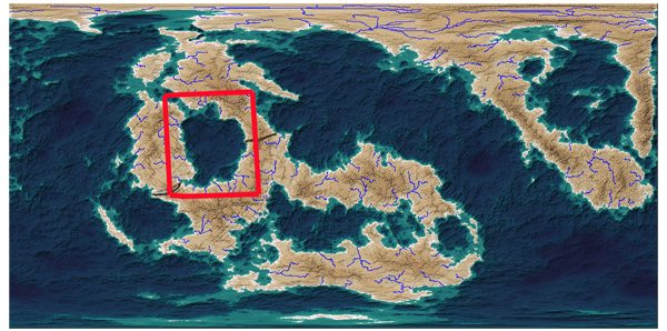
On the attached map I would like to crop the map to the section in the red border and save just that section separately as an FT map and then invert the land and water. Unfortunately I have no idea of how to do that and would appreciate any help


Comments
Perhaps I misunderstood your request. Would it be sufficient to simply zoom to the area of interest and use View>>View Window to define a view that lets you get back to the desired area quickly and reliably? Saving a CC3 file or an image file saves the current view area of the main program as its default behavior.
Inverting land and sea is pretty straightforward. It's what one of the more obscure tools was originally designed for. Select your area of interest using a rectangular or other selection tool (don't make a selection if you want to do the whole world). Then use Tools>>Global Math Tool and set it to (Roughness = Roughness *(Multiply) Constant [with Constant Value set to -1]). Click OK and that's it. If your world goes completely flat then you didn't set Constant Value to -1.
If you'd like to have the edges be a little smoother, use Select>>Feather with an appropriate value before applying the global math tool.
The reason I want to crop to just that selection is because I am setting everything else to water (actually it doesn't need to exist at all) and it will be able to work with it easier as a smaller file. I didn't think I could crop it, but I was hoping