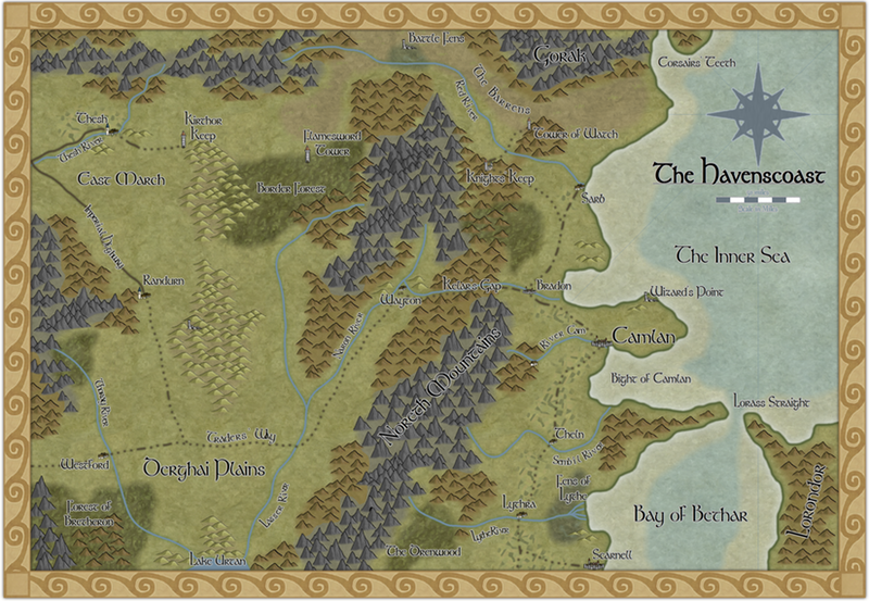
The Havenscoast: Annual December 2012 style
Haven't ever posted anything here as - well to be honest - the quality of maps posted here scares me most of the time 
But I recently completed this map using the Annual Style from December, which I really like a lot. It's an area of my world that I've mapped using a number of styles, but I think I like this one the best. You can see the full size image via my blog.
All comments welcome!!
But I recently completed this map using the Annual Style from December, which I really like a lot. It's an area of my world that I've mapped using a number of styles, but I think I like this one the best. You can see the full size image via my blog.
All comments welcome!!


Comments
I especially like the hills down the left quarter of the map and the mountains across the north.
I should probably tell you to prepare yourself though... someone's bound to point out something about rivers not splitting, the way the Naron River splits at Wayton.
For my part, I really like this map. Also, I stopped by your blog. Very nice! I've bookmarked it so I can explore it in more detail later. Some nice stuff posted there as well!
~Dogtag
@Dogtag - hmm, on the river 'issue', its been like that since the mid-1980s when I originally drew it by hand
And yes, rivers usually do not split.
But there are always exceptions.
And then, it has been this way since the mid 80's. So its older then some on this forum :-)
So just let it stay split.