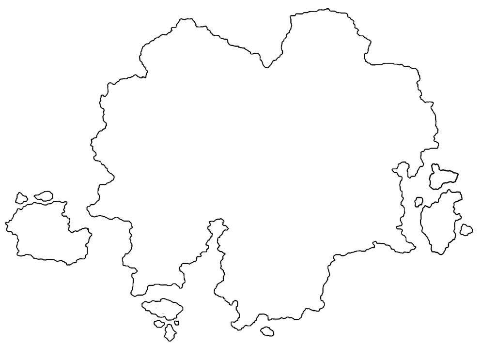
I need a tad bit of help
I have a map outline that I did in Photoshop but importing it into CC3 and creating the actual landmass is killing me! It either won't size properly and when it does then I can't convert it into a Jon Roberts style map. All I want to do is get started creating the actual map so I can get back to writing rather than killing myself over trying to import an outline which I've already spent two days trying to do!!!
Would someone be willing to put the png files into a map and convert it into a Jon Roberts style landmass for me?
I've broken the map outline into six pieces that should each fit into a 500X500 (or 1000X1000) square map in CC3. I also have the original full outline in both png and ps formats with the dividing lines for each 500X500 (or 1000X1000) section. I honestly don't know which would be the easiest method of doing it, but I read a thread about making a large map out of smaller pieces earlier so I thought that I might try doing it that way but I've had no better luck than I did with the full outline.
Just to clarify, what I need is the entire map at a scale that is large enough to be able to show roads, mountain chains, rivers and settlement locations, which seems to be about 3000X3000 for a full continental map like this one. I could be wrong though, obviously I'm not very experienced with CC3. The main landmass is the size of the western United States from the Canadian to the Mexican borders and from the west coast to about 3/4 of the way through Texas as far as comparable size goes, if that helps.
I would really appreciate anyone's help. Thanks in advance.


Comments
- First find the proper scale for the canvas size you want in CC3. To do that, you unhide and unfreeze all layers and all sheets. Then in the command at the bottom type, scalexy. Then press A, then press D. That should select all entities. Then put your x value first value 3 and then your y value, 3. Then your canvas size for your map should be ready.
- Then what you do is make this image a PNG and put it in the one of the catalog symbol folders.
- Then Symbol --> Import PNG's
- At the Import PNG's screen selection browse for the png you put in the folder. Usually for the highest resolution I put 100. Then press Ok.
- On top of where you see the symbols on the left there should be two buttons. One looks like a folder and the other one has a blue and green icon on it. Click on the blue/green icon. Then scroll down and find your imported PNG.
- Once you found your imported PNG you scale it to fit the canvas in CC3. You can do that by holding CTRL and moving your mouse up or down.
- What I do next may be a bit tedious but it's the only way I know how to do it. Use the landmass tool and trace over your map outline. Once that is done you can go ahead and delete the imported PNG and then you will have the desired shape you want for your continent.
Hope that helps. I'm sure there may be an easier way to do it.
I was hoping I could just fill in the outline or something easy like that... oh well.