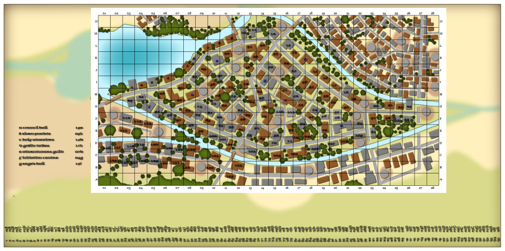
Fantasy City style section of a Larger map
I began work on a new map project for a new set of adventures I'm working on. The Main map is a massive ruined city. Part of which has been 'reclaimed' and functions as a small town restored within the ruins. Adventurers come to the ruins and make their home base out of this reclaimed area. The industry of this town is treasure seekers! Kind of like a fantasy version of a gold rush town.
So I did a map of the reclaimed area but wanted to show on this map that it's just a part of a much larger picture. Here's the result.

The surrounding 'border area' is just background details, but I'm thinking I might add all the details (like buildings, roads & trees) and have them set to the same blur. That way, looking at the map it will be obvious that this is just a small part of a much bigger picture. The index on the left are for the major locations. I plan on populating the rest of the buildings by using the index across the bottom. Right now, it just labels the building number and it's coordinates. I'll be adding what those buildings are as I develope the details.
So I did a map of the reclaimed area but wanted to show on this map that it's just a part of a much larger picture. Here's the result.

The surrounding 'border area' is just background details, but I'm thinking I might add all the details (like buildings, roads & trees) and have them set to the same blur. That way, looking at the map it will be obvious that this is just a small part of a much bigger picture. The index on the left are for the major locations. I plan on populating the rest of the buildings by using the index across the bottom. Right now, it just labels the building number and it's coordinates. I'll be adding what those buildings are as I develope the details.


Comments
How did you get the grid to do just a small section of the map?
This map took a LOT of small fiddling with to get everything just right. Now that I've done it, I thought of many ways of achiving the same result with a lot less work.
And for the grid, that would have been a whole lot easier than my way!!!
Thanks for the suggestions. This is definelty the kind of map effect I was looking for.
One thing though, you say the mapped section represent a restored part of the ruins. It sounds a bit unlikely that they have restored a perfectly rectangular section, so perhaps a few ruined buildings in the outskirts of the reclaimed are map, to indicate that civilization ends here (for now)?
I"m looking forward to doing other sections of the ruins like this too. There are many rivers and such forming natural divisions throughout the city. The only part that is actually reclaimed is the part within the rivers. The section to the south is acutally just plain abandoned.