

WIP - A Hand-Drawn Fantasy Map of Jack Vance's Dying Earth
 Wyvern
🖼️ 280 images Cartographer
Wyvern
🖼️ 280 images Cartographer
Having seen several Forum topics in recent months regarding the creation, and recreation, of maps from various past fantasy settings, both literary and in role-playing games, and despite having several ongoing mapping projects for the Nibirum Community Atlas, I've lately become distracted into trying a map of the Dying Earth, based on the fiction of Jack Vance that used this setting. Vance's Dying Earth writings were one main fantasy influence on the original Dungeons & Dragons RPG, and they continue to resonate in numerous other games now.
In approaching it, there's the complication that there are no definitive maps created or authorised by the original author himself for the complete world he created, and the story descriptions are sometimes vague enough to make constructing one tricky. Prior to the post-pandemic period, there'd been probably no more than five attempts, all of which show sometimes considerable variations between one another, and sometimes split between different maps. This post on the Lost Delights blog from 2020 discusses the five, with image links.
Over and since the pandemic, there has been one more, by Doug Kovacs, created specially for the boxed set for the Dungeon Crawl Classics RPG by Goodman Games, following their hugely successful Kickstarter campaign to produce a Dying Earth setting for the DCC rules in 2021. There are some images of the map on the Goodman Games store page for the boxed set. Even so, despite this being perhaps the most colourfully lively and more nearly complete of all the maps, the vagaries of the tales mean all such attempts are based on personal interpretations, and thus none are truly definitive.
I'd had my own vague notions of trying to map the Dying Earth, going back more than 40 years to when I first read the stories, deterred previously by that vagueness. Having recently managed to secure a copy of the DCC boxed set though, I thought it might be fun to try to redraw the Kovacs map (and maybe some of the others later) as a CC3+ version. Hence this topic.
For those unfamiliar with the setting, it is in Earth's 21st Aeon (an unimaginably vast time ahead of our own). The following is a snapshot provided in one of the earliest tales, "T'sais", first published in 1950 in "The Dying Earth" anthology of six stories. "T'sais" is the third of the six. Pandelume, a near-god-like mathematician-magician, whose form must never be seen as it would cause utter madness, speaks:
""Earth," mused Pandelume. "A dim place, ancient beyond knowledge. Once it was a tall world of cloudy mountains and bright rivers, and the sun was a white blazing ball. Ages of rain and wind have beaten and rounded the granite, and the sun is feeble and red. The continents have sunk and risen. A million cities have lifted towers, have fallen to dust. In place of the old peoples a few thousand strange souls live. There is evil on Earth, evil distilled by time… Earth is dying and in its twilight…""
Add to that that the Moon is long gone, stars in the night sky are very few, that the world is filled with marvels and dangers both magical and technological (there is no difference between them) and has been visited by creatures and beings from what were once distant stars and galaxies, all too now largely long gone and forgotten, and you start to get an impression of where we are!
So, preamble done. Now to the mapping. I chose Ralf's Hand-Drawn Fantasy overland style, as it had worked very well for my attempt at redrawing the Blackmarsh partial world map previously, and this was going to be a similar project. The first complication was there's no scale on the Kovacs map (or indeed, on most of the others), largely thanks to the vagueness in the tales. So I simply went with an approximation of the ratio, and doubled the normal map area to 2000 by 1600 mapping units. Dropped-in a copy of the Kovacs map to trace on the normal BITMAP Layer and Sheet, and started drawing. This is an early screenshot:
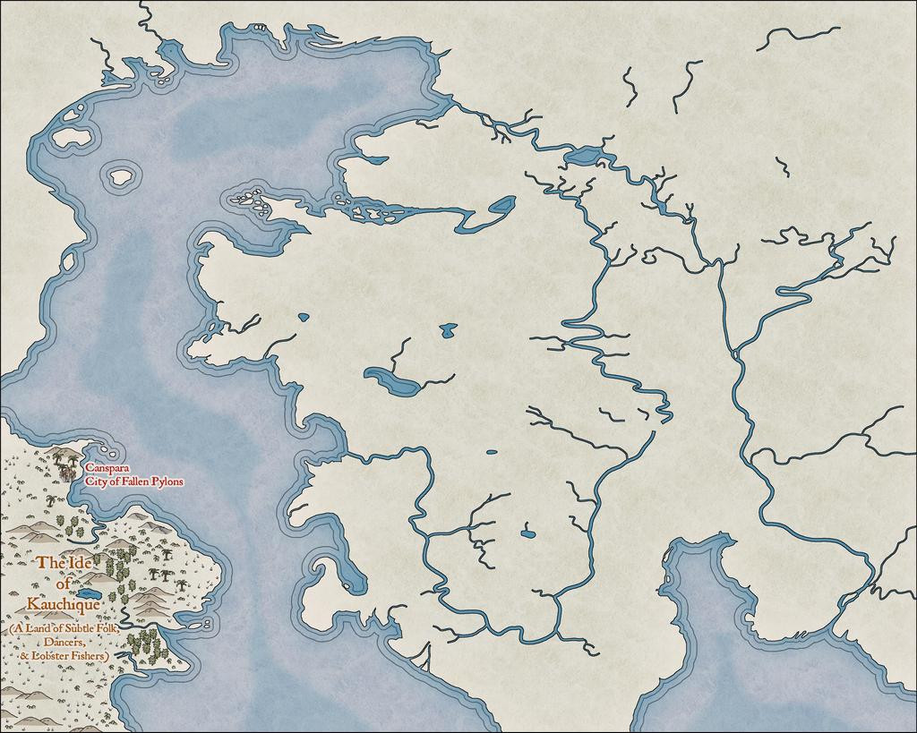
It was taken some way in to the mapping, as I'd had a couple of false starts by this point. At one stage, I'd thought it might be possible to split the main landmass in two along the line of that curious river that apparently connects the northern and southern oceans, but it proved much too tricky to get the river width to look right. Given that this style uses the Color Key effect to cut through the land to the sea, that wasn't really necessary anyway.
Most of what's visible here is a test, to see what works and what doesn't, and the odd-looking, truncated river lines will be tidied-up as mapping proceeds. It has been strange to stick with the default Effects settings that use the Percent of Drawing Extents Width here, which I'd ordinarily swap-out for Map Units instead, but as they work very nicely at this level of viewing, all seems well.
The next image shows how the river lines are going to be tweaked, added-to and adapted along the way, just in that Kauchique quadrant for now:
Other adjustments have been made too, in changing the deeper sea contours, and such processes are liable to recur frequently as the journey proceeds, given this is not going to be a rapid process, because of the detailing involved.
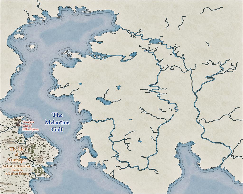
Somewhat strangely, I found I was adding the map detail much as if it were hand-drawn in reality, from left to right:
As each of these snapshots shows the progress from an individual mapping session, it took several days to get to this stage:
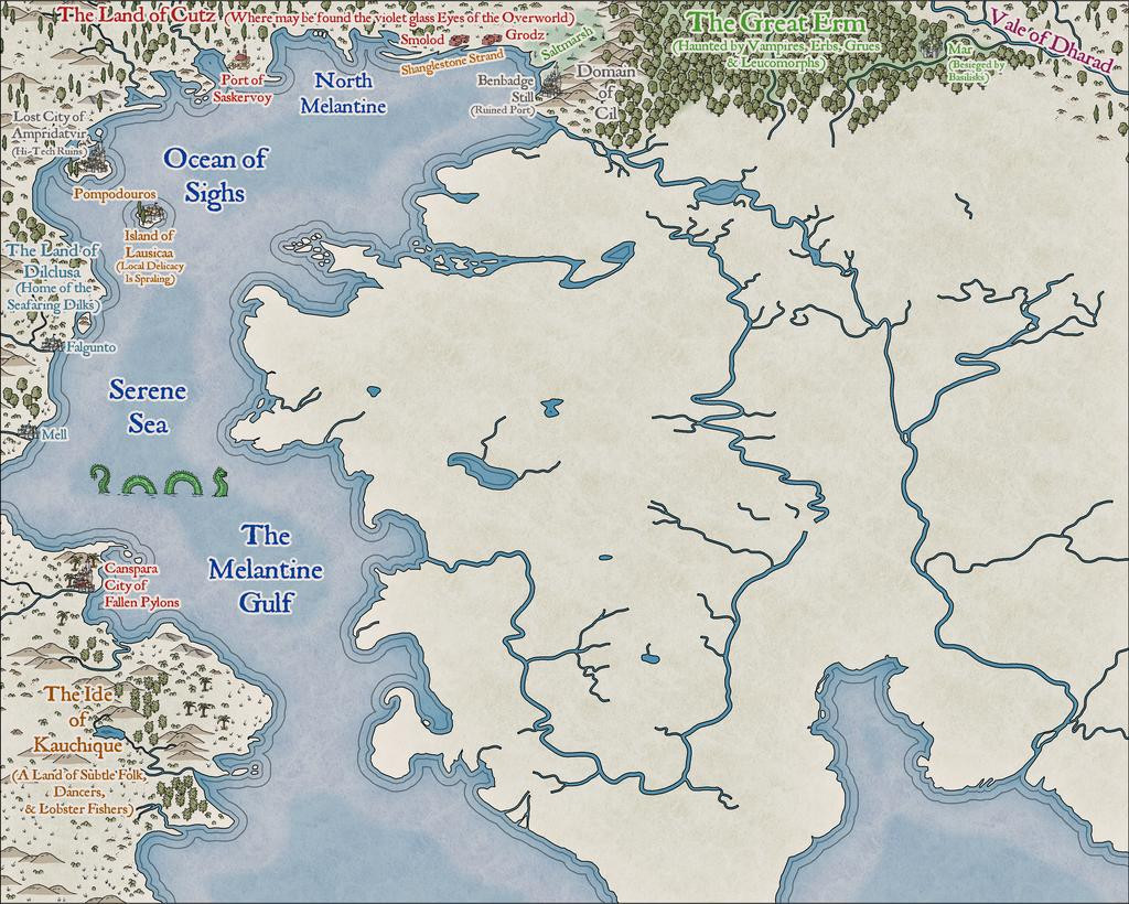
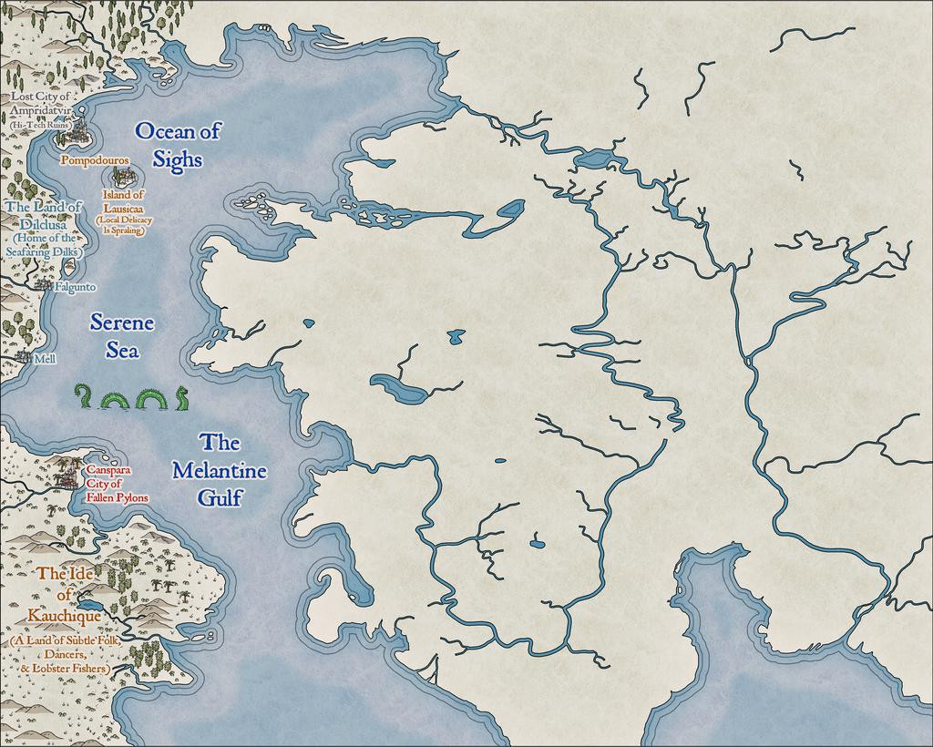
Which is where things are currently; clearly, with lots more still to do!


Comments
This is outstanding! I love that work, and it's great to hear that you're doing this.