

[WIP] Applevale
 Royal Scribe
🖼️ 388 images Mapmaker
Royal Scribe
🖼️ 388 images Mapmaker
This is my first pass work-in-progress attempt to create a city map using an overland style (in this case, Handdrawn Fantasy) that Ricko does so magnificently.
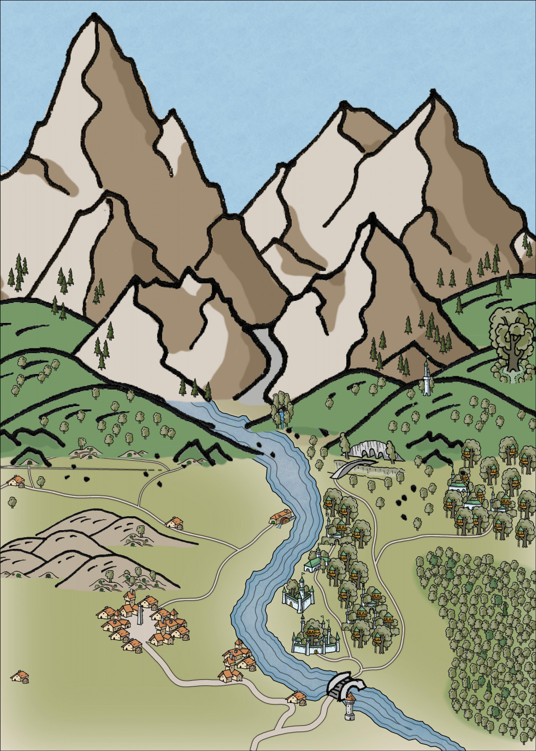
It's meant to be a community of halflings and elves living together harmoniously, albeit mostly on opposite sides of a river.
Not sure if something like this would work for the Atlas because the scaling is tricky (and if it's not suitable, that's okay -- I had fun doing it). The map is set at 5x7 miles but then I had to enlarge a lot of the symbols.
Tagged:


Comments
Something you might consider is using this kind of pictorial drawing to illustrate a more traditional top-down map of the same (or a larger) area, in a loose medieval style. Pauline Baynes used this concept to splendid effect on her Middle Earth maps for J R R Tolkien, and her Narnia maps for C S Lewis, for instance, showing images of selected, specific places on the maps.
Oh, meaning that I would have a traditional top-down map, with this as an inset or off to the side? Is there a top-down style you'd recommend that is complimentary of this style?
Hey Royal, why don't you use a "water" sheet over the images to cover this passage and turn it into a waterfall?
To add more depth to the image, I suggest considering establishing 3 or 4 regions in the image (at least I usually do this) where the icons change size, each time a little larger.
To avoid getting lost, I usually leave an example of the size outside the map as a reference if I need to go back to work on a previous area.
In this small example, I've separated them into even more sizes, adding an extra, even larger, fifth line.
Note a small detail: in topic 2, among the standard-size trees, there are some smaller trees. Compared to the others, where only the standard size is present, it gives a more "organic" and realistic appearance, at least to me.
Trees behind and in front of the hills also contribute to a more harmonious view.
This is awesome - I love this style of mapping! And thanks for the breakdown of how you do perspective, Ricko.
Exactly!
I don't think it really matters what kind of top-down style you choose - even if the settlements are just dots, the pictorial representation shows what's actually there, which is really the point in many respects. The actual region map would really be too small to show pictures of the settlements to scale, so the drawing shows those at the expense of "unrealistic" scenery and scaling instead.
Many of the pictorial styles we routinely use in CC3+ are already a compromise between accurate images and true scaling anyway. Ricko's shown masterfully and repeatedly what can be achieved by ignoring scaling entirely, and going for a purely pictorial representations using those images!
Have y'all used the Perspective Scale commands as described at Profantasy's Map-Making Journal » Blog Archive » Leveraging the new features of CC3+? As with too many features like SYMFILL, it exists purely because I was unable to muster the patience for doing things the traditional way.
Thank you for the reminder. I remember seeing a video about that which I think Remy did. Even though this is a small enough map that doing it by hand wouldn’t be that onerous, it would be a good one to try out that technique. As soon as I finish my Halloween hags’ lairs, I will come back to this and try that approach.
I think the video you remember might be this one?
The very one! Worth a rewatxh.