

[WIP] Atlas Contest - Yréas Kóltyn Village (Kingdom of Enía, Gold Coast region of Dóriant)
 Royal Scribe
🖼️ 233 images Mapmaker
Royal Scribe
🖼️ 233 images Mapmaker
When I was working on Fon'Anar, my elven farming village in Verinress'Arl on Artemisia, I had an idea for a different approach for an elven village that I wanted to try next.
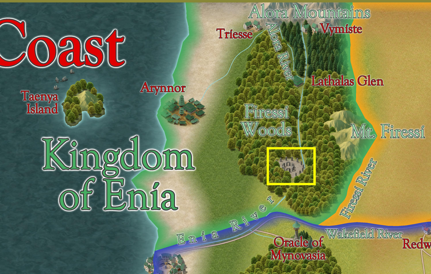
This little village of Yréas Kóltyn is set in the Kingdom of Enía, a northern country in the Gold Coast region of Dóriant that I am submitting as parent (or great grandparent) map to the Atlas. It's a religious community overseen by an archdruid who oversees religious observances at a Great Henge located in the Firessi Woods. For context, it's located in the yellow box on this map:
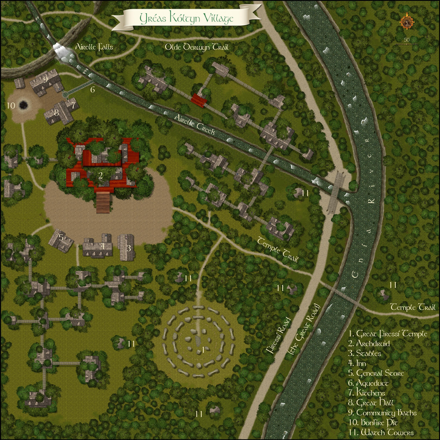
I did the map using the Forest Trails annual, with heavy assist from the Darklands City annual. Here's the map in progress:
And here is a more battlemap-ready version of it with the trees (and treehouses) hidden, and just stumps and shadows shown:
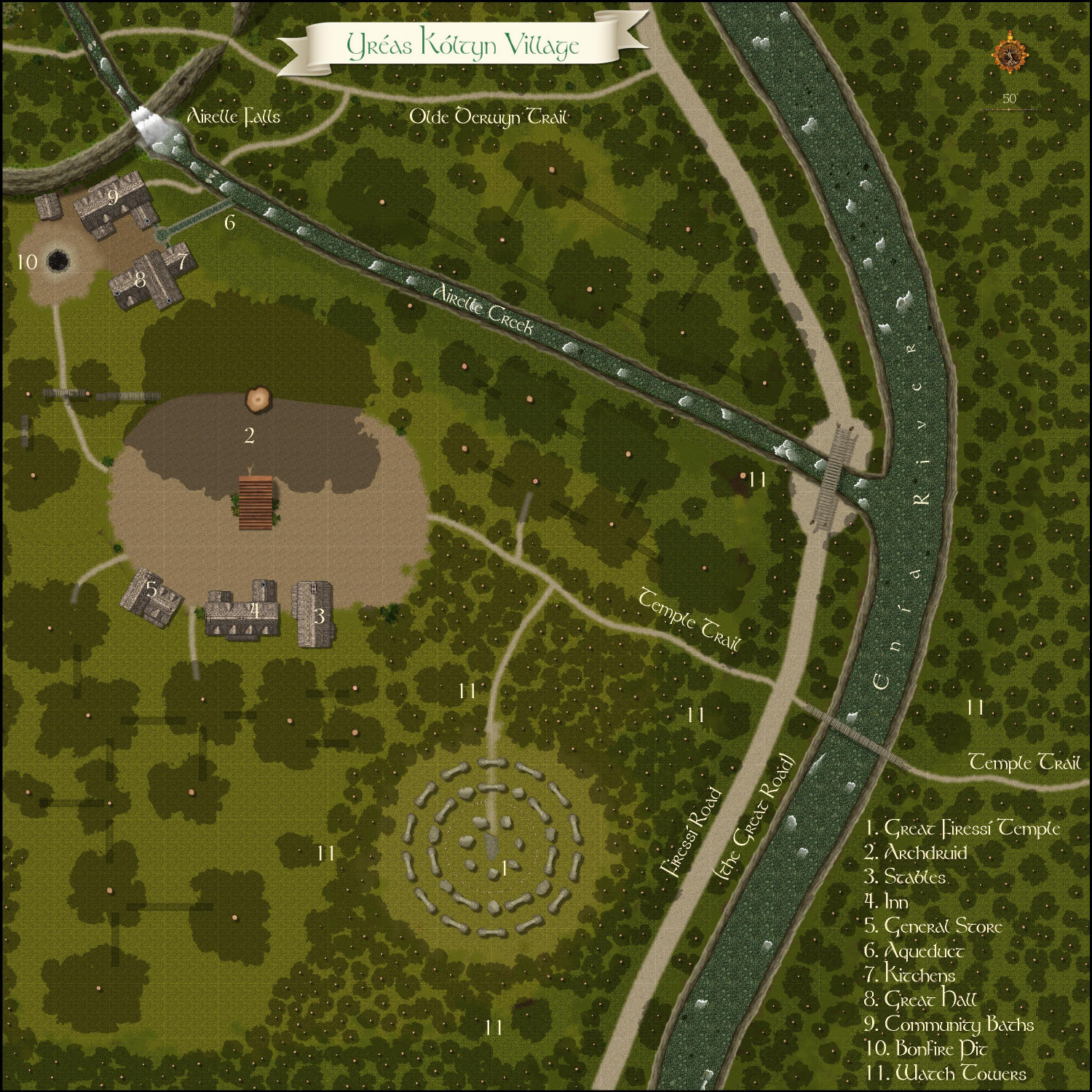
The treetops and treehouses are all on a single layer to make it easier to toggle them on and off.
The idea of the village is that they've grown up in support of the temple in support of the elves who make pilgrimages there for the opportunity to experience religious services in one of the holiest places in the kingdom.
Here's the temple close up:
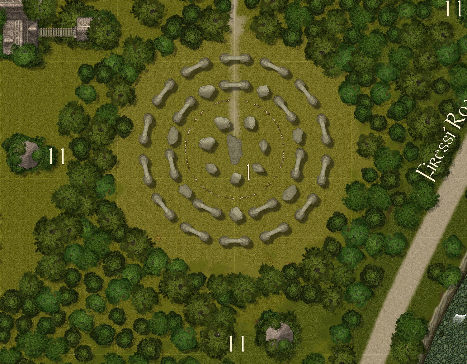
In my campaign world, the elves have seven gods, which is why this has seven standing stones in the center ring, then seven arches and seven stones in the middle ring, and then fourteen arches in the outer ring.
The archdruid's home also serves as a sort of local government for the community. It's the only treehouse home accessible with proper stairs. All of the other treehouses have wooden ladders or rope ladders that can be pulled up to impede access from intruders. Here's the archdruid's home:
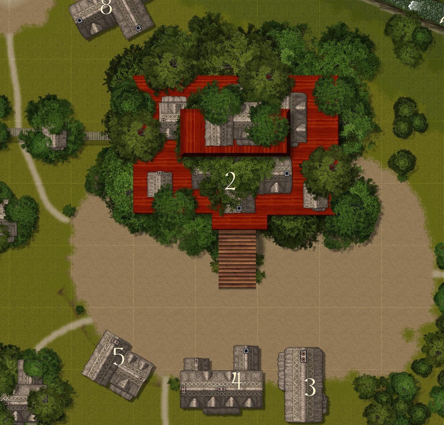
The other buildings on the ground here are stables (#3), an inn (#4), and a general store (#5).
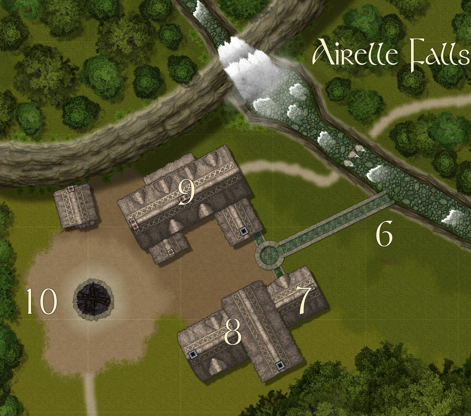
The villagers live somewhat communally. Since it would be kinda dangerous to cook food in a treehouse, there's a common kitchen and Great Hall. Everyone has a job, and for some, it's to work in the kitchens to cook for the village -- kinda like the dining commons at a university, perhaps.
Here are the "commons." It includes a small aqueduct to bring fresh water to the kitchens (7) and community baths (9). Dining is in the Great Hall (8). On nice evenings, a bonfire can be lit (10), around which the elves often sing and dance.
Most of the elves live in multigenerational treehouse homes. There are a few neighborhoods of these homes in the village, and residents can walk through their neighborhoods on elevated bridges without needing to go down to the ground. Here's an example of one of those neighborhoods:
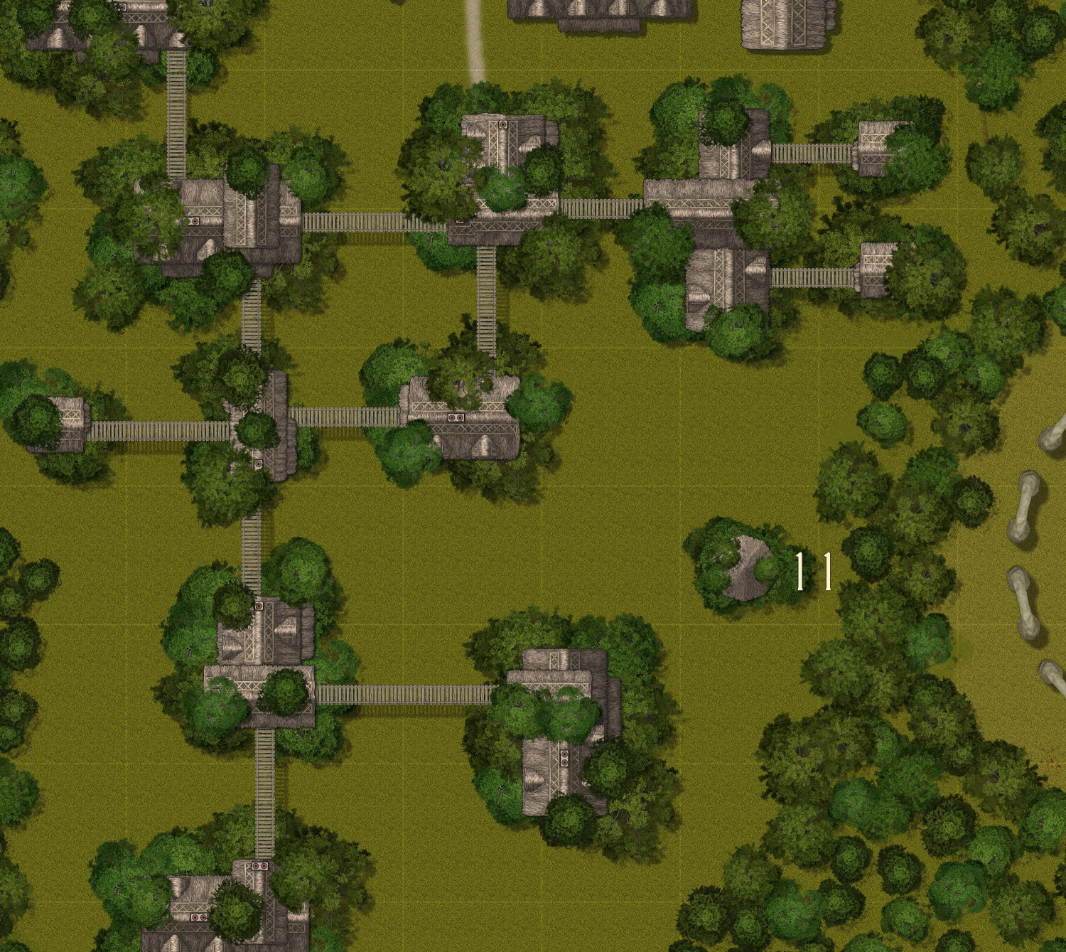
I was going to add lots more trees throughout these neighborhoods, but they kind of distracted from the homes themselves.
Since the treehouse homes wouldn't have cooking or fireplaces, I guess these residences shouldn't have chimneys. I tried to cover the chimneys with upper canopy foliage, but I missed a bunch.
I think there are 28 residential treehouses (excluding three attached to the archdruid's that I thought might serve as guest accommodations for VIP pilgrims. They're meant to be multigenerational homes. In calculating the village's population, many residents do you think I should assume per residence?
Any thoughts or feedback?


Comments
Related to this village: I am planning on submitting an intermediate map of the Kingdom of Enía portion of the Gold Coast. And now I'm thinking that I might also do another map of just the Firessí Woods. I think it might be easier to do the Firessí Woods map now than after this temple village is added to the Atlas.
If I do create a Firessí Woods map, are there any sorts of adventure hooks or mapping possibilities you'd recommend including? I have the Tempuwari Ruins, which were meant to provide a place for an adventure reminiscent of the opening scene of Raiders of the Lost Ark. Other than adding a few more tiny elven hamlets, and maybe a few cave openings in hills, are there other mapping/adventure hooks you'd like to see?
In terms of what you want to put into your write-ups for the Atlas, that's entirely up to you (within any existing constraints that previous mappers may have set for the region). I tend to go with things that interest me, either that I've developed in the past, or had as ideas previously, or that have been suggested by rolls on random tables (or similar RPG mechanics). You may find those ideas also come to influence changes in how the maps look though, so beware 😁!
With the Elven village map, the linking aerial walkways seem both a little too wide, and much too grid-rectilinear right now. The latter aspect jars with the far more free-and-easy surface pathways, and while the nature of the walkway symbols means they will always be less curving, their long straight tracks don't look so good to me right now. It may be worth experimenting too with some scattered trees/bushes around and even under the walkways (some are long enough they probably need support from below of some kind, for instance), as well as between the arboreal buildings. Tree houses really shouldn't be all that easy to spot, although mapping often brings compromises that aren't wholly realistic, of course.