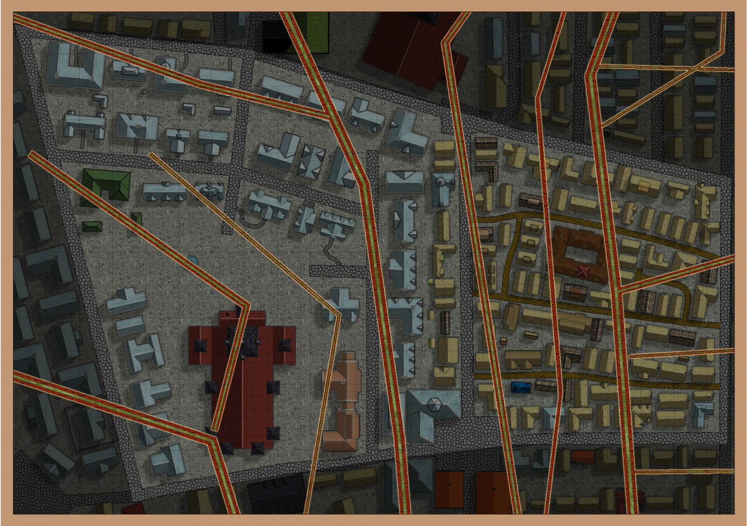
Torstan Holy Head Sewers
I have decided to give the sewer annual a go, and am using the sewer map I did for Torstan, just for the Holy Head District. Even that might be a bit much, but we will see how I go.
I will keep the buildings on the map with a solid50 bitmap between them and the sewers. It will also be for the same city in my campaign world, where it is the city of Krakatos.
So, this is what I will be doing. There will be three sewer widths - the main channels about 5-7 metres, the intermediate ones of 3 metres, and the smaller ones less than 1 metre (not shown on the map above ... yet).


Comments
This is what I get with the connecting symbols. What am I doing wrong? I am using the metric version, as the parent map is in metres.
The connecting symbols only work in the imperial maps. If you do a metric map you must use the metric catalogue and place the symbols one by one by hand.
In imperial maps you must also use a default symbol scale of 1 and make sure it is still set to 1 when you use the connectig symbol.
Here is the fcw
I'm not sure how you have ended up with that, but if you have used the connecting symbol in a metric map that may be part of the problem.
While I was testing a new metric map I discovered a glitch that may not have helped. The metric template opens the imperial symbol catalogue. It shouldn't. There is a metric catalogue, and it doesn't have the connecting symbols in it - just separate elements to paste by hand.
However, that is not the only issue. Some of the bends appear to have been scaled slightly wrong in the metric catalogue.
I've asked Ralf for advice.
Oh, dear. I really need to use the metric map. What should I do - just put this on the backburner till the problem is rectified. I must say, this is not the first time that there are problems with the metric maps. And that does make me rather cross, given that only two countries use the imperial system for measurement. And UK and USA are NOT the arbiters of good sense, style or stability.
I have been working on a sewer system where although I’m using Imperial measurements, there are sections of the map where I am placing symbols by hand instead of using the connecting symbols. If you have snaps turned on, it goes pretty quickly.
If the corners were ok I might suggest that you start a new metric map, and make sure you have the metric version of the symbol catalogue open. The connecting symbols do not work in the metric template, as is stated in the Mapping Guide, but there is a full set of the pieces ready for a metric map in the metric catalogue.
However, since there are 3 corners on the drain symbol set that are not scaling correctly right now, it might be as well to hang fire for a few hours and see what we sort out - bearing in mind that it is late evening in Europe right now.
Sure. Thanks for that. Why don't the connecting symbols work for the metric version - will they ever be able to?
Perhaps I should do it in imperial (yuk), and then convert the whole map to metric - would that still work?
Connecting symbols with actual corner pieces have never worked in metric maps. This may change at some point in the future, but that is just the way it is for now.
Connecting symbols that have no actual corner pieces, like a fence or a hedge where the pieces are all straight sections, will work in metric templates as long as you use the set that has 'metric' in the symbol name.
Yes, you could make the map as an imperial map; sizing the map to be the same area as the metric map. Draw the drains using the connecting drain symbol in the imperial map, and then copy paste the resulting drains into your metric map. I'm not sure if you would have to scale them down during pasting, but the pattern and width of the drains would be correct.
One more thing - the corners or bends are done in 15 degree steps, so you may have to slightly modify your layout if you want to be able to connect everything smoothly.
Ralf has kindly uploaded an update to the style with bug fixes and an improved set of templates. You should be able to redownload and install it over the top of the old version from your registration page.
I recommend doing that before you start any new maps.
I did that last night, so I think I have the current version.
No. This one was uploaded about an hour ago.
OK, I will redownload it, thanks.
Downloaded and installed.
Well, thanks to everyone. Here is the start.
Very handy when adventurers need a sneaky (and smelly) way to sneak in or sneak out.
Nice work Quenten. Just a thought; to me, it looks a little odd having the sewers 'on top' of everything, have you considered putting the sewers towards the top of the sheet order, 'under' everything else and applying appropriate transperency effects to the sheets on top of them?
No, I want them to be on top, as this shows the sewer map, with the houses they connect to in the background. Otherwise, the sewer detail will be lost. And there is a lot of that to come.
Also, the above ground detail will be severely cut back, anyway.