

Developing new Overland bird's eye view Overland style for my world maps
 Quenten
🖼️ 125 images Mapmaker
Quenten
🖼️ 125 images Mapmaker
I increasingly want my larger overland maps to be top down look, eh 13th age, but still show contour like features, and 3d mountain ranges.
So I am making my own style, using existing CC3+ symbols and fills, with a few vector ones of my own, to make this the way I want. Thanks to Ralf and Remy for their video tutorials on this, and also Hadrian VII (no longer on the forum, sadly) for their help and inspiration. As I go, I am also creating my own Drawtools etc.
Here goes.
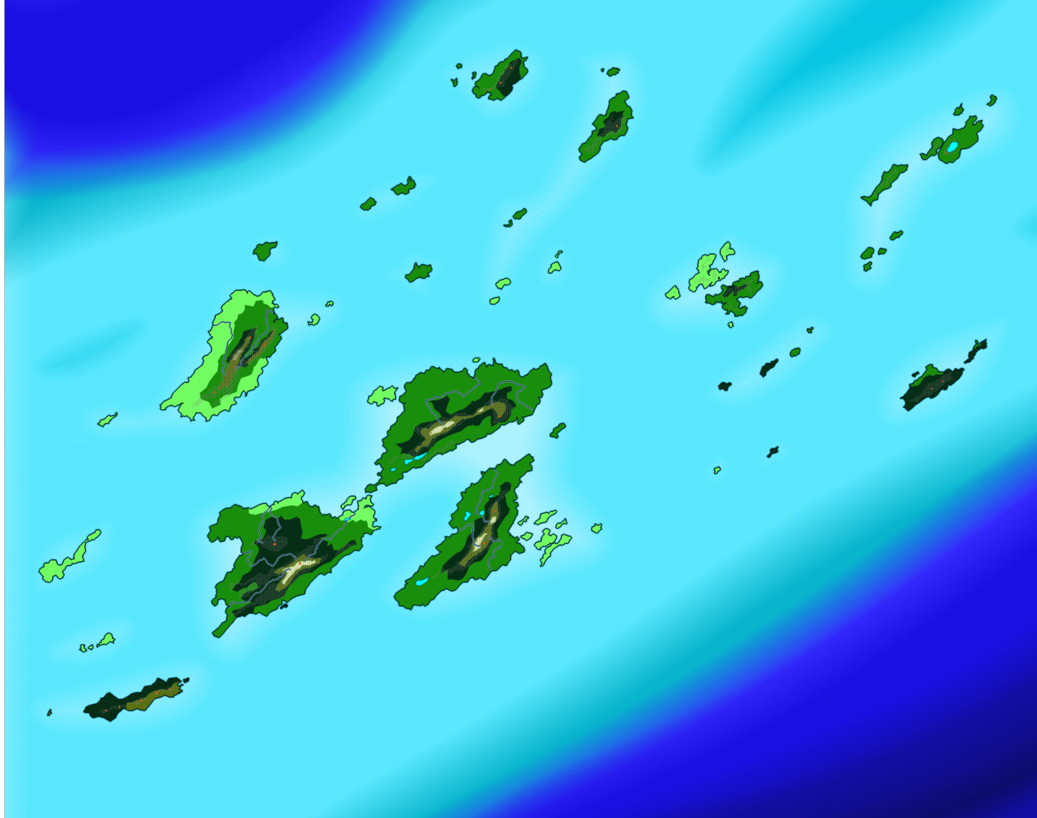
The raw map from my original Myrandios map. The Southern Archipelago, mainly occupied by Maratoaki (Maori) people


Comments
The map so far - much to be done, or course. Comments and advice VERY welcome.
I have also used Google Translate to make sure the names actually mean something. Here is the last map with the text in English
Fantastic !
welcome master Quenten
Very Nice Work.🤪
ka rawe!! = awesome in te reo Māori 😃
if you want that extra authentic touch, you could use macrons on the te reo words, like the ā in Māori - but I'm not sure if the font packages support it
you can probably guess that I live in Aoteoroa/New Zealand - Land of the Long White Cloud is a much cooler name than a rebrand of a part of the Netherlands!!
Yes, because I wanted it font neutral, I got rid of the macrons. Kia Ora (from an Aussie). And I agree about Aoteoroa being a far better, and also 'prettier' name