Mega Continent
 Dak
🖼️ 37 images Surveyor
Hello everybody,
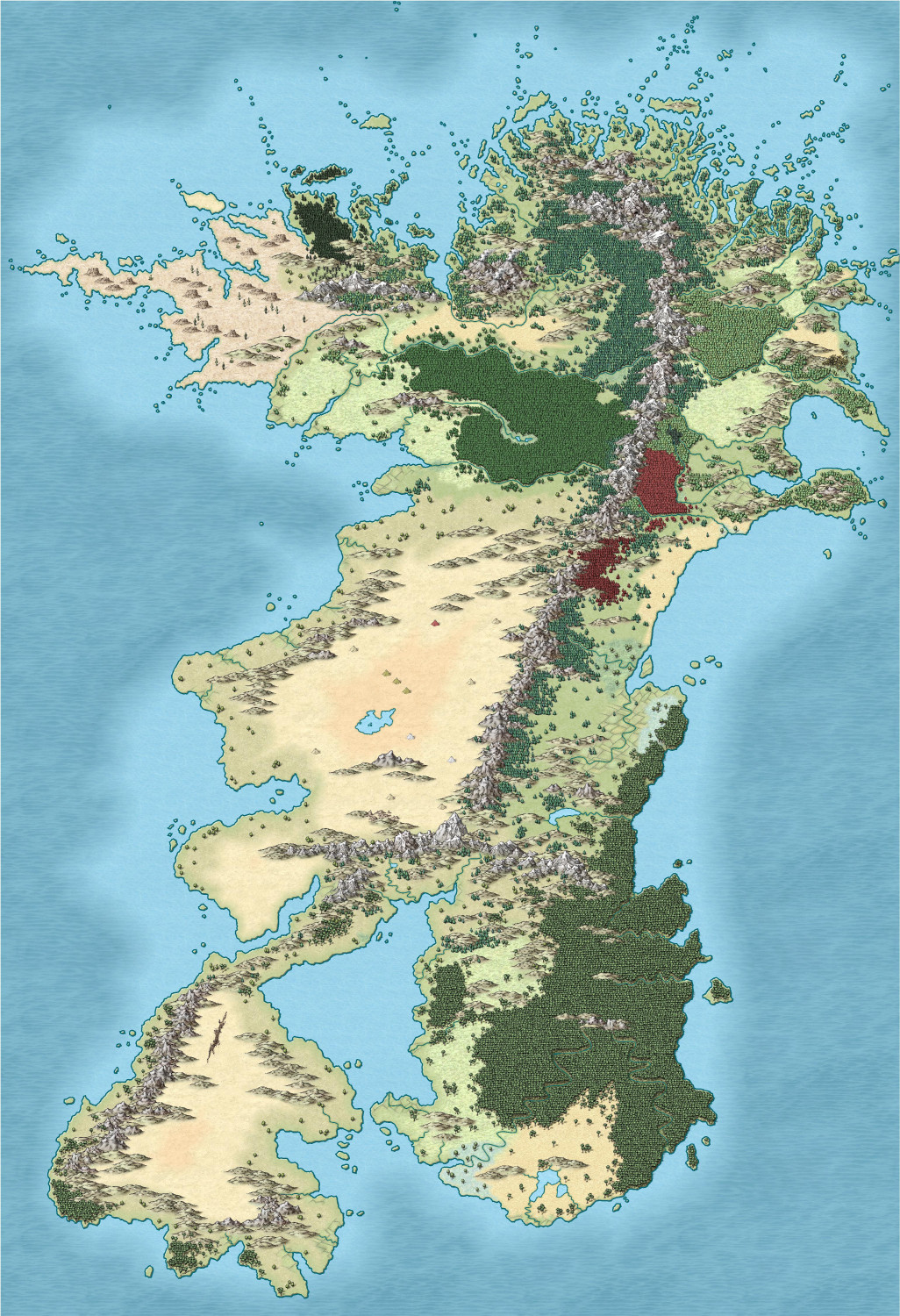
I've just finished these maps of my main D&D continent. I have run several campaigns in these lands.
The North is a medieval European based society although the terrain is more like North America.
The South is a medieval Arabian based society.
It's taken me long enough to do this map, I've been plugging away at it for over 4 years.
Dak.
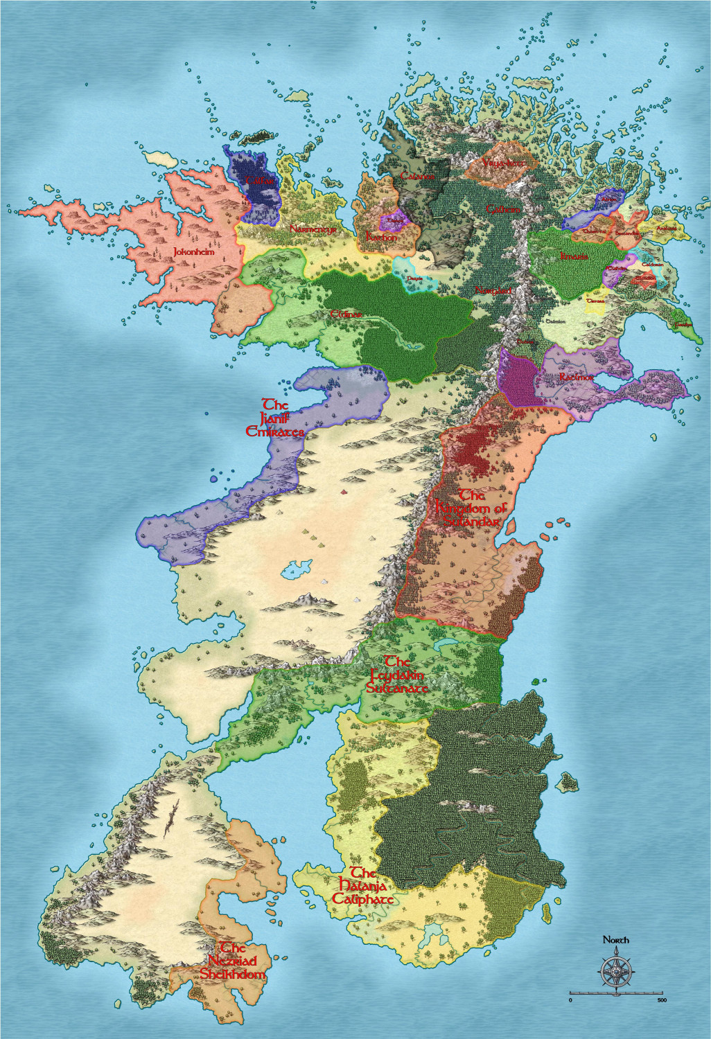
And here are the nations within the lands circa 1200's (human calendar) or 4000's (elvish calender).
Tagged:


Comments
Time well spent. It's beautiful :)
I do believe, and I mean this completely seriously, that this may well be one of the most beautiful pieces of Artwork that I have ever laid eyes upon. As a child I would look at the maps in my fantasy books and dream of my own stories that might happen there. Never did write them down though. Anyway, when I saw your map above, entire civilizations sprang forth in a flash fully formed, then burned to ash in an instant because I have the short term memory of a goldfish. So for that one brief moment of childlike bliss, and from the bottom of my heart, I thank you.
I really like the way you combined the compass rose with the scale bar - it looks very elegant that way, to me.
I need to rethink coastlines of my continent. Awesome work!
Hey @Dak If it's not too much work, could you make for us a mini tutorial sharing the techniques and workflow of the king of coastlines and isles 😎?
Cheers
OMG, Dak....so awesome! I could study this map for hours.
Beautiful!
Cal
An amazing map has a bit of a middle earth feeling to it when I first glanced at it. Not sure why I think that but it was my first impression. How does one do the kingdom borders like that? Is that a separate layer or just a copy of the map with that drawn on top?
@Frosty I got it from a vid from Joe Sweeney at his youtube channel https://www.youtube.com/watch?v=p2M8vLJEDk0&list=PLX_qe1x-2Ys6J8_rCaX0MLbeDKvSEDuxZ&index=12
I use this basic technique but I think I have my settings slightly different to Joe's. I use Edge Fade Inner with an Inner Opacity of 25% and an Outer Opacity of 75%. It's in Map Units and High Quality. The edge Width is 20 units but this is the number I change the most as it dictates the size of the darker border, and because this map covers a huge area this number is higher than from a map that focuses on a single country for example.
I have the borders on several sheets as whenever a border is against another border you don't get the line separating those borders if they are on the same sheet.
I also did a map making tutorial on my twitch channel https://www.twitch.tv/videos/1738843513?filter=all&sort=time but unfortunately the quality is not as good as it should be but if you can follow what I'm doing you should be able to replicate for your own maps. The borders info' starts at about 18-19 minutes in.
Dak
Thanks for all the great comments, and I am heavily influenced by Tolkien, and my world is inspired by his works. Someone read my world history once and laughed and said it's just like Tolkien (which they meant as a put down). It's very different to Tolkien, but I want the feel of it to be Tolkien so I took the put down as high praise indeed.
@Ricko Hasche I will try to do a vid soon showing how I go about doing coastlines and islands if that will be any help.
Dak