Freehand selections and Simple Create
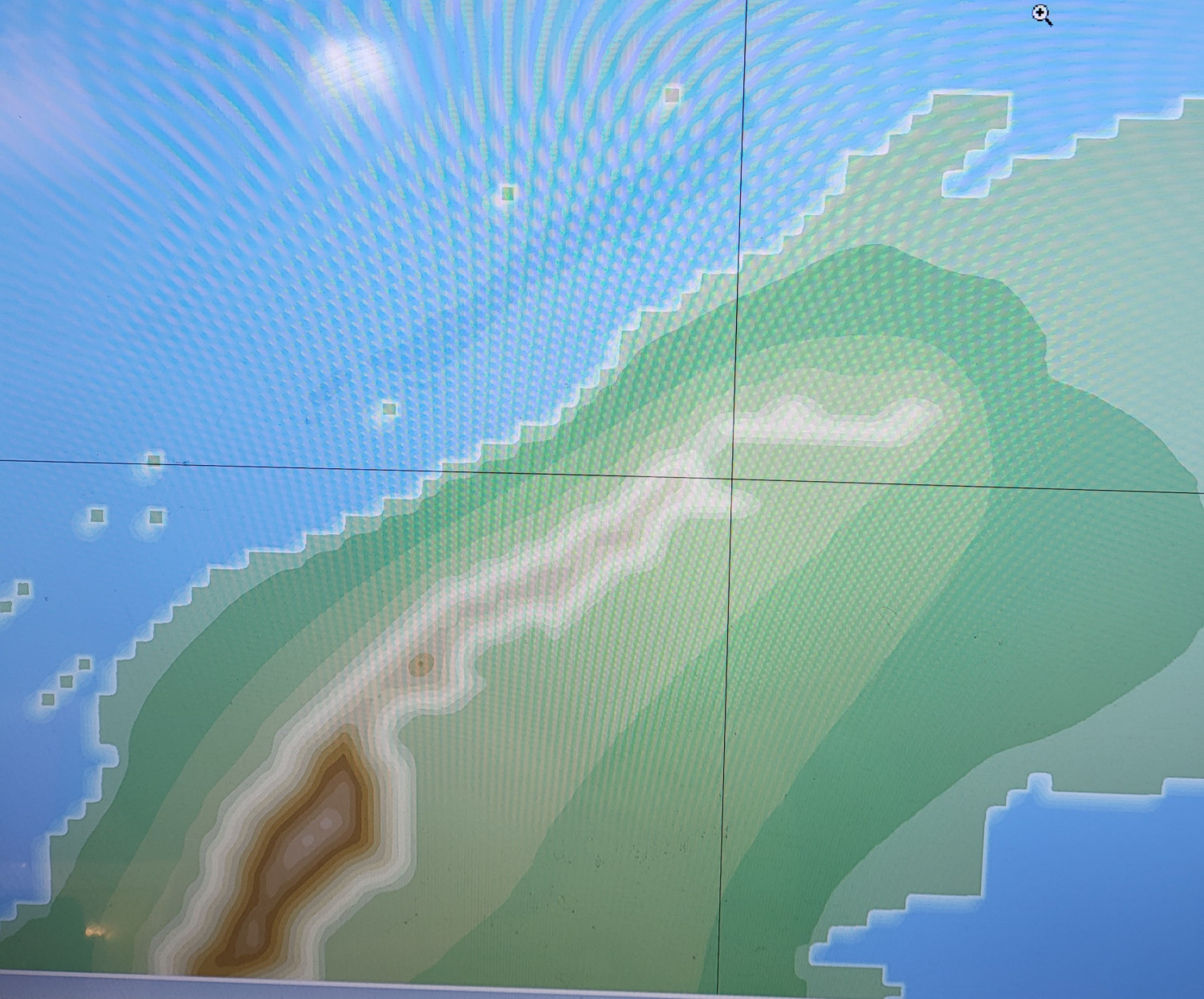
Working on a map in FT3+ I noticed that the size of freehand selections is very large (100-500Mbytes) and yet when a Simple Create is executed, the resulting continent looks very blocky on the coastline. Anything that can be done about this?


Comments
I was going to suggest using the resolution slider in the Quality Settings dialog found in the Simple Create Mode dialog, but it looks like that slider only goes up to 1024. Probably missed that one in the 64-bit translation.
There is another way, but it's ugly. You'll need to manually edit the FT3 config file and add a line.
The steps in 2 and 3 are very important just in case something goes wrong, like a cat running across your keyboard at just the wrong time.
Ok. Tried that, but it doesn't seem to make much difference. What's interesting to me is that the mountains don't show such blockiness, only the continents.
What resolution is your SimpleCreateLayer image overlay (Image Overlays>>Show Overlay Window)? The default is 1024x512, but the width of your image overlay should be at least the size that you'll be using for Simple Create mode, maybe a bit larger.
If you're using Simple Create mode for a whlie world, you should probably turn off continental shelves. The light blue band wandering through your terrain are likely an artifact of the original continental shelf edge.
Simple Create mode has a lot of limitations. Let's say that I've learned a lot since I originally implemented that feature and that some day I might get around to implementing a bit of that learning in a future version.
Resolution is 10000 x 5000
Hmmm... My quick experiments had suggested that if the resolution of the image overlay, editing data, and simple create were similar that these jagged edges would be greatly reduced. I'm not sure what is happening here.
Most of the blockiness seems to be outside the original selection area of the land masses. So I'll use Lower Prescale Land Offset paintbrushes to remove it by loading the selections and then using inverse.
Oddly enough, last night I re-ran the simple create with continental shelfs on. It was taking a while to run so I pressed cancel repeatedly. That unfortunately locked the program, so I just called it a night. This morning it had completed and had significantly less blockiness. Ignoramus that I am, I didn't save it in that state or save a jpeg of it. My conclusion was that since I had totally re-done the drawing of the simple create was why it worked. Unfortunately that is not the case: repeated runs continue to have the same blockiness. Nonethless, something changed it for the better, I just don't know what that was to repeat it.
It really needs a way to do different processing for the final result. The deterrace algorithm is hideously slow and yields questionable results in many cases.
What I'm trying to do is make a better map for the old rpg Jorune. My attempt about a year ago stopped without much erosion.
This was FT3, not 3.5. And there are a lot more islands now. I tried taking my FT3.5 map through Israh, but it ultimately failed at the import into Wilbur. This was due to persistent recurring voids at the outer edge of the map and a rectangular one consisting of lower left 3x2 grid section. Renormalization would make the 3x2 section into a shallow ocean, not abyssal plain, but the edge remained. I tried a height clip in Wilbur, but that didn't work.
I have kind of a hobby of making better maps for old rpgs that had kind of crude hand drawn maps: http://powersandperils.org/lands/world.htm
I've been trying to use FT3/FT3+ to update Perilous Lands and Jorune to FT3 height maps using simple create, but it's been a somewhat tough road so far.
But definitely lots of fun.
Has there been any progress toward fixing the blockiness issue with Simple Create?
There has been no work on that feature in the last year, sorry. Programming resources are very limited and currently directed at other projects.