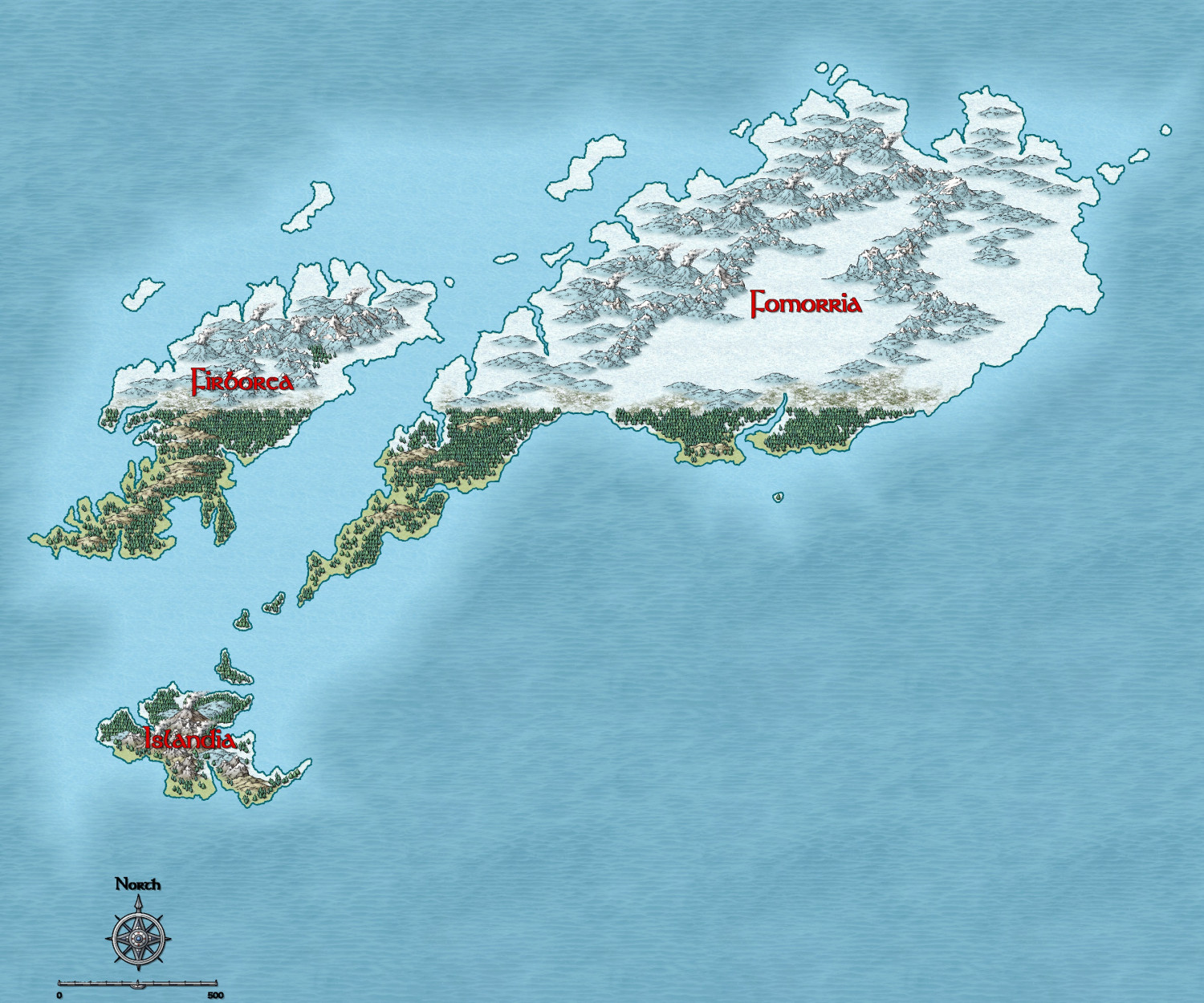
Frozen arctic lands
 Dak
🖼️ 37 images Surveyor
Here is another continent sized map for my game world depicting the Northern frozen lands of Giants and the Northmen.
The previous continent map of the Akaga Shogunate I posted lies just below Fomorria along the right hand side
Any suggestions for improvement are as usual welcomed.
Tagged:


Comments
It looks really good, though I would try to make the dividing line between temperate and arctic a little less defined and perfectly horizontal.
In the real world, that line is broad area of transition that can be bent further north or south than usual by warmer or colder ocean currents, prevailing winds and mountain ranges. It's a whole lot more irregular than you might expect. The UK, for example, should be as freezing cold as Labrador, but we bathe in the warmth of the Gulf Stream bringing heat up from the Gulf of Mexico.
Hi Sue,
I know exactly what you mean. I was going for the tree line beyond which they won't grow and did use a straight line on the rivers sheet to guide me. If I took the trees away it may be clearer that the arctic and temperate lands are not quite in a straight line but it is subtle. I could have done with the placing the guide line either a little north or south of where I did.
I do like the forests though, and I hate deleting things that took so long to do.
I think this is still a WIP, as I have another map where I altered the southern island to be more temperate, but I think it may look better if I keep the islands as they are but extend the arctic regions of Fomoria to cover the entire land.
Not sure if either of these are any better as the tree line still stands out.
There are trees beyond the line in Firborea, but there is a magical reason for this and I've been toying with the idea of making them deciduous.
It may look better if I extend some of the trees north slightly just to break that line up.
Maybe if you thin them out as they get closer to the snow line so you end up with a sort of edge fade, but done in tree symbols?
On the treeline problem, you might also try swapping-in some of the scrub or even swamp trees from the Mike Schley catalogue, and make use of some of the bare deciduous trees too. At this scale, you'll hardly be able to tell the difference in tree types, and it'll make the trees look less connected. The swamp trees have "water lines" that on the snowfield should make it look as if they're growing through the snow a little, albeit they may be too small to really tell that as well here.
With the trees beyond the line in Firborea, it probably depends how extensive these are as to whether they'd be practical to add. Each tree symbol covers an area roughly 20-25 units across, judging by the map scale, which is something to consider at least. If they're smaller than this, but important, perhaps some individual trees set just as markers would work?
some geizers near mountains. frost giants need spa time from time to time XD
Ah, now I remember what I was curious about. I don't see any tundra between the trees and the ice.
Greets, fellow Artists,
I'd either open up the thick fill below the 'line' or scatter trees out northwards from the line. Lookin good, though!
Cal
I think Jim's comments about the tundra are very important. As one goes closer to the poles, the Taiga thins out, becomes tundra with scattered smaller vegetation, gradually becoming the Dreaded Plains of Icy Death of the White Witch of Narnia.