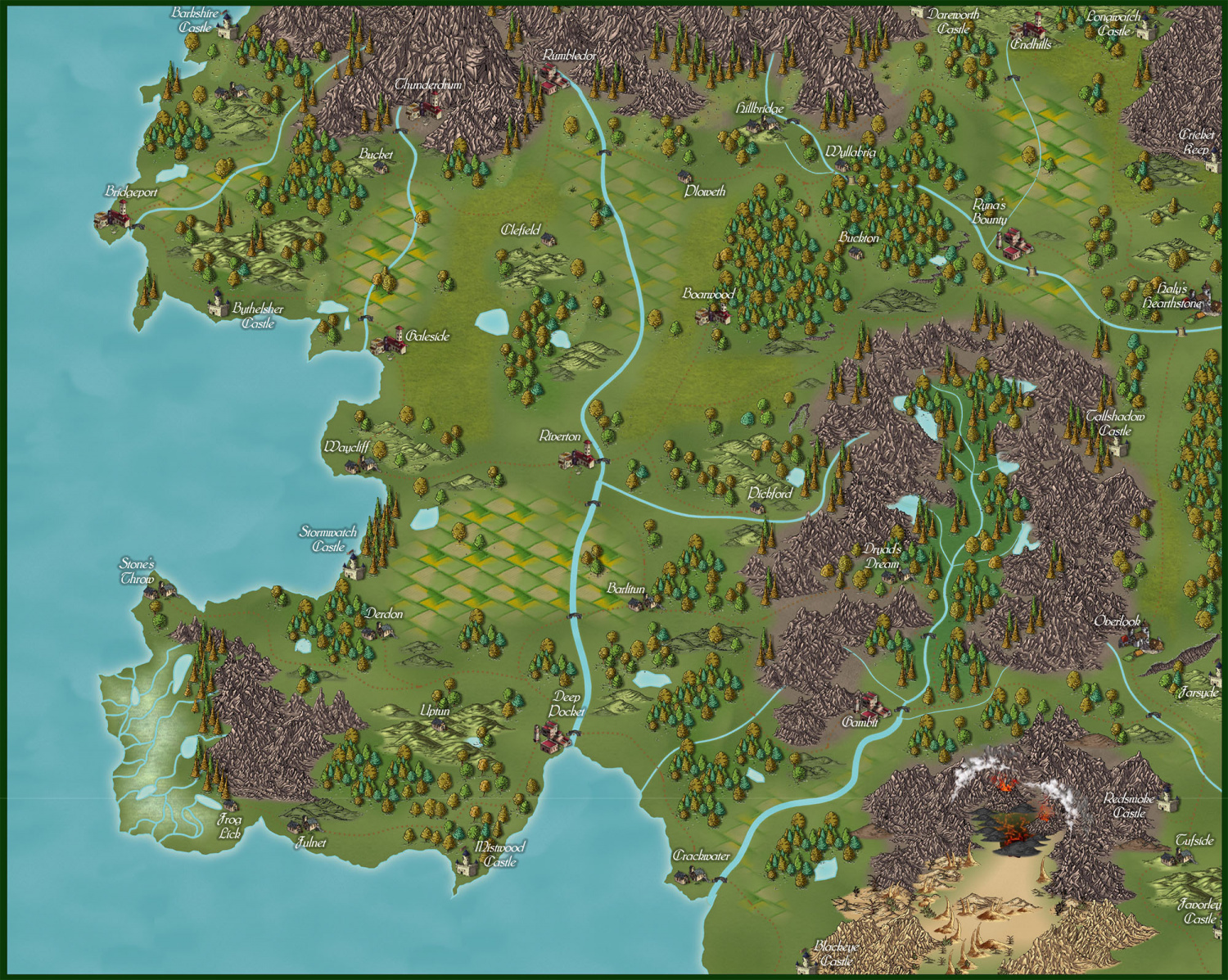
New Overland Map with Alyssa Faden & Friends
 Kathleen Ann Cox
Surveyor
I have been looking and lurking at the maps in the Show and Tell section and all I can say is I am amazed and humbled. I tried for three days to do an Ancient Realms map modeled after the one Loopysue did for Jerry and I while I did not get much of a map, I gained a lot of respect for the amazing skill of the experts on here.
I keep promising myself I am going to buckle down and actually go through all the guides and tutorials and learn how to work in the program instead of cobbling maps together and faking it most of the time. Patience is a virtue, but alas, virtue has never been one of my strengths.
I have been diddling around with maps for a decade and today I just learned from Ralf on a video about copying and pasting effects from one sheet to another. It seemed really OBVIOUS after I heard him say it. That node editing feature is pretty nifty too. (Thank you Loopysue for pointing me to the videos.) I can't even imagine how much frustration I could have avoided if only I took the time to check out the instructions and directions before diving in when I first bought the software.
I gave up on an Ancient Realms map (for the time being at least) and put this one together using Alyssa Faden's style and borrowing a few bitmaps and symbols from others.


Comments
Very nice. It does look a bit odd that almost none of your lakes have rivers feeding them though, makes them look a bit random.
Yeah, I usually always connected them to rivers but then I read something about lakes forming from depressions too (retreating ice?), so I felt freed from the lake-river codependent relationship and I went a little crazy with just adding them. If one isolated lake not connected to a river is good then forty of them must be great ... right?
No?
It's a lovely map :)
I had a lake problem when I did Jerry's map of Michigami. There were a lot of very tiny lakes that would have been like a rash of dots and rather messy on the final map because of the scale. They weren't fed or feeding any obvious rivers either, so I didn't put them in. Instead I designated those areas as marsh or bog.
The assumption is that isolated lakes are low points where the ground water has seeped to the surface as it would in a well, or fed by runoff from the surrounding area that is insufficient to form rivers into, or out of the lake. Crater lakes and oases are examples.
It's really up to you how many of these lakes you have in a map :)
Here is a quick revision of the map implementing Remy's suggestion. I am not sure if I like the shapes of my lakes or how they are connecting to rivers. I made several changes and the map now needs to be cleaned up and tweaked (bridges added, fixing end points to look right, missed town names, etc.)
Thanks to everyone for the comments. My job was eliminated in September due to the Covid19 situation and mapping has become one of my isolation tools to stay occupied and keep my sanity.
Sorry about your job. Hope this situation normalizes soon so people can get back to their jobs, or at least have an easier time finding a new one when not everyone is trying to hunt in the same limited pool.
At least the time isn't wasted when you spend it mapping :)
Thes lakes were perhaps a bit too large, given the scale of the map, but they could easily just be farm dams. Being a mildly arid country, we have them all over the place in our rural areas.
Great map! I think you might have overdone it a little with the rivers connecting the independent lakes. Maybe a cross between the first map and the second?
And sorry to hear about your circumstances. I can relate. In the south of the States it's.... well, it ain't great right now. Mapping, my cat, and Charlie Parker are pretty much the only things keeping me from losing it. Here's hoping the vaccines drop sooner than said.
-simianorganism