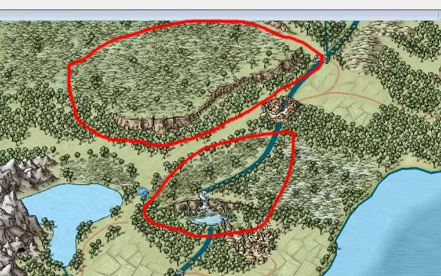
How do you create elevation in maps (not just add mountains)?
I ran across the map. It looks like the Mike Schley style. However, there is an elevated plateau area. There is also another area with a waterfall. I did some searchs on the internet and couldn't find anything.
Is this a technique you can do, or is it done with symbols? I did not see anything in the Schley style symbols, so if it not those, does anyone know where to get these symbols from?


Comments
They are all Schley symbols in the Natural Features catalogue
Hmm wasn't showing, but when I opened the folder I found them. Thx.
You can get to it much easier by clicking the Natural Features button on the top bar. That way you open the catalogue rather than using the raw png images. The catalogue will contain any random collections and varicolour versions, which won't be usable directly from the folder.
It did not show up in the Natural Features when I clicked the button. Reloading from opening the folder showed me and then it started to show up in Natural Features.
I was trying to make sure that you opened the .FSC file, rather than loading directly from the folder. If you have varicolour symbols available to you and random collections then you got the .FSC and all is well.