FT3 to CC3 export
I have both FT3 and CC3, but when I try to export a world from FT3 to CC3, I am stuck with climate/contour etc.... How can I export the exact image on my FT3 screen to CC3? I can't find an export setting that gives me that exact image.
Best Answer
-
 Loopysue
ProFantasy 🖼️ 41 images Cartographer
This comes up a lot when people first use FT3 to generate maps for CC3.
The thing you see in FT3 is a heightmap with a smooth transition between all the thousands of individual data points describing your world.
CC3 cannot yet express heightmaps as anything other than a bitmap image exported from FT3 and imported as that same a bitmap to CC3. Here are two example extracts of CC3 maps generated in FT3 and processed in two different ways, taken from the 2019 Cartographer's Annual November issue (CA155).
https://www.profantasy.com/annual/2019/2019-cartographers-annual.html#November
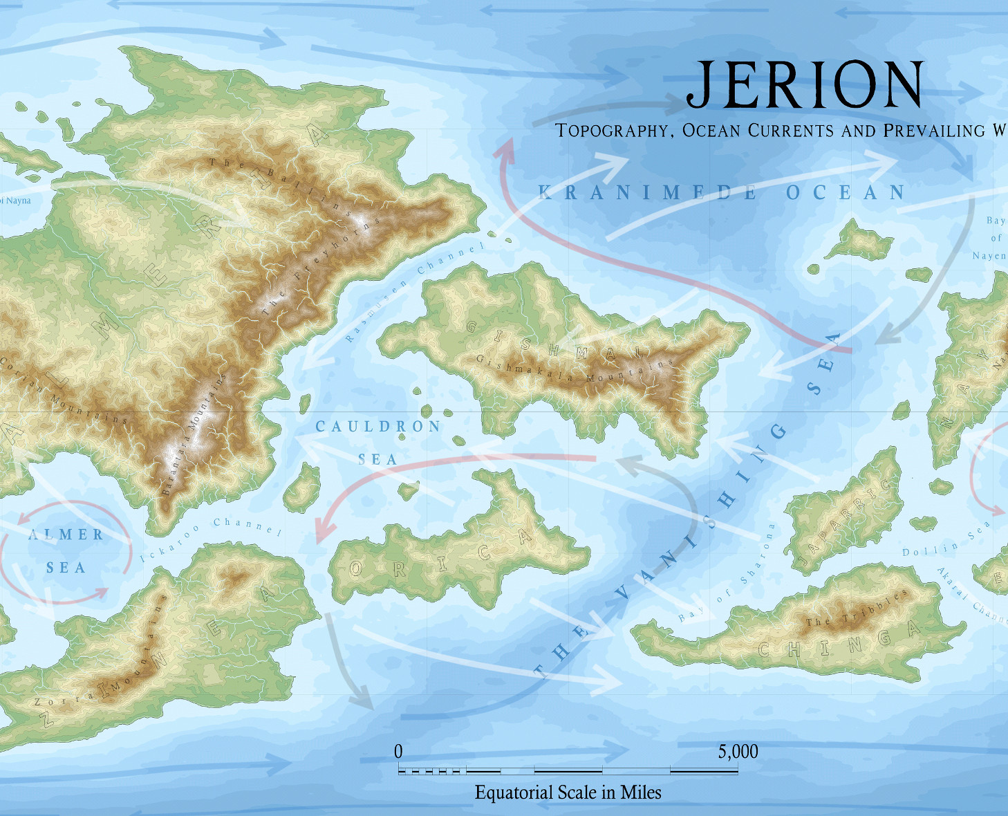
This first one is a contour map.
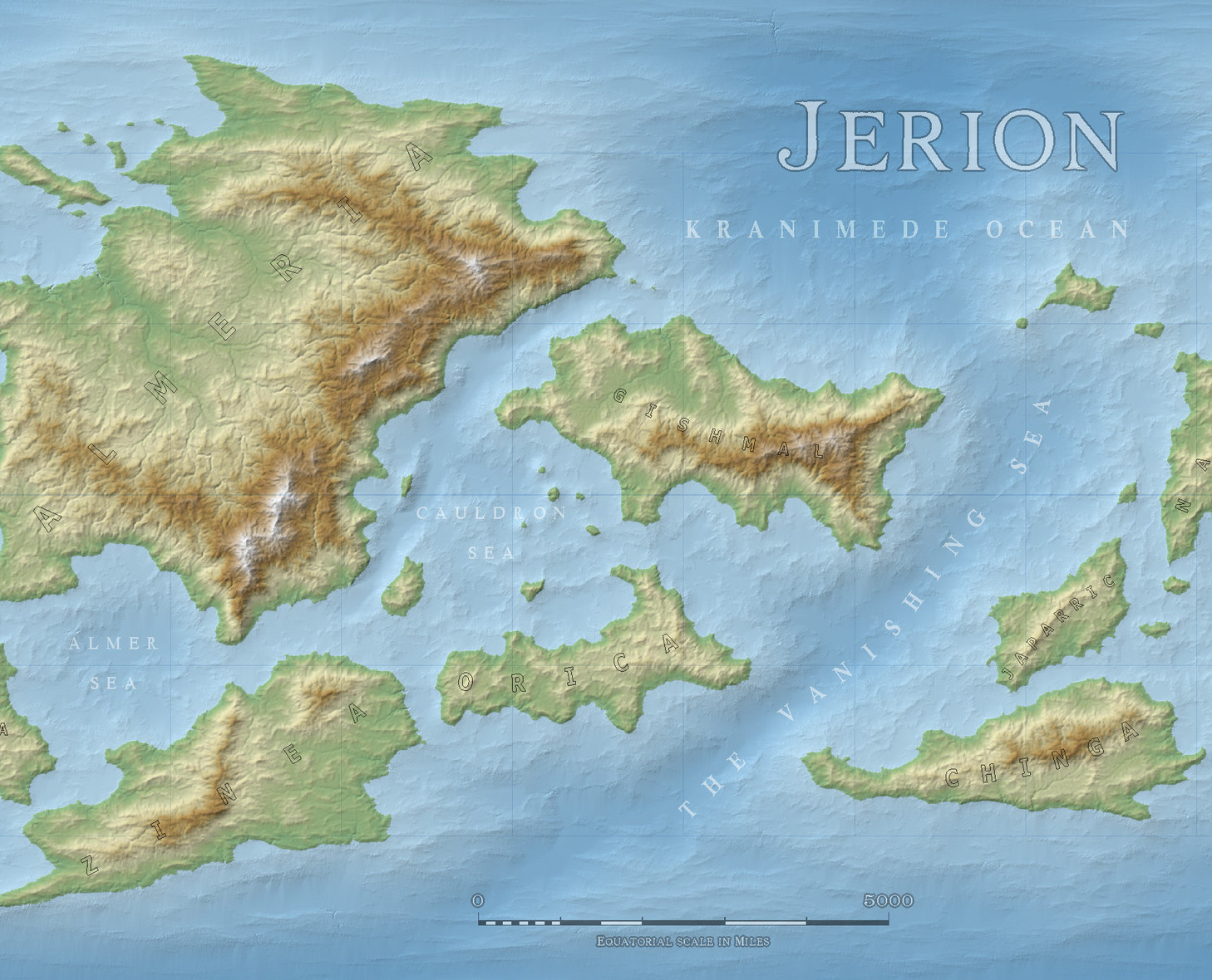
While this second one is the same extract using a bitmap background.
Both these maps have been taken through a step by step erosion process described in the above mentioned annual using a free app called Wilbur, which you can download and install here...
...and have colour schemes provided in the annual.
So to summarise there are 2 ways of getting a similar result to that seen in FT3. The first example is done by contours and self contained, and the second example is a bitmap image background that requires you to keep the bitmap in the same folder as the CC3 map that uses it.


Answers
This comes up a lot when people first use FT3 to generate maps for CC3.
The thing you see in FT3 is a heightmap with a smooth transition between all the thousands of individual data points describing your world.
CC3 cannot yet express heightmaps as anything other than a bitmap image exported from FT3 and imported as that same a bitmap to CC3. Here are two example extracts of CC3 maps generated in FT3 and processed in two different ways, taken from the 2019 Cartographer's Annual November issue (CA155).
https://www.profantasy.com/annual/2019/2019-cartographers-annual.html#November
This first one is a contour map.
While this second one is the same extract using a bitmap background.
Both these maps have been taken through a step by step erosion process described in the above mentioned annual using a free app called Wilbur, which you can download and install here...
...and have colour schemes provided in the annual.
So to summarise there are 2 ways of getting a similar result to that seen in FT3. The first example is done by contours and self contained, and the second example is a bitmap image background that requires you to keep the bitmap in the same folder as the CC3 map that uses it.
Thank you :-)
You're welcome :)
What I described is only a very general summary. Both these processes are described in the annual in far greater detail as two separate 20+ page illustrated mapping guides.
I'm in a bit of a hurry (game tonight), so I saved a HUUUUUUUUUUUUUUGE bmp for now and it works like a charm. When I have more time, I'll check out the other method as well. Thank you so so much :-) :-)