Gettysburg
 mike robel
🖼️ 15 images Surveyor
I am in a pause of sorts on my Covering Force Game plus Andre made some awesome palettes of 32 and 48 brown/green colors as well as two that start brown and transition to green or start green and transition to brown that I am itching to try.
After Covering Force will be a game based on Hammer's Slammers (If I ever finish CF. While I was hoping for a (2020) Christmas release, I will now just say a Christmas release and you all can guess which one, if you care to.) and I want to set it in places of historical interest (even though it occurs in the 23rd or 24th Century on different planets). One will be at the Little Bighorn and I decide another would be Gettysburg.
This is a much smaller map, only 2 1:24000 map sheets versus the 12 or so for the Little Bighorn (cause I cover the approaches) or the 9 or so 1:50000 sheets for Covering Force.
The challenge here is the 20 foot contour interval (which is why I needed the large green/brown palettes), my hand-eye coordination, and my color blindness which makes distinguishing fine color graduations difficult. Some of the contours are extremely close together. Unlike German maps, the US maps of the area do not have spot elevations and they follow the normal practice of only listing the height every fifth contour, so following intermediate contours off the map is very challenging. Therefore, instead of building the map from lower to higher, I am going the the other way, which is slower.
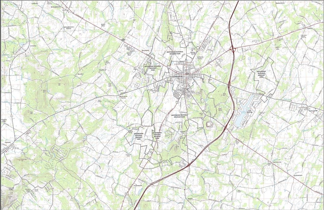
Anyway, here is the untouched Gettysburg map (made in 2016). They map is going to be 44 inches x 64 inches in size (yes, I size the map to the physical map I wish to produce), so there is a lack of detail. The grid squares are 1000m on each side.
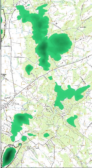
And this is the map thus far. I started at the 1160 elevation on the left, then worked down to 700. Before I move to far to the 600 level, I want to complete the contours on the left side of the map, which is the next step. The Black line marks the boundary of the 700 line and I need to finish filling in to the left side of the map and the bottom left hill.
Next shows a little closer view of the left side of the map. I really like the color interplay, but it is probably too fine for easy wargaming. It may be just too bad. Hahahaha.
and then close ups of the interesting terrain features thus far.


Comments
I went to that battlefield last century.
I've been to the battlefield twice. Once in about 1980 for a quick look and once last year where I spent 12 hours just walking Buford's masterfull covering force battle on the 1st day, and then a quick dash to 20th Maine's stubborn defense of Little Round Top and then for a quick look at Pickett's charge (which thoroughly depressed me at the lack of tactical craftsmanship of it). I have to go back for another look at
Pickett's chargeBuford's action.I've never been to Gettysburg. When I was in Boy Scouts (back in the late '70s and early '80s) our troop went to Shiloh every year.
My trip was in the early 1970s. We mostly went up on the ridge. Part of a Scout trip. Some of us opted for the 'battle in the round' experience, but I couldn't afford it. It was inside a building. The battle was painted on the walls, and the walls lit up with each change the 'experience' talked about. I was out of the Navy for less than 5 years at the time. I know I took photos, but I haven't seen them in decades. Probably lost in a move.
Oh, and we went to Shiloh for the hikes. I have those patches somewhere. By about 1980 I was no longer in Scouts. Wanted to hike on my own.
I just finished with all 41 contour levels, ranging from 360 feet to 1180 feet at 20 foot intervals. I like the way this looks, but the contour shades are probably too subtle for me, so I may outline the levels in some brown shade to enable people to see them when printed out. When printed, it will be on a 4 x 4 grid of 11 x 17 (or 12 x 18 or 13 x 19) inch paper with 7/8 inch hexes represent about 300 meters using 5/8 inch counters.
The close up shows the area around the Little and Big Round Top, for those who don't care, where the 20th Maine Regiment stopped the Confederate Army's attack on the Union left, but a lesser known battle on the Union Right went on through the night.
Rivers and Lakes are next. Followed by Roads.
Thanks to @WeathermanSweden for the custom Palettes (again!)
Now with rivers/streams and lakes...I think they give the terrain better form.
Now, the dang questions are:
Sometimes, I am just not the sharpest knife in the drawer...
Like this?
And yes, if it is vector symbol, you should eb able to clone and edit it.
Well. Yes. But even here, the pattern is inconsistent. Is that just the best I can hope for given the line configuration?
Although I like it better than using different colored lines.
Turn off the Scale to fit ends, should make it a bit better
Now, the big advantage with your newest map and your new colouring method is that you can change it from spring to autumn by just changing the colour palette.
Did you @mike robel already give it a try? I am rather curious about seeing that version of the map too...?
@WeathermanSweden I wanted to get a little further along in the process before I try that. ?
Actually, that's how I got to the version that I posted. I can live with this though. I think, for no good reason, the exhibited behavior depends on the distance between clicks and the curvature of the line, as well as magnification. Long straight lines show the three dot's and if one zooms in and out, the pattern changes.
It shouldn't change with zoom unless you enable paper scale (unless you zoom far enough out that there aren't enough pixels on your screen to represent it properly). CC3+ isn't perfect at handling the patterns in curves though.
@WeathermanSweden And Here it is in Brown.
@WeathermanSweden and then with the Green to Brown. Looks funky of course because that one used 32 color steps, but it works fine. ?
I'll play with it some more.
In the meantime, I opened symbol manager, found CA42 Swamp 4 x 2, which is Blue. Cloned it. Highlighted it. Selected Edit, drew a new window for the symbol and it appeared. Clicked the Green color on the color bar (#2), then clicked on the Change Properties Button, selected the symbol, right-clicked, selected Do It, enabled the checkbox to the color to turn the Swamp Symbol from Blue to Green, clicked OK, and the map displayed hideous shades of purple and the edited symbol does not show up in the Display showing the drawing tools.
No idea about the purple, the map shouldn't change colors just because you make a copy of a symbol and modify it, that wouldn't affect the map at all.
As for drawing tools, they are not automatically created. You will never see a new drawing tool just because you added a symbol or imported a new fill. If you want a new drawing tool, you need to make it, usually by creating a clone of a similar tool and modify it.
As for that tool in particular, the drawing tool doesn't use the swamp symbol, that is just for manual placement. The drawing tool is instead based on a hatch style. These are basically CC3+ drawings defining a pattern to use as a fill. These are found as CC3+ drawing in @Hatch Styles. You can just clone the existing files in here and then edit them. But as mentioned before, a new drawing tool doesn't get created automatically, you still need to create a new tool to use your new hatch style.
@mike robel The purple belongs to the "non existing" 16 colours that the 32 colour scheme not make use of. Both the brown and the green palette schemes use 48 colours, but the brown-green scheme does only use 32. I have now sent you a 48 colour version of that scheme in a PM. That should work and replace the purple area with dark brown colours.
I obviously used the wrong terminology and my description was wrong. Or maybe not and I don't understand your answer. I wanted to use this 'symbol' and turn it green.
You are saying it is really only used as part of this?
If, so why CA 42 Swamp 1 different than CA 42 City Large?
Understand. I was pretty sure that was the reason. I just wanted to show that the blended one worked as well. Thanks for the updated version!
@mike robel wrote:
You are saying it is really only used as part of this?
No, the exact opposite. That symbol is NOT used in that drawing tool at all, the hatch style is.
In your previous post, you commented that your new symbol didn't show up in the drawing tool list. I was explaining why it didn't (because drawing tools aren't created automatically for new symbols)
OK
Hey @WeathermanSweden Here it is with the green to brown transition in 48 colors. This looks like dynamite!