

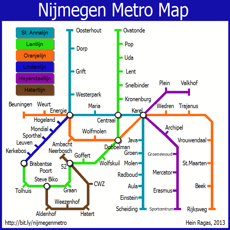
Map of the metro lines of the city where I live

As an excercise, I wanted to create a map in the abstract subway style of Annual Issue 41. Instead of creating a fantasy city, I decided to plan out the metro lines of the city where I live, taking into account the roads, where people live, where they work and where they go to play. I started out with an actual map of the city (copied over from Google Maps) and drew the lines on top of that. Then I looked at the layout of the lines in reality and abstracted that into a square map.
The 'real world' map and a huge explanation on what choices I made can be found on my personal blog. Attached is the abstract(ed) end result map.
The 'real world' map and a huge explanation on what choices I made can be found on my personal blog. Attached is the abstract(ed) end result map.
Comments
Also like the explenation you did in your blog.
And being dutch myself I recognize a few of the names you used, that also fun.
Cheers,
~Dogtag