

Extracting from Fractal Terrains 3 to Campaign Cartographer 3 issues

Hello, I have extracted a map make in FT3 to CC3 and it lost so much detail, what am I missing? I am using the Jon Roberts version to extract.
This is side by side.
Hello, I have extracted a map make in FT3 to CC3 and it lost so much detail, what am I missing? I am using the Jon Roberts version to extract.
This is side by side.
Comments
I have a detailed map in FT3 as well:
This is the 'default' export I get from it using the JR setting:
But if I pick the setting and hit the Edit instead of Create and Next my way to the third dialog I can change the level of detail of the output. My 'default' is Fine (only because I set it at Fine many years ago).
If I slide that right down to Coarse and hit Next again, then Finish, and Create the map, I get this result:
So if you want to reverse that just head for that third dialog after Edit and move the slider up.
There is only one caveat to setting it on Fine. If you have it set on Fine and your world is extremely detailed you may find the resulting CC3 file is unweildy, in that it may have too many nodes and will start to get sluggish as you add more and more terrain to it. The slider in that third dialog was put there to allow the user to reduce the detail if it became a problem.
Mine is set to Fine, this is just a smaller island on the whole map that loses its detail. This is the full map with the island marked.
Ah yes, that will happen if the whole world has been exported. If you had exported it at a lower resolution the detail would be even less when zoomed in that far.
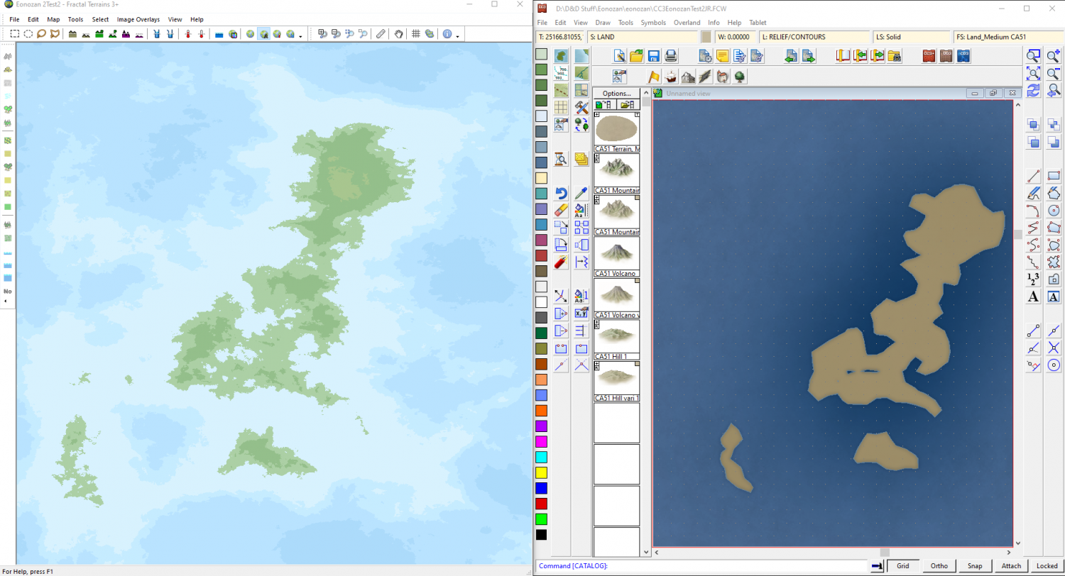
Here is a small group of islands on my FT world
And here is the same group of islands on the CC3 map I exported yesterday (when I exported the entire world at Fine resolution).
This level of detail is fine for the world map, where an excess of detail on every inch of coast would only serve to make the map incredibly slow in CC3, and would be completely unnecessary for the world map in any case, with most of the detail being wasted on our comparitively weak human eyes.
If you want a detailed map of the islands zoom in to the FT map and export again to create a regional map of that area using the same Fine resolution.
This is the result of exporting just those 3 islands from the FT map while I was zoomed in to them.