

Having trouble with settings

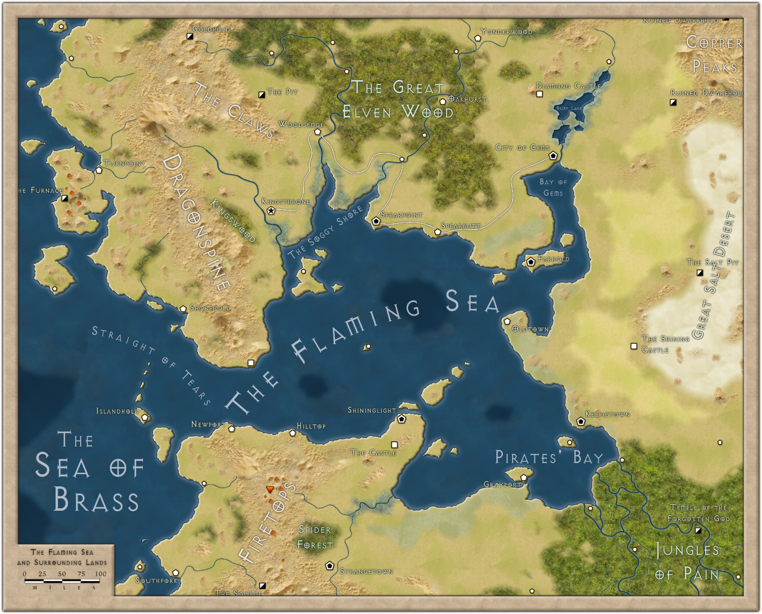
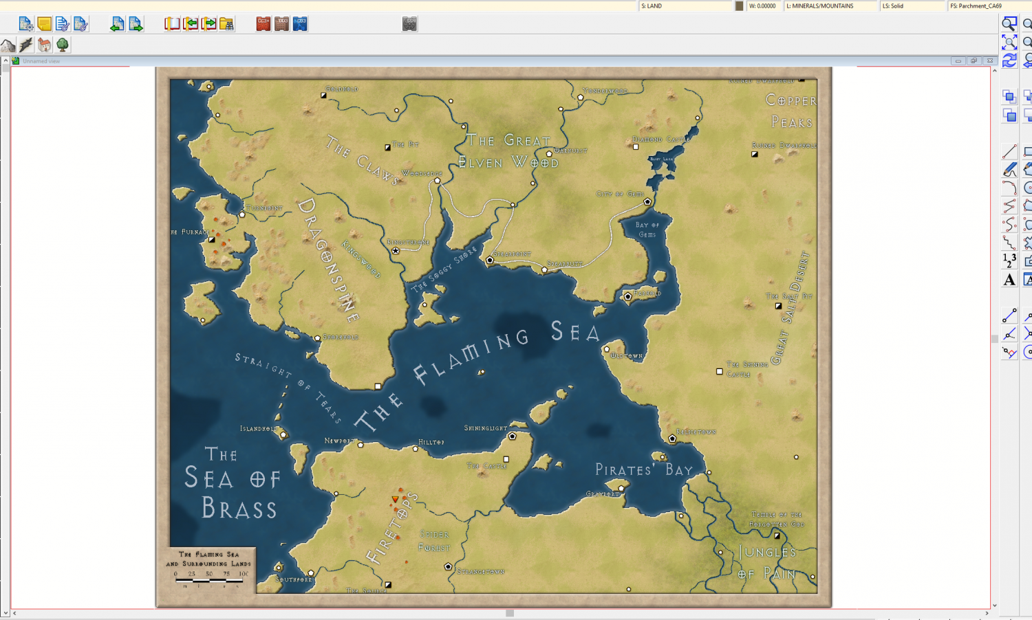
Several annual maps such as 13th Overland and Satellite View refuse to render the same look on my computer when sheets are enabled as the supplied PNG of the same map. I'll attach a screen of both to show what I'm talking about, one of the PNG and the other a screen grab of the example map itself loaded into cc3+ with all the sheets enabled.
I've tried to tinker with settings from within the example map but nothing seems to work, plus the sheet effects parameters are distinctly different than any of the older, dated tutorials I've seen on the subject. Any advice or thoughts would be much appreciated:)
Edit: after publishing the question I realized that the pictures weren't attached correctly. The one on top is the PNG of the supplied annual map and the way it's supposed to look. The second (bottom) picture is the way the map actually looks inside my version of cc3+
Best Answer
-
 Loopysue
ProFantasy 🖼️ 39 images Cartographer
Loopysue
ProFantasy 🖼️ 39 images Cartographer
You have to click Apply to see the result.
And yes - most of the terrain sheets have the same issue.
The difference between those two settings is that the Percent of View Width is really huge at '10'. That's 10% of the width of your window. If you set 10 map units thats just 10 miles rather than possibly a few thousand miles.

Answers
Yes, I found that when I opened the same map a couple of years ago. I think it is the sheet effects. Things like the Edge Fade, Inners seem to be set far too wide for some reason.
Ok, that's a relief. Thank you. Thought something might be wrong with my program. All the documentation I can find on sheet effects are pretty outdated and don't cover the current options very well, is there some explanation in a PDF or video somewhere that I can look at regarding them?
All I did was change the units from Percent of View Width to Map Units. You have to do quite a few, but it's relatively easy to put everything right.
Hmm, I just tried that, went to "Terrain/Grassland" and switched the settings to follow along with the picture example of yours and nothing changed
Edit: that's the missing ingredient? Switch all effects to "Map Units?" I'm not even sure what the differences are between those choices.
You have to click Apply to see the result.
And yes - most of the terrain sheets have the same issue.
The difference between those two settings is that the Percent of View Width is really huge at '10'. That's 10% of the width of your window. If you set 10 map units thats just 10 miles rather than possibly a few thousand miles.
Perfect, thank you. I went through the map and switched everything over and it worked. Looks beautiful now!
You're welcome :)
It's a beautiful style with a lot of fans.