

[WIP] Using Watabou as a basis for a mediaeval fortress town, using the 1930s Street Map Annual
 Mythal82
🖼️ 19 images Traveler
Mythal82
🖼️ 19 images Traveler
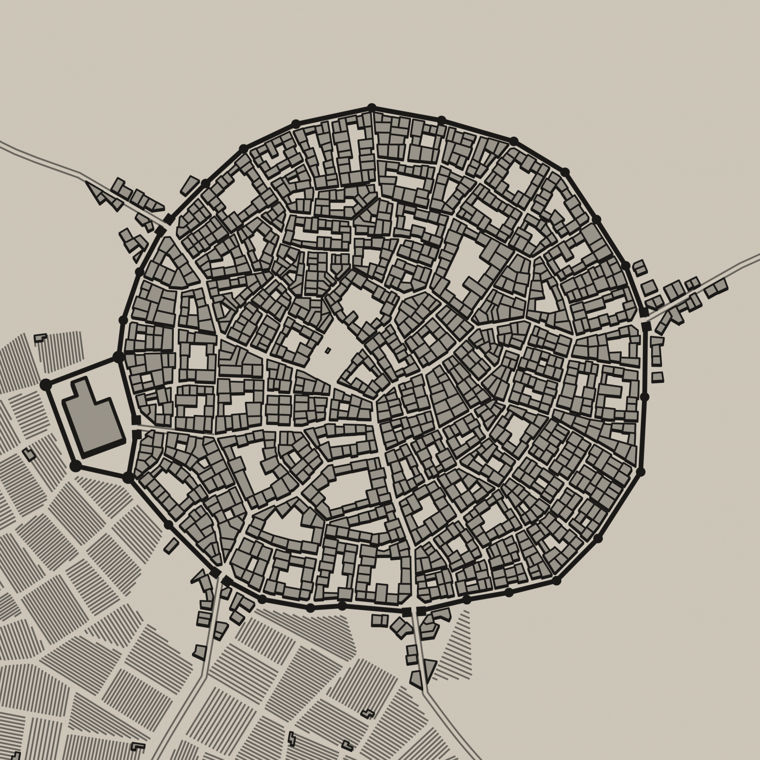
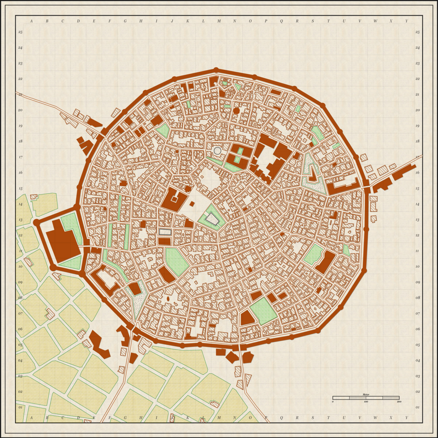
I really enjoyed the Annual issue which explored how to paint over Watabou-generated cities while keeping the general aesthetic of the maps it creates (which are fab), but I’ve always wanted to try my hand at giving one of them more of a holistic makeover. After going back and forth over the best way to do it, and repeated false starts using more detailed Annual templates as a base, I decided that possibly a less-is-more approach was warranted, and made a concerted effort using the 1930s Street Map annual style.
The mapping is mostly finished at this point - I’m now working through the process of identifying the important buildings and swapping them from hatched to solid. It was a bit of a labour of love, but the flexibility of the 1930s Street Map Annual Style, when it came to a Watabou-generated base, was that it bypassed the most frustrating problem I’d found (which was “how to make the building positions and shapes feel natural, or at least not jarringly unbelievable, with so many acute angles on the blocks”); I simply drew buildings of abnormal shape, rather than trying to justify those shapes with extensions and dormer windows.
Would love feedback on the result - does it feel “believable”? Does the aesthetic work? I’ve had to use hatch textures from other annuals for grassland, graveyards and farmland, as the Annual (understandably) doesn’t have those as standard options, and if anyone has better suggestions for these I’m all ears (since they do contrast quite a bit with the Annual’s standard hatching).
I’ve included both the original Watabou-generated base, and my map’s current iteration.


![[Deleted User]](https://secure.gravatar.com/avatar/c75d9a245b74d9c59be0999ea81ca541/?default=https%3A%2F%2Fvanillicon.com%2F92add7f8c954488718110edc4896ad39_200.png&rating=g&size=200)


Comments
Looks both great and believable to me.
The Reddish - brown should provide a good contrast, if / when map annotations are done in black.
Thanks! Here's what I think is the final draft - all feedback gratefully received, as always (edit: realised tired me had mucked up the alphabetisation for the last quarter of buildings)