

Any way to fix this
 mike robel
🖼️ 15 images Surveyor
mike robel
🖼️ 15 images Surveyor
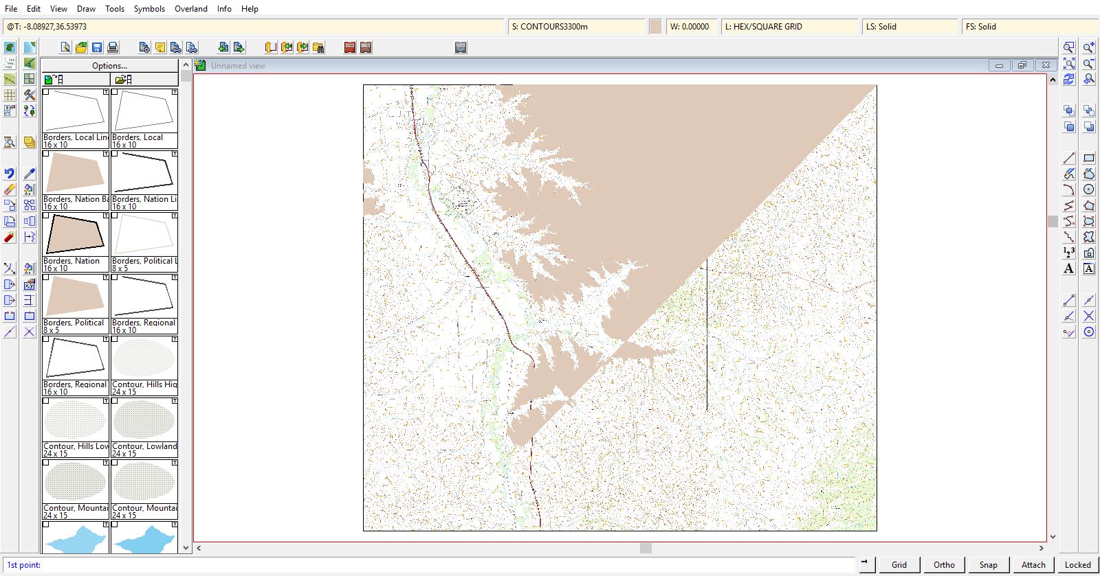
Making a map, obviously and tracing contour lines. I do this with the smooth polygon tool rather than the Contour Lines tools because they are limited to a relatively small number of contours and appear to have fixed fills rather than letting me choose from a variety of colors. This has a big handicap in that I cannot backspace to fix small mistakes as I trace the contour.
However, I don't think there is a way to get out of my current predicament with either way to place contours. While well into tracing the contour as seen below, I accidently, while moving the mouse, hit the right mouse button which of course completed the contour. Undo helpfully erases the entire thing. It is very demoralizing to have this happen to you.
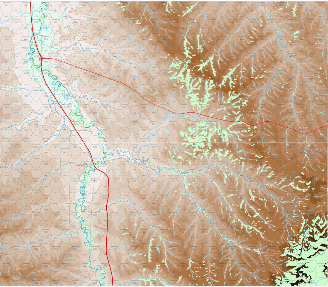
I'm using modern political overland.
However, I don't think there is a way to get out of my current predicament with either way to place contours. While well into tracing the contour as seen below, I accidently, while moving the mouse, hit the right mouse button which of course completed the contour. Undo helpfully erases the entire thing. It is very demoralizing to have this happen to you.
I'm using modern political overland.


Comments
But the basic steps are:
- Reduce the current polygon to a path, and delete that erroneous segment added when you finished the command
- Draw the rest of your area using the path tool, start exactly where you ended the last part
- Use Combine path to combine both paths into a long path. (You said you where using smooth polys. You may need to use smooth to straight on the paths before combining them, then use straight to smooth to turn them back into smooth entities)
- Close the path, turning it back into a polygon
I recommend you just make your own drawing tool with the properties you need.
It so happened, I was a 2 - 4 kilometers of reaching the bottom edge of the map, which from that point to complete the polygon, I merely had to go to the bottom right hand corner and then up to the top right corner. So I grabbed the lowest point on the polygon, then used the Node Edit Tool to move the last node on the contour to where the contour met the bottom edge of the map. Then I inserted a point to go the the bottom right corner. Right click, and presto chango! the bulk of the drawing was not correct. "All" I had to do was use Node Edit and the and insert/delete point to move points to the rest of the contour. It may have taken more time to do it this way, but it didn't seem so bad. Yay. Brute Force and Ignorance is not without its benefits. So, now the map looks like below. Now to the right half of the map which does not need to connect to the original contour line.
This has happened four times to me today. Twice on the 3400m contour line, but the third time was the charm, and then twice on the 3500m contour line. It takes quite a long time, sometimes over an hour, to complete a given contour line, but I do it quite often. This map is only 216kb, I have maps that are in bigger in surface area with many more contours that are slightly larger, 496KB, and some that are nearly 1.83MB.
For the one, I saved the map to a different name, closed it and restarted CC3+.
I thought it might be to my clicking speed, so I slowed down and clicked less as well. One cannot "split" the line in half as I want it to be filled and this line literally snakes across the screen.
Courses of action:
1. Trace the line as a path, then close it, change it to a polygon.
2. Keep trying.
3. Think of another approach.
I have attached the file.
Thanks for any pointers. This is not a new problem for me, but I've always been able to work through and have seldom this behavior 5 times in a row.
Mike
What operation are you carrying out when this happens? Move nodes, add nodes... ?
I did a test just to experiment on your map, and the redraw time on your map is 7 times faster when I convert everything to straight instead of smooth, which says something about the extra requirements for smooth paths.
@Monsen. I will give that a go. I have to admit, I get tunnel vision and don't always think about such an easy alternative. Brute Force and Ignorance only goes so far.
Thanks
Thanks. I switched to the Straight Polygon and that seemed to do the trick. I moved onto the next contour line and hit the dang right click button again. So I went to Edit|Transform and saw Explode, Combine Paths, Smooth to Straight, and Straight to Smooth, and cleverly selected Explode which broke the thing into lots of pieces.
I guess I just should have selected "Break" and cut the connecting line near the "start" point and where i made the mistake (the end point?), then erased that orphaned line. After that, I selected the Straight Line tool, then clicked "On" to place the starting point on the old line and continued merrilly until I made another mistake of a different sort, which caused me to pretty much start over.
So, I think the proper thing to do this the next time is:
(1) don't click the right mouse button till you really mean to.
(2) When you do, cut the line twice, then erase the "orphaned" part of the path.
(3) go to your former "end point", select straight (or poly) line, select the "on path" button, click to your heart's content till you get back to the start point, select "on path" again, then right click and finish.
(4) highlight both paths, then select Edit|Transform|Combine paths.
(5) then edit as necessary to fill in the poly (in my case).
Sound correct?
thanks and Kind Regards
Mike
The advantage is you can stop and save ( go to dinner, etc) anytime. When you start again you put in an overlap that you go back and trim before making the poly. Editing is simple and retracing a segment to get it right is also simple. The drawback is that it take more time.
For me the exchange of frustration to time is worth it.
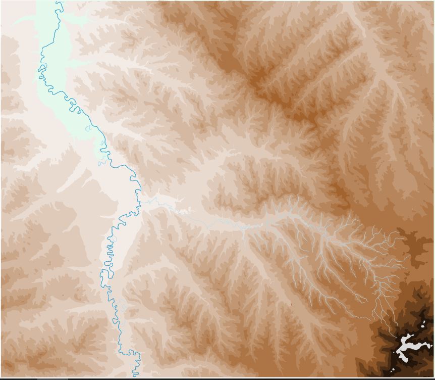
There are many contour lines with a 20 foot interval, but I left those out because I would go mad trying to do them all. Only mapping the 100 foot interval (200 in the SE) makes the terrain a little easier to see, especially if you one doesn't know how to read contour maps.
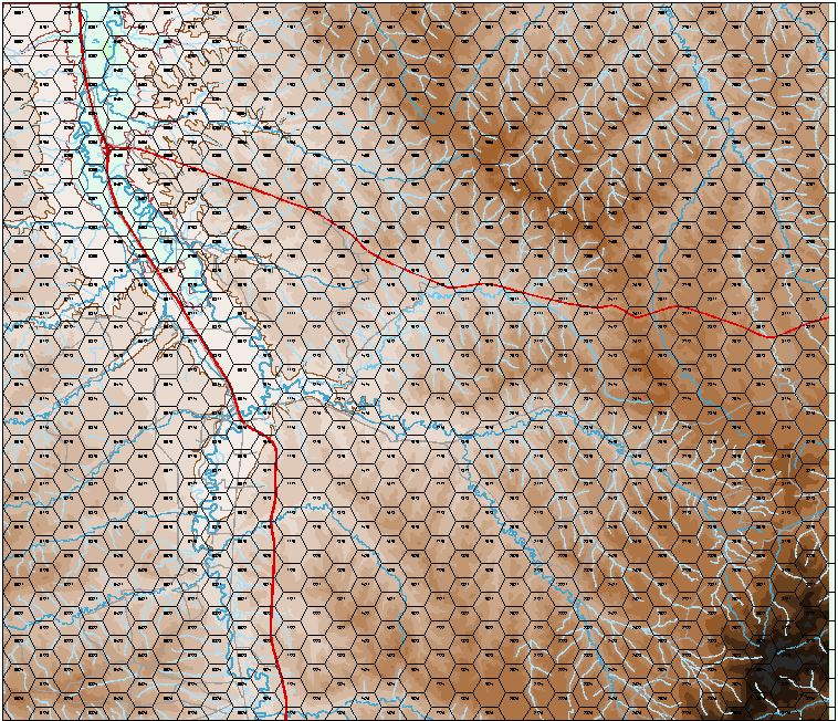
The Little Bighorn river flows from South to North. The generally vertical thick red road is Interstate 90 and the generally East-West Road is US Highway 212 and they the major highways through the region. The Gray lines are probably unimproved roads, the long gray line from the East side of the map that ends by the major road is Reno Creed Road which approximates the path the 7th Cavalry moved over. The battlefield itself is North and South of the rounded gray road making a partial rectangle bounded on the left by Interstate 90.
Left to do are the water courses, the rest of the roads, and the vegetation.
I am studying the battle and battlefield terrain in preparation for my trip there in the last week of May and first week of June. I will likely use this map in another game, but not modeling the Little Big Horn battle.
I really like the way the contours blend and shows how interesting the terrain is.
Thanks for everybody's help in helping me fight the tendency of the programs tendency to crash while drawing the large smooth polygons. I tried using lines and then generating paths/trimming them to form the contour lines, but had a difficult time with it, so I just went with straight polygons, which are not too noticeable at his level. I will probably convert them to smooth ones.
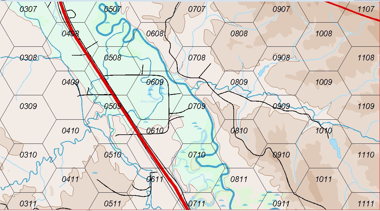
I'm trying to draw the railroad, as seen below. Note that it is Huge in proportion to my other roads on the map. Also, there are the large blocks in the railroad. It clearly is paying no attention to the size I want to draw the line.
Also, if I am trying to draw a line using dashes, the size of the dash and the spacing is always seemingly random. See the 2nd Picture, using the Road Long Dash? How can I control this so the lines are the same size.
Also note in the 2nd drawing the size of the railroad line as compared to the size of the roads I am drawing.
This has perplexed me since the beginning and I am totally unable to find a remedy in the help files or manual, so I am sure it is very simple and common sense.
Thanks again for the help in advance.
Personally, I recommend to stay away from that particular tool , and instead just draw a simple line on the correct sheet, and then use the Symbols along command to put on those perpendicular lines along the path once you are happy with the line placement. You'll probably need to play a little with the settings to get the exact result you need, but once you have them, you can save them for future use.
You can also look at last years free bonus annual issue for how to make your own drawing tools that handles both action in one tool which can then be used just like the original railway tool in the map.
I really need to dealve more into making my own tools...