

Community Atlas: Basher Bay, Dead Forest, Village of the Salt Gatherers
 JimP
🖼️ 280 images Cartographer
JimP
🖼️ 280 images Cartographer
Area map, then map zoom into the village area. Map size: 1.42 x 1.1 miles
Preliminary area map. I'l update it as I work on it. Or I can post the changed area maps. Which do you prefer ?
Preliminary area map. I'l update it as I work on it. Or I can post the changed area maps. Which do you prefer ?
Comments
An adventurers' camp. Some tents and gear, horse tack, but no one is there. No bones are there. The food is gone, likely eaten by wild animals. The water skins are empty, no water no more.
Wild horses are a short distance away. Could they have been brought here by the adventurers all full of hope ? Do the horse remember those who rode them ? Or are the voices of the adventurers, just echoes in the horses' minds ?
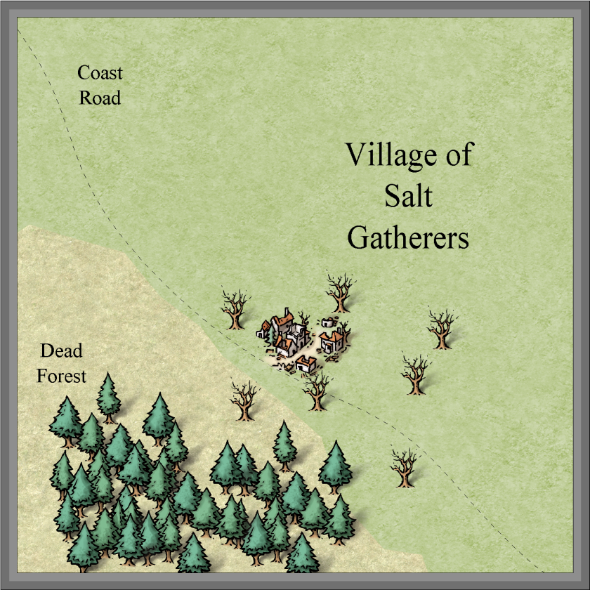
Village of Salt gatherers, Dead forest, near Basher Bay.
land_MS for background.
sandy looking area: Scrublands_MS
Symbol set: MIke Schley
Area map: 1.42 x 1.1 miles
Our Pond is: bitmap fill Desert_MS
The paths from the village into the Dead Forest were for gathering firewod.
The hovel symbols mark a last attempt to recover from disaster.
Any changes suggested ?
I'll look into changing the road. The ones going into the forest are paths, but they need to be changed to.
I'll attach the png and the fcw.
Road is 8' wide, of bitmap fill CD3A_Dirt 2 The foot paths are 3' wide.
If nothing else over the next several days, I may not be able to map for a few days starting Friday, I'll submit on Monday or Tuesday.
Village of Salt gatherers, Dead forest, near Basher Bay.
village_area01
Template: CC3 City basic.
Area map: 1.42 x 1.1 miles
The ocean calls, but the salt gatherers never come to the shore. The little pond is no more. Its water no longer lap on its shore. The village is quiet, except for rocks, timber, and thatch, that falls to the ground. No one there to make a repair.
An adventurers' camp. Some tents and gear, horse tack, but no one is there. No bones are there. The food is gone, likely eaten by wild animals. The water skins are empty, no water no more.
Wild horses are a short distance away. Could they have been brought here by the adventurers all full of hope ? Do the horse remember those who rode them ? Or are the voices of the adventurers, just echoes in the horses' minds ?
for background: land_MS
sandy looking area: Scrublands_MS
Our Pond is: bitmap fill Desert_MS
Symbol set: Mike Schley
The paths from the village into the Dead Forest were for gathering firewod.
====================================
village_area02 Template: CD3 Bitmap A
2426' x 1717'
14 families were living in thatched homes.
hovel symbols: CD3 bitmap B CD3B_Hovel.fsc
The hovel symbols lower left in the Dead Forest mark a last attempt to recover from disaster.
Rocks near the Our Pond shore are CD3C Half Rock a 1 and CD3C Half Rock a 6, the rock path is made of CD3C Half Path a 2 from CD3C Halfling in Cities CD3 Vector Shaded. The map trees are also in this symbol .fsc.
Road is 8' wide, of bitmap fill CD3A_Dirt 2 The foot paths are 3' wide.
A small green orchard still producing fruit. The rest, the fruit rots on the diseased trees.
75% of my original export.
Village of Salt Gatherers Environs
Village of Salt Gatherers