

WIP - The World of Rodinia

All,
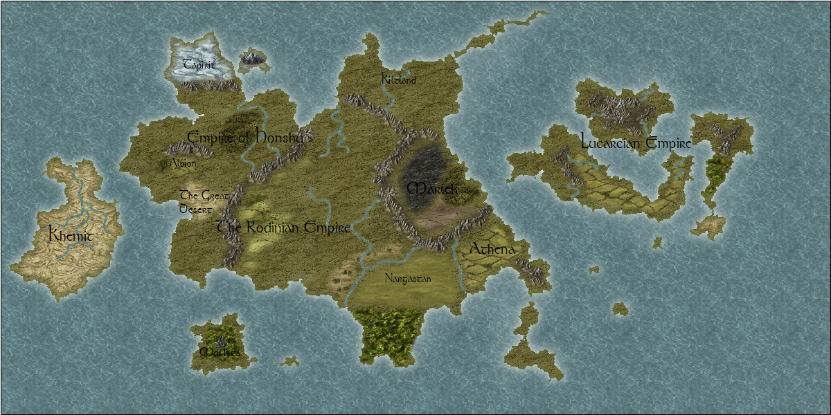
I'm an utter newbie at this and this is my first effort at a map with CC3+. I've got a homebrew world, known as Rodinia, which has been in the making for 18+ years now. It's been the locale for my D&D campaigns for that period and one of the continents was the setting for the two novels I've published. But I've decided to revamp the whole place, starting with drawing some (I hope) good quality maps for it. So I have come here seeking feedback. Be as complimentary or as constructive as you like - I'll enjoy any good comments and try to learn from any constructive ones.
Here is my first effort. Any comments?
Thanks in advance
Blakey
Comments
The text may improve if you put some sort of outside glow on it. It is a bit hard to read right now.
Congrats for the great work!
So, regarding the placement of terrain like the Great Desert, that is fixed as it's already a part of lore and been visited by characters, so I can't suddenly transport it across the mountain range. :) That is true of most of the major land features.
Reducing the scale of the cultivated lands is excellent feedback - thanks. I'll go and figure out how to do that when next working on CC3+.
Scale can be added. For reference this map is 3,500 miles by 1,750 miles. As you guessed it is northern hemisphere only (and probably only a part of the northern hemisphere). This is why there are jungles in the south and icy areas to the north.
I think I need to add some icy terrain to the top of Kiltland (I hate that name and it needs a rename).
Finally, regarding text, I agree it is getting a bit lost. I did have it glowing (default effect) but then it was really in your face. Maybe it needs to glow but reduce the "glare" if that is possible.
Does it need more detail? I've no cities marked on it - does it need them and if so how would you mark them?
Thanks
Blakey
I think naming a few of the major rivers, not any tributaries, and a few large forests would work to. But at this scale, you are looking at millions of square miles/kilometers.
I'll consider adding names to rivers - though I did not want to put too much text at this level. Maybe it will be clearer if I can highlight the text with a gentle glow as discussed above. I'll experiment.
For the city markers, you could just draw a circle (or any other basic shape that takes your fancy), but for ease, you could equally use the symbols from the Geometry.FSC set in the Symbols > Maps > Filled group (these are varicolor symbols, so you can also indicate who owns which place by using different colours).
I'd be inclined to agree in keeping name labels to the minimum. Adding terrain-feature names at this scale is liable to make things look too cluttered.
I found my biggest problem is deciding which Annual symbol set to use for which nation for cities, towns, castles, etc. in my game world.