

Naraya, Campaign world of a long time lurker

I have started mapping with Campaign Cartographer when it was still CC2 Pro, but my mapping was done just casually with big intervals in between. I used my mapping to create maps to enhance my Roleplaying Campaigns throughout the years, but never really posted anything for the rest of the world to see. My goal in mapping, and yet one of the harder things in my experience, is for maps to make sense. At different levels this means different things. On world scale it means that rivers, mountains etc. seem to be in the right place, on a smaller scale it means that structure and buildings in a city feel logical to how a city would develop. Fortunately on the scale of worlds there is Fractal Terrains, which helped me a lot in designing a believable world. With local maps and cities I've read tips and tricks, studied real world examples and still it gives me headaches sometimes ")
Having seen a number of Show and Tell examples here, I decided to step over my normal reluctance and post some of my efforts for my current running campaign world Ranaya. As a show and tell I think it would be nice to illustrate my efforts, going from the raw Fractal Terrains Image to the maps I made from it, zooming in in a few steps from the complete world to a major city.
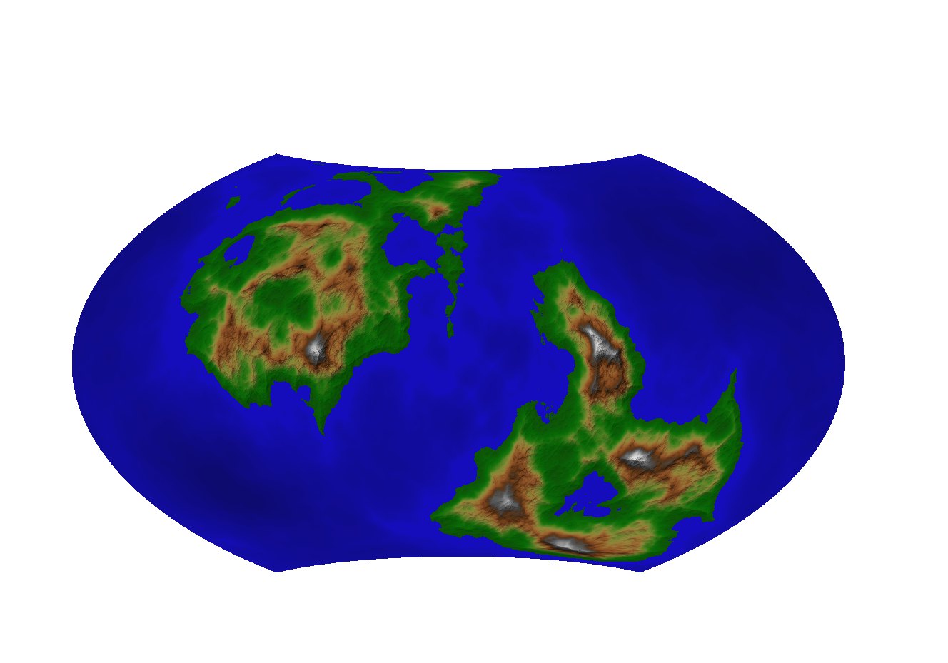
So to start off with, the height visualization from Fractal Terrains, shown here in a projection (Wagner VII for enthusiasts) that gives a good impression of the whole world in one image. In my actual process I used different projections to get individual images of the main continents to get less distortion and then stitched those images together. This, together with the Climate visualization were the basis for mapping this world in CC3.
Having seen a number of Show and Tell examples here, I decided to step over my normal reluctance and post some of my efforts for my current running campaign world Ranaya. As a show and tell I think it would be nice to illustrate my efforts, going from the raw Fractal Terrains Image to the maps I made from it, zooming in in a few steps from the complete world to a major city.
So to start off with, the height visualization from Fractal Terrains, shown here in a projection (Wagner VII for enthusiasts) that gives a good impression of the whole world in one image. In my actual process I used different projections to get individual images of the main continents to get less distortion and then stitched those images together. This, together with the Climate visualization were the basis for mapping this world in CC3.
Comments
The result of that is this world map of my world Naraya
First step of course was just adding more detail to this continent and fine tuning things a bit, with this as the result
So I decided to make a submap of the Cirelan Empire to facilitate my further detailing. In this map, once again made as a cut-out from the larger map I added the larger cities and main travelroutes between them to get a better idea for myself how dynamics in this empire would be and what the hot-spots would be in terms of where most of the action would naturally occur. At the same time going over the map in my mind to find naturally interesting areas that might be useful for developing.
The result was this map:
So I decided to map Nehlin with a bit more detail and Give cities names, adding a few more in the process. All in all though this is still a high level map. What's shown here is the map as it is now, but it still is in progress and details are added as needed (the players only know part of the map)
At the same time I wrestle more with these regional maps. It's harder to keep things interesting without cluttering too much, and at this scale I often wish for a little more variety in vegetation symbols. Fills often feel less suitable at this scale (especially forests)
The result of all that is this map, though this too is in a state of change.
The map in its basis is made in the CD3B style, but with some symbols from CSUAC and Bogie's used in there as well. There's not a lot of labeling in the map as I use the image to create an interactive map in my world-building software and add pins to it that link to actual information about what it points to.
This map was made more for functionality than for aesthetics. It's mostly finished though I might at some point make a pass over the exterior area outside the walls. I hope the map comes out okay on this forum though the details probably become lost because of the size it will be reduced to
So thank you for that
Thank you very much for showing them to us
Of course what you don't see in these maps posted right after each other is the countless struggles I've gone through wrestling with things like proper scale of fills, the fine tuning of effects or masking side effects of blends at the map border. Also I don't really consider myself much of a visually creative mapper, which is why I try to do my research what "right" is supposed to look like and why I use Fractal terrains as basis. For me that makes all the difference between a map that looks nice to me or one that I end up abandoning because it just looks wrong.
Maybe for contrast (and a bit of fun) compare the above to a map I made with CC2 nearly 20 years ago in 2000. I had the software for a couple of years then. Things have come a long way since then