Noobie problem

I've just downloaded CC3+ today, and I'm slowly overcoming the learning curve, but there's still a few things I'm struggling with. Chiefly, selecting the things I want to select, and not selecting the things I don't want to select.

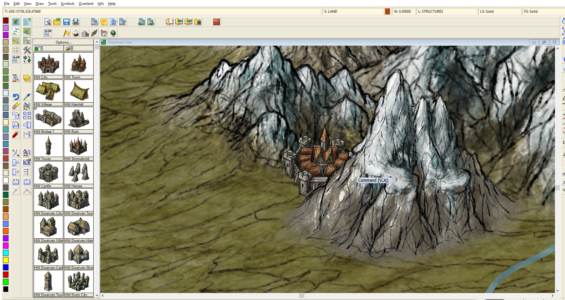
In the attached image, I want to select that city and enlarge it. I've been struggling to find any resources (youtube, forums, etc) to show an easy way to go about doing this. What is the most efficient way to go about accomplishing this?

Comments

  • Assuming the mountains and the city are on separate layers, what you can do is click on the Layer button (where it says "L: STRUCTURES"), find the land layer, and click the -- I think -- right-most box. You'll know you did it right when it says "F". That freezes the layer and then you can't do anything to it. Then click away, as you won't be able to select those mountains.
  • <blockquote><cite>Posted By: Ghoststrider</cite>Assuming the mountains and the city are on separate layers, what you can do is click on the Layer button (where it says "L: STRUCTURES"), find the land layer, and click the -- I think -- right-most box. You'll know you did it right when it says "F". That freezes the layer and then you can't do anything to it. Then click away, as you won't be able to select those mountains.</blockquote>

    Thanks so much! I figured it would be something embarrassingly simple.
  • MonsenMonsen Administrator 🖼️ 46 images Cartographer
    edited March 2018
    I also recommend that when selecting, make sure to pick the entity by clicking on the edge, don't use the window/rubberband select method, as this very easily selects way to much stuff.

    For a lot of information about all the ways you can use selections in CC3+, check this article.
  • Thanks, I'll check that out!

    While I've got you here, could you maybe help me with another issue?

    In the attached file, I'm trying to create a mountain range created by one plate moving into another, like how the Himalayas were formed. But it just looks like garbage. I've looked at satellite photos of mountains and I just can't seem to get the level of detail necessary to make it look decent. Do people use FT3 in conjunction with other software to sculpt more detail, or is there something deceptively simple I'm missing? Or is the software just not capable of that level of granular detail?
  • jslaytonjslayton Moderator, ProFantasy Mapmaker
    The problem is mostly likely too low of an editing detail level. If that's the default 30 degree grid, then it looks like your editing resolution is around 256 samples, which would probably be the default world editing resolution (roughly 150km per editing sample assuming a 40 000km world circumference).

    http://www.fracterra.com/CGTutorial/index.html might offer some assistance if you haven't seen it. Note that the upper resolution limit for FT3 is 8190 samples across (which translates to about 5km per sample across the equator).
  • Thanks so much for your advice! This community is very helpful. I'll give this a look when I go home on my lunch break.
  • Hey there's one more thing I need help with. The Smooth and Roughen tools don't seem to smooth and roughen, they seem to more aggressively lower and raise the terrain. I'm trying to create some nice flat plains, and don't seem to be able to figure it out. Thanks again for your help, everybody! Such a great community to be a part of.
  • And it's looking much better now! Thanks again!
Sign In or Register to comment.