

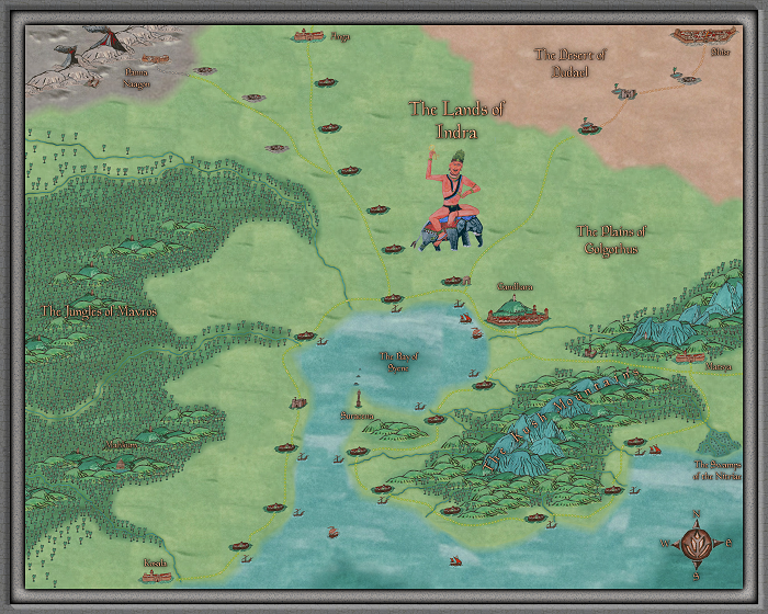
The Lands of Indra
 CharlesWayneRobinson
Traveler
CharlesWayneRobinson
Traveler
The Lands of Indra
My final art project for my Foundations A course for my Communication Design Degree.
This was a multi-medium project. I started with the research getting inspiration from two maps of cities in India from the 1500's, photographs of volcanoes, ancient architecture, and relief sculpture from ancient India. I then had to draw concept images of all the mapping elements. I then hand painted them, painted terrain textures (to create bitmaps), photographed them, adjust them using photo-manipulation (giving them a slightly warmer tone), then used a combination of Photoshop and GIMP to process them (such as making the backgrounds transparent) and then I used them to make my map. The scope of the project, the number of art pieces that I done (41), the quality, and the map itself blew my classmates away - they loved it! I got an awesome critique for my final project for the class. I want to give thanks to the people that gave me advice on this forum for completing my project, gave me feedback as I went through this process, and for the three people on this forum that allowed me to interview them for the paper that was part of my project. You are awesome and I greatly appreciate each and every one of you! :-)
I used the Myrr style for the basis of my map. Everything on it except the border and the text are my hand painted bitmaps and symbols. I hope that you like it as much as my class did.
Sincerely,
Charles W. Robinson
Comments
Sincerely,
Charles W. Robinson
Here they are,
https://charleswaynerobinson.deviantart.com/gallery/65012734/Communication-Design-Cartography-Project