

Community Atlas - Dunor Valley - Runcibor Region
![[Deleted User]](https://secure.gravatar.com/avatar/c75d9a245b74d9c59be0999ea81ca541/?default=https%3A%2F%2Fvanillicon.com%2F92add7f8c954488718110edc4896ad39_200.png&rating=g&size=200)
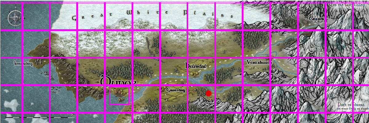
Here is my draft of the Runcibor Region in the Dunor Valley, Ezrute. The map is 20x20 miles, and contains the village of Runcibor (in draft form atpresent), the Drunken Bear Inn (already in the Atlas) and Loupe Zu hamlet (soon to be in the atlas).
In addition, I have attached a 20x20 mile grid of Dunor valley, in case anyone wants to do more 20x20 mile local maps
The mapping style is Annual 104, Local Maps
A bit more text goes next, but not much else
In addition, I have attached a 20x20 mile grid of Dunor valley, in case anyone wants to do more 20x20 mile local maps
The mapping style is Annual 104, Local Maps
A bit more text goes next, but not much else

Comments
Those are lovely mountains!
One thing - you seem to have a tree growing right in the middle of Guadalupe River between the bridge on the main road and the mountains
Thanks for another great contribution! How was your trip, by the way?
The Map Notes are done, and I will submit this to Monsen in 30 hours, so please let me know of any more improvements to make.
Maybe also add a label for "Jim's" cave? And perhaps increase the size of the labels on the scale bar?
Just as important, it looks like a great place for some unexpected adventure!
Thanks for sharing!
Cheers,
~Dogtag
I have a small issue with this map, I'm not sure if it's just me... The top half of the map really looks like a top view map (with 3D symbols, but this is fine), while the bottom half looks a little bit more like a 3D view. I can't exactly pinpoint what give me this feeling... Maybe it's the winding river at the bottom, maybe it's the feeling that the mountain symbol are at scale, being a real representation of what a bird would see, while the village symbols are just symbols.
Both half of the map look wonderful, but put together, they give me a kind of unease, just like when you look at those impossible perspective drawings (Escher-style).