

Managing Sheets and other odd effects

I just start using CC3+. I like to draw large (planet sized) maps. The current one I'm working on is 24,800 in width and 12,400 in height.
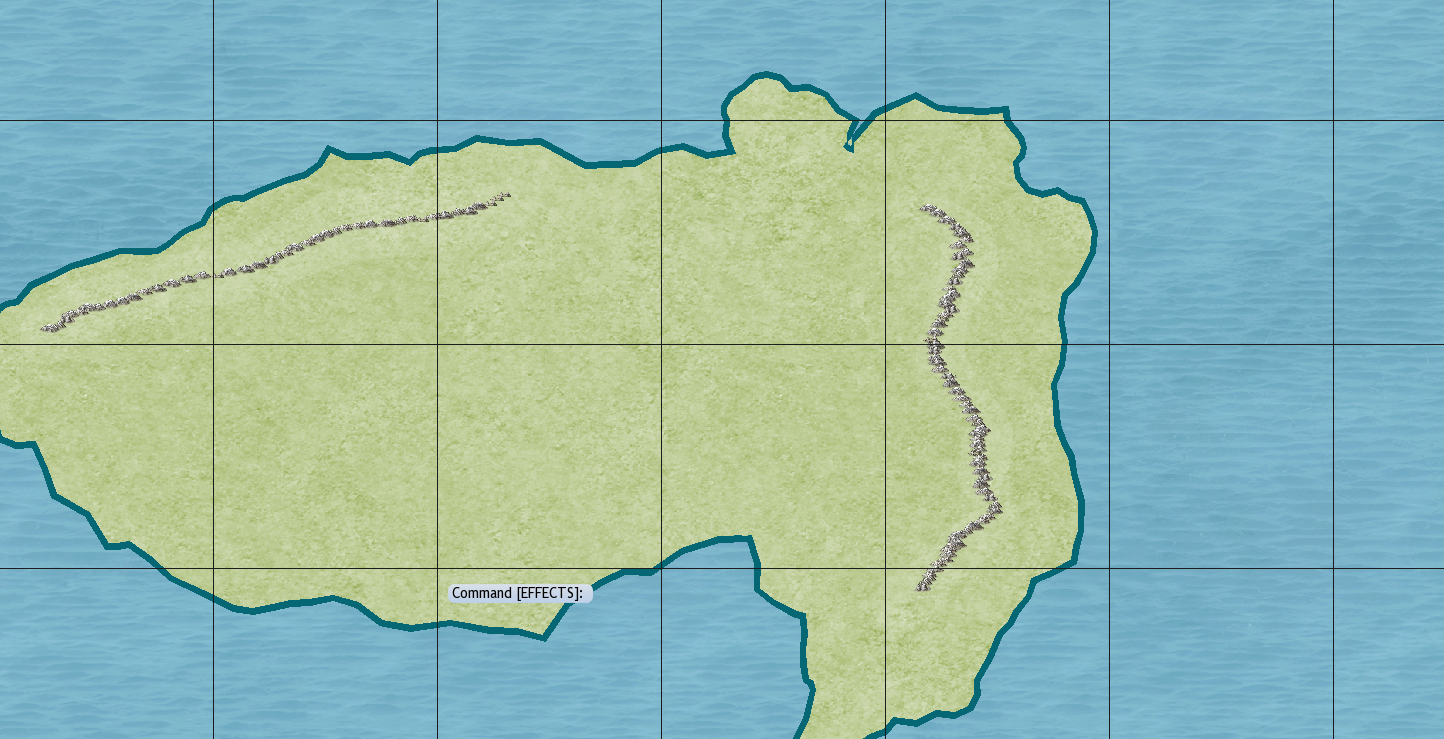
For some reason, my landmass has a thick, dark green outline. I've removed the sheet effects, and it made no difference. I can't figure out where this outline is coming from. I've included a screen shot in case that helps.
I'm also having some trouble getting sheets to work, possibly because my map is so large. Any tips on using sheets with a large map would be greatly appreciated. Thank you.
Comments
I think the thick green line is the coastline. Try hiding the COASTLINE sheet.
You're creating a very, very large map there. At sizes roughly higher than about 2000 x 1600, or smaller than 1000 x 800, you have to start changing a lot of settings in CC3 to end up with the effect you desire.
As a starting user, my advice would be to decrease your symbol size rather than increase your map size. Maybe go for 2000 x 1600 map size and reduce symbol size to perhaps 0.5.
Good luck and enjoy CC3+!
DMG
When you say you have trouble with sheets, I assume you are talking about sheet effects here (since sheets themselves work the same no matter map size).
The main thing to check for sheet effects if the size of the effect. For example, a glow effect 1 map unit in size won't be very noticable on that huge map, so basically check the sizing of the effects, and bump up where required.
I do also note that your symbols looks a bit small. Now, I don't know the size of your entire map, but I assume what you posted here is just a section of it. So, if the world is much larger than that section, mapping the entire world with symbols of that scale is not recommeded for several reasons.
- Using tiny symbols is nice because you can do a deep zoom and check out details, but it generally makes the map look very cluttered and difficult to read when you look at the full map
- You're going to end up with a huge amount of entities, which will severely impact performance
- It is very easy to get fatigued from all the mapping, leading to an unfinished map.
Instead, I recommend mapping the world map in a much lower detail level, and then making detail maps of the regions that need them, much like we do in the community atlas project
Edit: Ninja'ed by DMG
But you are right, the task of keeping regional maps aligned with world maps is pretty daunting. I've not even looked into the best way to accomplish that task, so I am interested in how you proceed.
Tim
So I did it like this.
Hemisphere, then continents, then kingdoms, then local maps.
Crestar